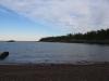
Mount Baldy of Eagle Harbor
The Keweenaw Ridge has plenty of interesting rises of conglomerate and basalt. The spine stretches from the Porcupine Mountains all the way past Copper Harbor with dozens of prominent mountains and bluffs, some remote and forested over, others easily accessible and well-known by locals and tourists. One of the more famous peaks sits right outside of Eagle Harbor and is protected by the Helmut and Candis Stern Preserve. It was a sunny summer day when I headed over to climb Mount Baldy (aka Mount Lookout).
Eagle Harbor far below Mount Baldy
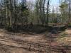
I had a frustrating start to the hike. There was a nice sign right off the Eagle Harbor Cutoff Road, less than a half mile south of M-26, and I knew that the one-lane dirt road leading east was the right one. A few hundred yards later the road split, one lane leading through the woods and the other climbing along a steep slope of sand. There was no way to tell which fork would take me to the mountain. I tried the wooded drive first, coasting my car between the green walls until some downed saplings blocked my route. Giving up I headed back to the sandy hillside. There was a small spot here to park (the road was too steep for my car) and I started to walk up the road, still keeping an eye out for some sort of sign or arrow to point me down this route. There was none.
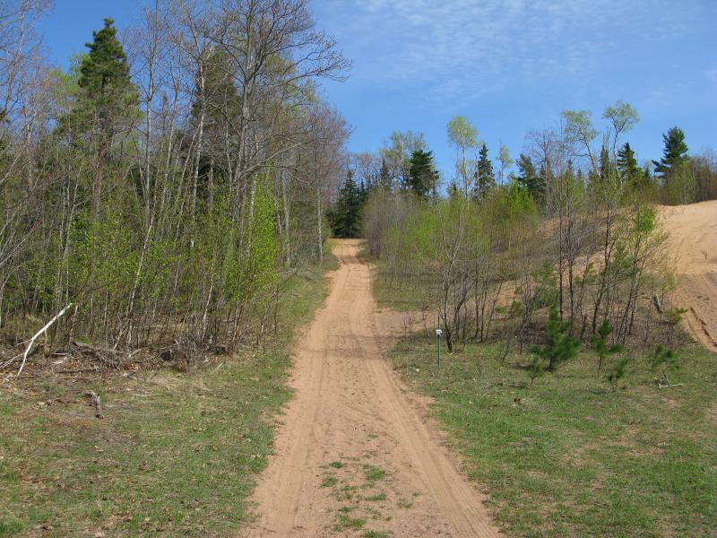
Sandy two-track rising through the woods
My legs were dreadfully tired. I had just finished up a hike around the tip of the Keweenaw, a long twenty-plus mile hike along tough shoreline and backroads, and I had hoped that this hike would be an easy and well-marked stroll. Within the first ten minutes I was already questioning if I was on the right path while I panted up a long climb with giving sand. Mount Baldy was not going to be an straight forward visit.
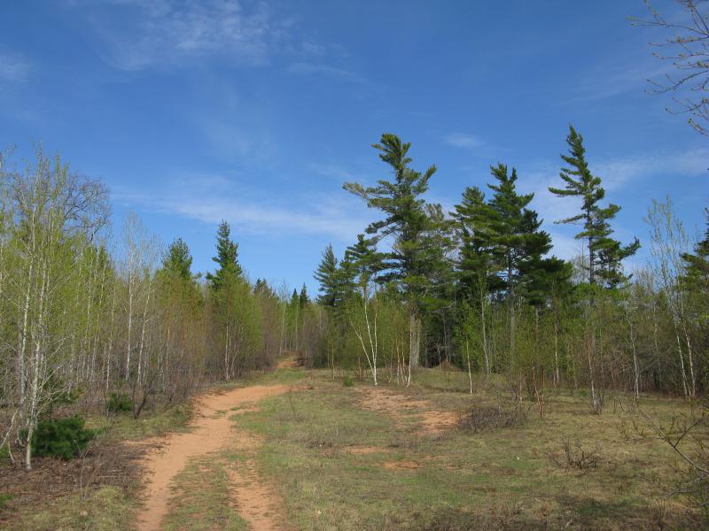
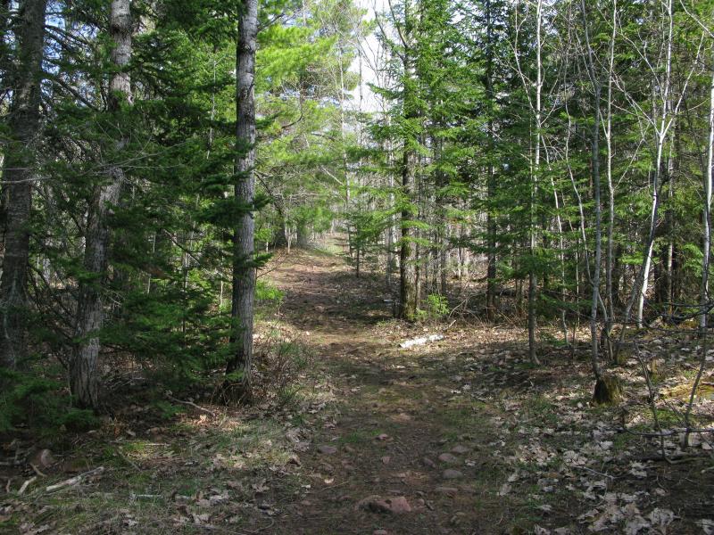
The grade leveled out slightly above the sandy hillside. The path I followed east was an old two-track, winding slightly through a pine-y forest, with a few open clearings on either side. There was still a grade, a gentle climb, just enough to keep my breath tight and my legs from feeling rested. I was just starting to get my old stride back when I bumped into the creek.
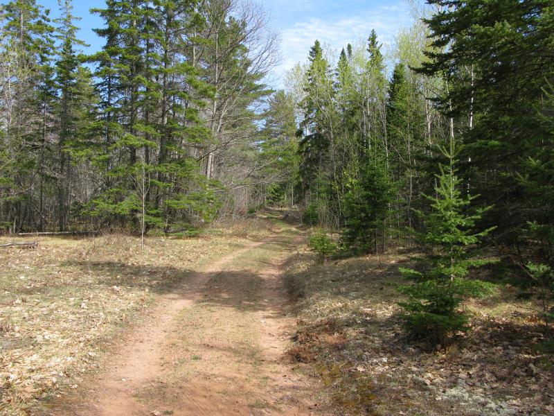
Winding road and pines
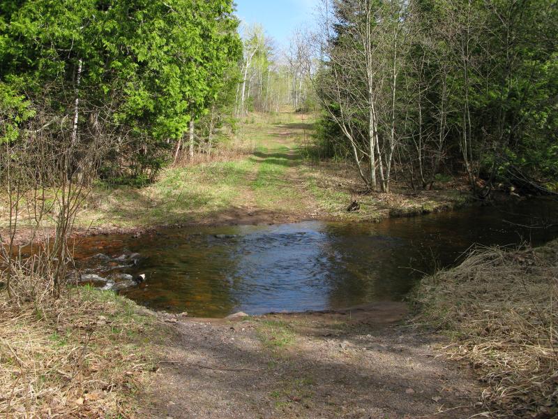
Swollen creek in the way
Cedar Creek drains a few swamps to the south and east, normally a small flow of water that flows into Eagle Harbor that was swollen today with the remnants of spring melt. The stained water made a wide and deep obstacle across the road, far too large to jump. I wearily looked around, hoping to find a useful blockage or downed tree within a few yards, and found nothing. This crossing was not going to be straight forward, either.
I headed downstream, following the soggy bank of the flooded creek until it split into several smaller branches through a cluttered portion of forest. There were a few small islands formed by stubborn tree trunks and at least one crossable cluster of debris. It took a few daring leaps and some reluctant slops through shallow portions to reach the other side. In a rush I crashed back towards the road, put off by the annoying detour downstream.
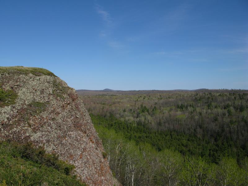
Once the two-track crosses Cedar Creek it wastes little time gaining elevation again. Mount Baldy, like many mountains along the Keweenaw spine, is a long ridge going east-west, and the track now climbed it from the west. As I labored up the route I began to see the first fruits, some mild views opening up to the south and larger trees rising up ahead of me. The distance fell away underneath me, several hundred feet at least, before I bumped into the real start of the preserve.
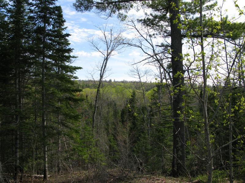
Another hill to the south
Young saplings and old pines
Since leaving the Cutoff Road I was uncertain if I was on the right track. A lot of clues hinted that I was climbing Mount Baldy - plenty of prints on the ground, the route was well-maintained, elevation seemed to make sense - but I had some doubts. This was a nature preserve, and a well-visited one at that, and I expected some more signage to be along the trail. It wasn't until I was over three hundred feet above and a mile distant from the parking area that a trailhead showed up and I knew for sure that I was in the right area.
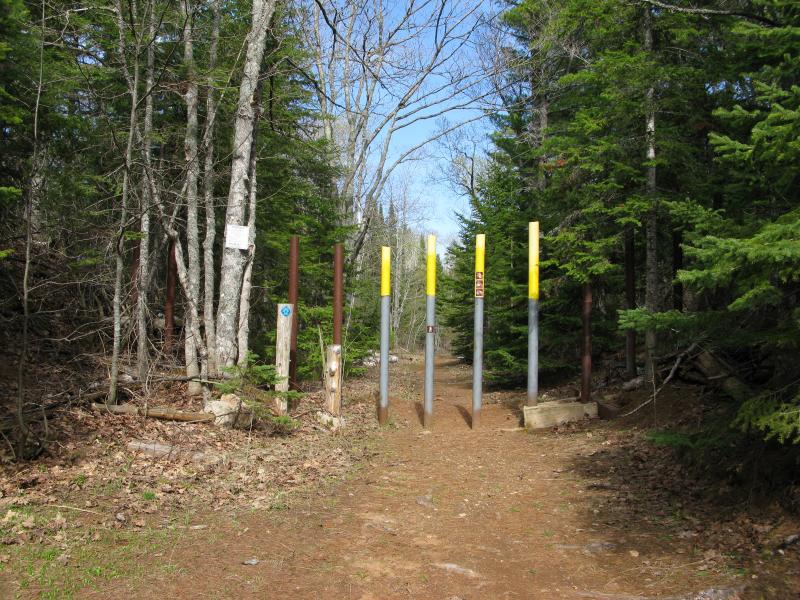
Trailhead
I'm not sure why this is. Sure, locals probably know this area well. There may even be some more adventurous people who just drive the whole way to the trailhead, up the sandy rise and through the creek, cutting off a good portion of the hike. There's a good chance that there is some land ownership questions along the route. Either way it would be nice to see some more markers along the way for first-time visitors, even if it was just a few friendly 'Mount Baldy, This Way' arrows on the trees.
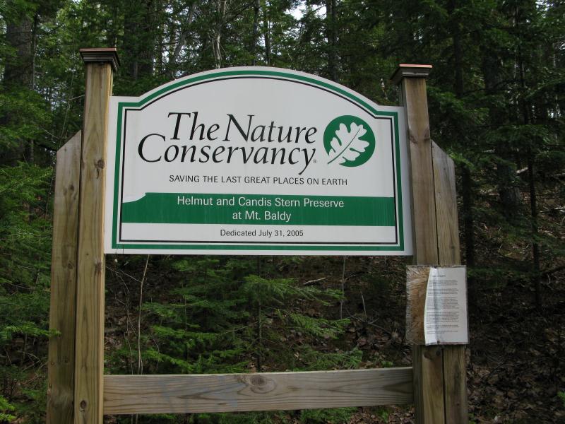
Finally, a sign for Mount Baldy
Once I passed into the preserve proper the two-track quickly narrowed down. There were still two tire treads that marked the trail, old remnants of the ATV trail that was slowly being worn down by foot traffic. The woods also started to pine up a bit, saplings and hardwoods being replaced by green needles. For a short time the trail evened out and I enjoyed the winding flat before a sudden final steepening.
Narrow trail through the young woods
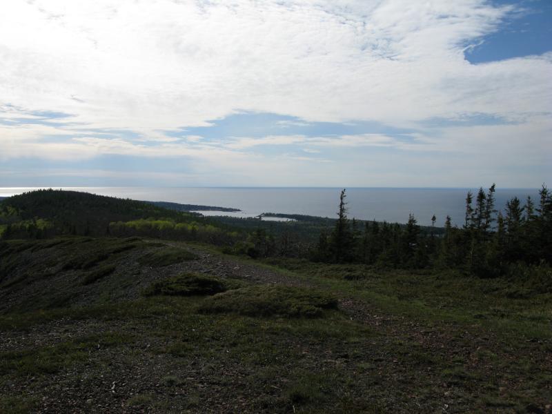
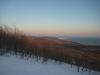
Not knowing much about this mountain I pushed forward quickly, looking forward to reaching the peak. The woods around me petered out into the short scrubbly trees that are so prevalent atop bluffs in the Keweenaw and I could barely make out Lake Superior in the distance. When I reached the far side of the rise these little trees fell back too, giving me wide open meadows to enjoy the view from. To the north stretched the blue of Lake Superior, so inviting under the summer sun. To the east lay… Hold on a minute. There's another rise over there. Damn.
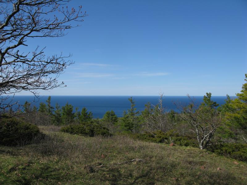
Lake Superior to the north
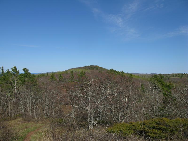
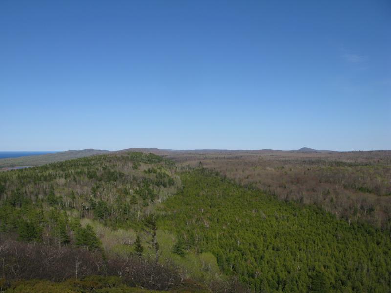
True peak of Mount Baldy to the east
So Mount Baldy had a raised shoulder that I was standing on. That was unexpected. I probably should have done a bit more research on this hike before starting out. I shrugged it off, too pleased by the views I had already gotten too, and headed down the little saddle.
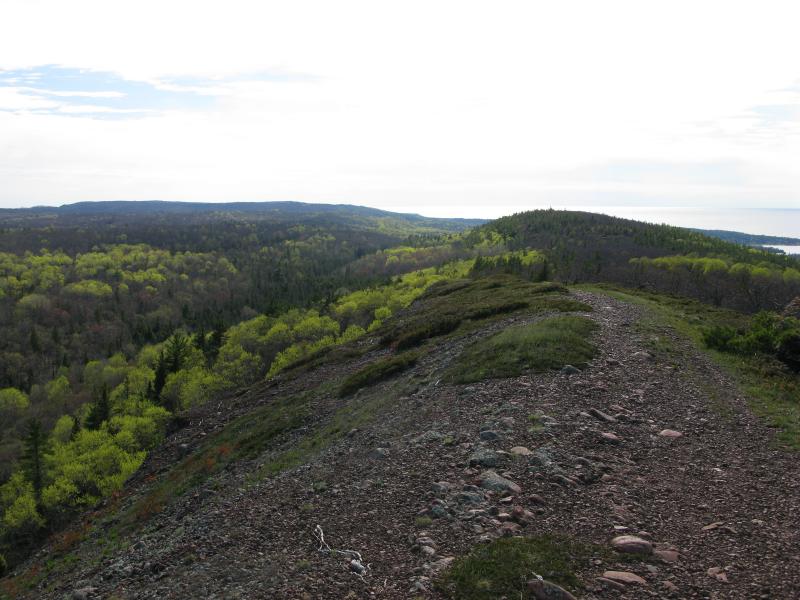
The real peak to the east looked pretty distant from the shoulder. Once you get moving in the saddle, though, it's not that far away. The trail winds through another little scrubby forest, now clearly just a footpath, and before I knew it I was climbing the last leg over clear ground. I passed a small group of college students on the way, all chatty about some political issue or scientific discovery or something before I paused on the western flank to take a look around.
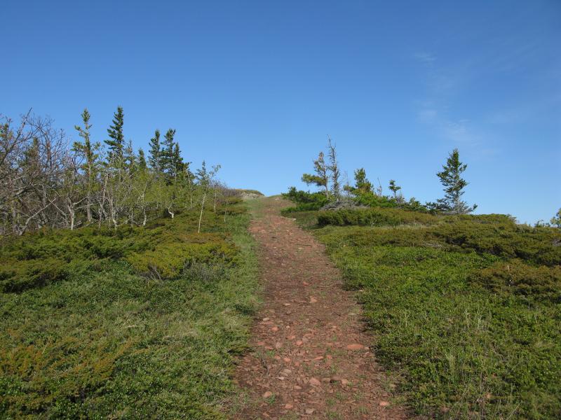
Last leg of the climb
Distant peak to the southeast
A distant mountain had caught my eye, far off to the southeast. Most of the south was blocked by the sloped north side of the Cliffs, blocking views of Keweenaw Bay and Horace Greeley and Gratiot, so this mountain really stood out. It could be Bohemia, or maybe Mount Houghton. Whatever it was I wanted to climb it… Though probably not today. The other cool thing was the south ridge here, the plunging conglomerate face down into the trees. It looked just like Brockway to the east (they are part of the same ridge, after all).
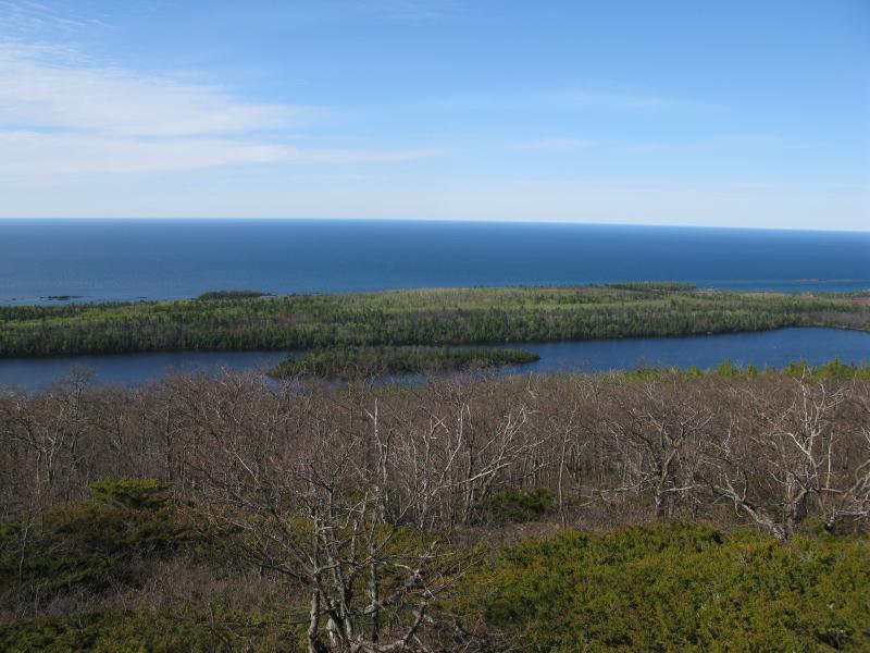
Lake Bailey and Superior stretching out below
I continued along the top of Baldy. The views were great, unobstructed on all sides. Lake Superior glinted brightly in the distance, though there was a slight distant haze that hid the view of Isle Royale I hoped to make out. Lake Bailey actually looked appealing. I had stopped there once, with Katie and a few friends, and had found the lake a mucky, stinking thing up close. May have just hit it at the wrong time of year (late summer). The trail took me further east, showing off the shoreline and Brockway and more pines that I could ever count in the crooks.
East towards Brockway
After the long climb I had no plans of rushing back down the mountain. I strolled around, finding little paths through the green brush, poking through a few trees, enjoying the stiff breeze and solitude of the mountain. I gazed further east, looking and finding the distant radio tower on East Bluff that I had stood under not three hours ago. It was a pleasant end to a full day of hiking.
Neon colors under the bright afternoon sun
Eventually I turned back and headed west. The trot down was busy, with almost a dozen groups of people just starting out on the climb. They were all winded from the climb, more focused on the ground in front of their feet than me, so I passed them each with only the briefest greeting. I wanted to tell them to keep pushing forward, that the views and peace atop Mount Baldy was worth the tough climb and teasing first peak. I kept quiet. Some things are better learned by your own determination and/or stubborness.
-
Jacob Emerick
Aug 20, '13
Yeah, I hear you on that! There may have been an arrow at the fork... if there was I didn't even see it. I didn't see any trails heading down to the east, though. A few on the summit, research ones winding around the different vegetation types, nothing heading down. Audubon is over there, as well as the Lake Bailey Sanctuary and some of the upper Silver River drops... Wonder if the trail wanders further along through those areas or just fades away in those pines? Kinda want to head up there in winter now, both to see it in a different season and to try tracking down that way.
-
dcclark
Aug 20, '13
There is an overgrown logging-ish trail which branches off to the right of the main trail, a little before those metal posts (I think). Topos show it following the base of the bluff, just above a swamp. I think I can see it on aerials, but I could be imagining things. Topos also show a trail running north-south in a valley between Baldy and the next bump over. Whatever they are, I'm certain that it would be a huge bushwhack. So, winter would be the best!
Add to this discussion