Moody-Coon Loop: Coon Creek
Waking up in the Sierra Ancha Wilderness, sleeping under a twisted oak with only a down quilt between me and the elements, was a pleasant and leisurely affair. I ignored the predawn rush and continued reading my book from last night, eagerly devouring the last dozen chapters before emerging onto a semi-light morning. Packing up my minimal site took minutes, coffee and oatmeal quick, and soon I was on the trail, heading towards Coon Creek, chased by the bright sun. Usually I would have pushed for an earlier start, and today I didn't really care. A mere seven miles sat between me and my ride.
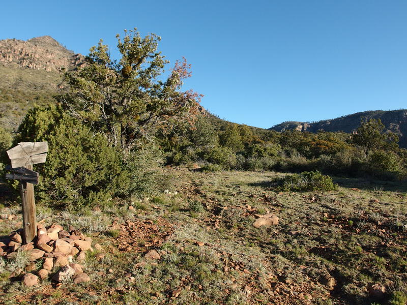
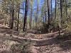
An easy start on Coon Creek Trail
Coon Creek stretches to the north, and the decommissioned Coon Creek Trail follows it to Parker Creek Trail. 4.5 miles of uphill bushwhacking through twice-burned wilderness and 2.5 easy downhill miles. Not all of Coon Creek was unknown - I had talked to someone who hiked the first two miles - though they warned me that their section was nasty and it looked worse beyond.
How bad could it be, though? Even if I averaged a mile an hour, following the old trail or falling back to the creek itself, I could easily be back to my car by early afternoon. I've hacked through the terrible manzanita of Willow Springs, the maze of fallen pines on Fisher Trail, and fields of catclaw on Tortilla Mountain. A little bit of deadfall or thorny growth can always be dealt with, as long as you have the time, water, and grit to keep moving.
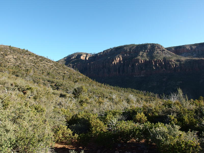
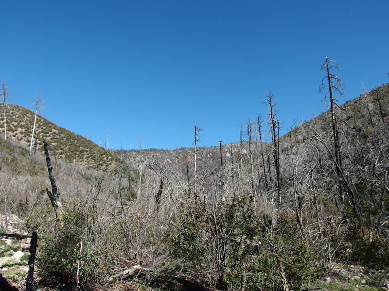
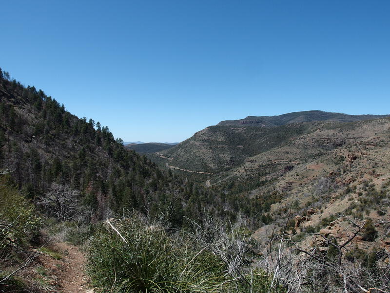
Big cliffs on the side of the canyon
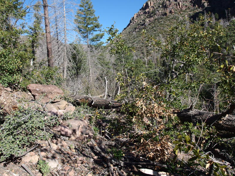
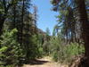
The start of the deadfall blocks
The first mile was very easy, with only minor overgrowth and washed-out tread to deal with. When the trail dropped into the first drainage the route-finding got more interesting, as the lush vegetation began to completely block sections of tread, and I had to make minor detours to find cairns or signs of the old path. At 1.5 miles I entered the burn, stands of charred pines, scoured and rocky earth, and straggly brush, and had to reference my GPS more often to keep moving in the right direction. Scrambling over blackened deadfall became a steady annoyance and I grew impatient to reach the creek.

Cairns marking a path that is mostly gone
My biggest concern with this trail was how it would deal with the elevation gain. The other two trails in this wilderness that follow a creek, Parker and Reynolds, alternated between a steady climb along the base of the canyon and shooting up switchbacks to avoid obstacles. I did not have a reliable track to follow, and so I didn't know if Coon Creek would follow the same pattern, and would have some insurmountable drop ahead that an old, likely devastated, series of switchbacks had to work around. With 2000' of elevation between my camp and the saddle it seemed very likely that some scrambling lay in my future.
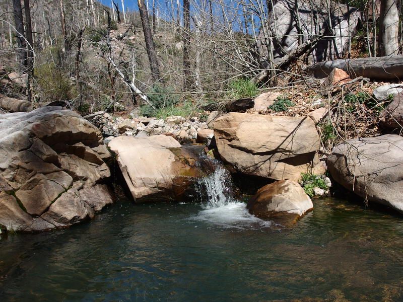
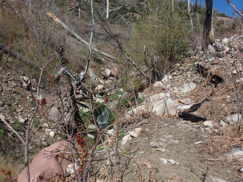
Little drops on Coon Creek
I reached the creek and immediately relaxed. The water was flowing, crisp and clear, and seemed to be more of a bubbling-brook-over-rocks variety than series of pour-offs. It swung back and forth from bank to bank, like any semi-mature water system does, and the trail crossed back and forth, trying to stick to the flatter of two banks. For awhile I followed the trail, carefully looking for the correct crossing spots and hunting down cairns, and then decided it was time for second-breakfast and relaxed next to the happy flow.
After the brief break I continued upstream. I tried to follow the trail, both to take advantage of the few stretches of clear, defined tread to stretch my legs and to make sure my GPS was tracking a clean route for future hikers. The thorny growth began to get more annoying as I continued on, though. The Sierra Ancha range is home to a most annoying plant that (I think) is called New Mexico Locust, which shoots up in close, straight stalks, studded with long thorns that tear into clothes and skin with ease. This stuff completely took over many of the trails after wildfire stripped down the trees. Plus, my GPS began to act up, and there were long sections where it refused to pick up reception and track my route. Boulder-hopping along the creek became my default mode of travel with only occasional trail-hunting when the desire arose.
Depressing views of the upper drainage
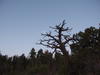
Faint reminders of a once-awesome trail
Hours passed, slowly, and the creek became more overgrown. Deadfall choked up the flow and thorny stuff, once confined to the banks, began to crawl over the water. I began to track my progress by watching for tributaries flowing in from the Rim in the east. There were two small unnamed ones and the one from Trailside Spring. The last tributary is when things got truly bad, with the once-busy Coon Creek now diminished to a trickle, most of which was fed by Trailside. I couldn't find the trail on the bank, some sort of berry-bearing bush was growing rampant across the trickling water, and deadfall was rampant. I had to crawl across the top of the bush, leaning into the thorns, hoping that the layers of vegetation would support my weight.

Horrible section of thorny overgrowth
Things only got more spicy from there. I had less than a half mile to the junction and the brush was practically impenetrable. For awhile I stuck to the creek, scrambling up a few rocky waterfalls and using conveniently-placed dead trunks like ladders, and then headed up to the bank, crawling and ducking around the thorns. It was far and away too late to turn around, though I'll admit the thought passed my mind a few times. The most frustrating thing was how obvious the tread was, even when it was overgrown and buried under branches. This must have been a fantastic trail at one time.
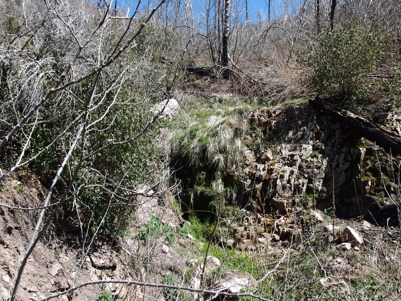
Dribbling water at Mud Spring
It was a complete surprise when I broke through onto Parker Creek Trail. In a daze I turned around, hunting for any sign of the ancient, overgrown, decommissioned trail I had been bluntly plowing along, and could find no sign of either the tread or my passage. Where the heck had I just came from? I checked my GPS and it was still acting weird. Was Coon Creek just a vivid dream?
Only a few miles left to go, and the uphill portion of my day was almost done. I leaned into the last 300' and knocked it out in minutes, only pausing when I reached the saddle and nice shade. The rest of my food and water disappeared quickly, and I dressed a few of the more productive cuts from the Locusts, and then it was time to push on. It wasn't even noon yet, and part of me was sad that the adventure was almost done.
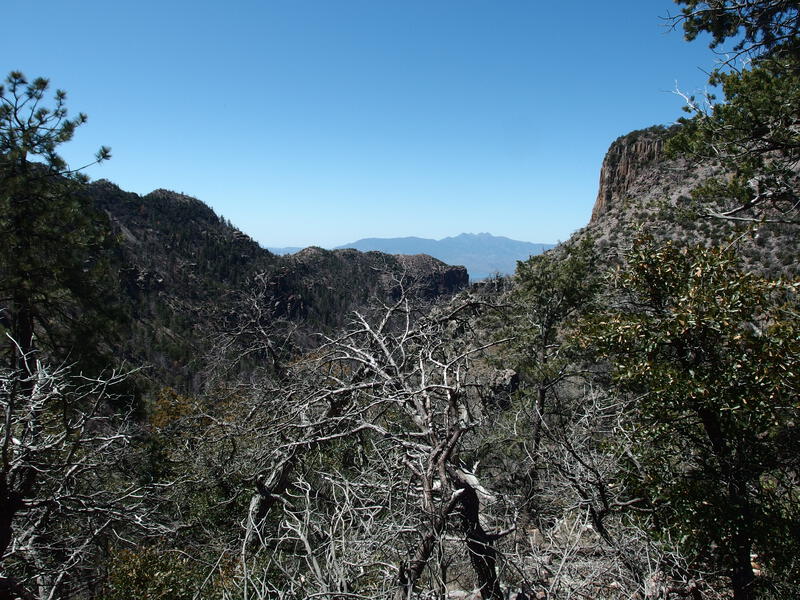
Four Peaks beckoning towards home
Looking down at the final drops of Parker Creek
Parker Creek Trail was a real joy to descend. The grade is gentle, constant shade is pleasant, and trickling creek made for a soothing backdrop. Thanks to this trip, and the failed Moody Point ascent from last month, I was already more than 2/3rds of the way done with the Sierra Ancha Wilderness trails. The northern trails can wait until the hotter summer months, and there's nothing saying that a return trip, mixing up pre-traveled trails to create new routes, wouldn't lure me back. This mix of overgrown trails and massive views was something that deeply appealed to me.
Comments (0)