Lookout Mountain on Section 17
It was late afternoon as I walked away from my parked car on the Northwestern Road. The air was cool and damp from the morning's rains, keeping the normally pervasive black flies and mosquitoes to a background detail. Several logging roads branch north from the Northwestern Road here before it becomes impassable in the west, as most of the big trucks and equipment come in from Big Bay area in the east. I followed one of these gated logging roads up into the Longyear property nestled in the Huron Mountain Club land this afternoon hoping to find a good view.
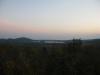
Lake Ives in the north
This was my first time on this particular route. I've taken a track further to the east and another to the west, but this road promised easy access to my destination. With a little bit of imagination the hills just off the Northwestern Road march northwards in columns, with creeks and rivers running parallel in between towards the sandy flat-lands between Mountain Lake and Ives Lake. These columns of hills often have multiple outcroppings, even north facing ones, and hold small waterfalls and rapids along the waterways. I've already climbed along many of these hills, from the Snake Creek outcroppings over by East Branch Salmon Trout River to the double-peaked mountain south of Ives Lake. Today I was heading to an outcropping on Section 17 thanks to a recommendation from Joel, another Huron Mountain hiker. A series of logging roads lead within several hundred feet, and less than a hundred feet below, a panoramic clearing. With a bit of luck I'd have a few minor slopes to tackle before seeing one of the more expansive views of the Ives Lake area.
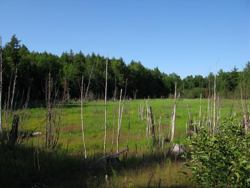
Small marsh on Elm Creek's headwaters
My walk along the sandy logging road was easy for a while. It was wide and well-traveled, allowing me to quickly head north. The Northwestern Road climbs up out of the Salmon Trout River Valley to an elevation of 1200 feet and this road, like the other logging roads, trend downhill along creek valleys. Distracted by how easy my route was I walked right past my first fork, losing almost a half mile in the process. Doubling back I turned right at a fork down a grassy, overgrown track over a swampy headwater of Elm Creek.
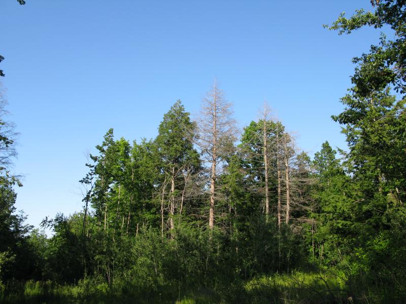
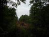
Tall trees guarding a fork on the road
Several overgrown forks complicated my route after I started down the overgrown road. Luckily I had done a decent amount of research on satellite photos before and knew which way to turn, avoiding any more mistakes. For the most part my path followed the most obvious route, even though there were more than a few downed trees to step around and the grass often came up to my waist. Eventually I got close enough to the outcropping to cut east off the trail.
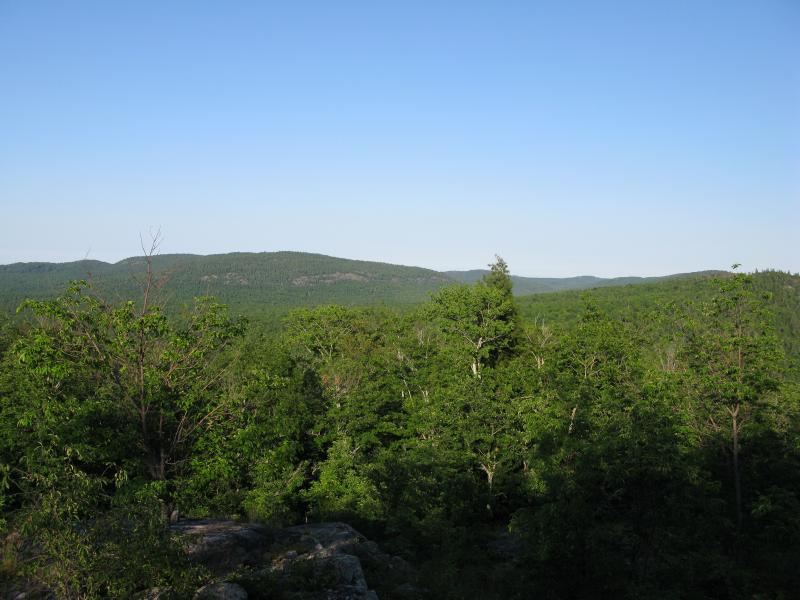
The climb was gentle and easy through a clear forest. While the forest was composed of large hardwood trees, the undergrowth was almost nonexistent and I easily strode up the hill. Before long I was standing on the edge of a sweeping northeast-facing stretch of rock.
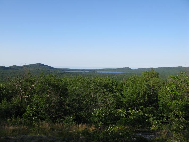
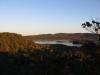
Ives Hill to the east
Ives Lake stretched to the north with Mount Ives and Breakfast Roll poking up on either side. Dull grey rock poked out from the western flank of Ives Hill to the east, a tempting destination for a future adventure. I couldn't see much to the west but the views north and east were definitely worth the climb. Sitting down on a large boulder I rested, peering out over the untouchable Huron Mountain Club land beyond to Lake Superior beyond as the sun crawled across the sky.
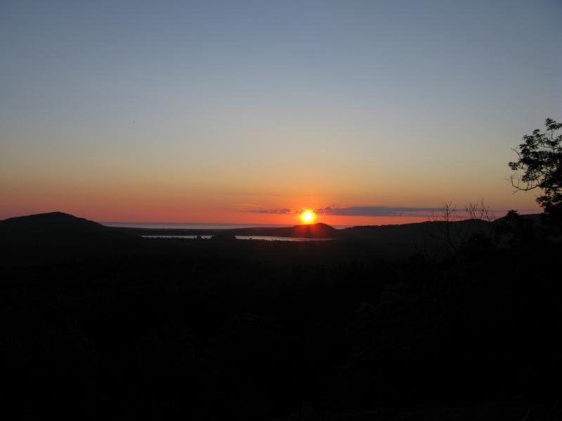
Sun over Ives Lake
The original plan was to continue north to a shoulder of Mount Homer that appears to be on public land. As the sun set, though, the bugs started to come out. The swampy lowlands of this area generate clouds of annoying insects unlike anything else I've experienced in the Upper Peninsula. I beat a hasty retreat. I had been hopeful with the earlier lack of bugs and wasn't prepared for this onslaught. As I walked back to my car I planned a future trip to Mount Homer and possible autumn visits back here and to other outcroppings overlooking this beautiful, remote area of the Huron Mountains.
-
Jacob Emerick
Dec 31, '12
Hey Joel, thanks! I came up on the west side of the ridge, parking just before the Northwestern Road becomes completely impassable for most vehicles (although I did drive through it this summer in my little Saturn Ion, something I really, really regretted doing as the trees were scraping the sides and I could feel it bottom out multiple times). So I would have been on the west flank, turning northeast to climb up and 'over' the hill for the view. I think we're just using different semantics to describe the same path, not sure which is the right way. I could just barely make out Homer from the bluff I was on but I don't think I saw Trout. The evening sun washed out most of my pictures to the west so I didn't mention them. Or I might have just missed that leg... Either way I'm hoping to bring Katie up next fall for a color tour, this hike may just be long enough for us and a baby (not sure if it's a good idea to haul a 3 month old around in the Huron Mountains, but there's plenty of time to make that decision).
-
Joel
Jan 1, '13
Happy New Year, Jacob! Here's hoping 2013 brings some new and amazing hikes! I understand now, while you hiked the network of logging trails on the west side of the ridge, I always hike the trail network on the opposite (east) side of the ridge- judging by your photos, the trails are very similar- starting off wide and sandy before making a turn and following over-grown remnants for the remainder of the hike... Also, I see in my 1st post, that I mixed up the viewing directions at the Sec. 17 summit when describing the open area as an "inverted V"- the leg to the NE points to Ives Hill (this was the leg you were on), while the leg to the N/NW points to Mt. Homer, Trout Mt., etc.. Sorry for the confusion! I hope you guys can make it out for the fall color- the entire panorama of the Ives Lake Plain lights up with pumpkin orange, deep red, and green (mixed in with vibrant yellows)! I've seen dads carrying their babies (not yet toddler-aged) up to the summit of Hogback Mt. over near Marquette, so I think Sec. 17 would be do-able with a little one, and a great introduction to the Huron Mountains! If you got a stroller with off-road wheels, you could even push him/her part of the way- oh yeah, I forgot the gates on the Longyear property state "No Wheeled Vehicles".........
-
Jacob Emerick
Jan 3, '13
That's pretty funny, Joel! I never thought about a stroller when I saw that sign. I have wondered a bit about snowmobiles getting back there, even considered what would happen if someone was to haul golf clubs back there. A stroller would be fun, can't imagine the guards kicking you out with a baby. Good to know about Sugarloaf too - I'm really not sure what sort of hikes I'll be tackling next year. As for the route, I've been down the east paths a few times on other hikes. They're a bit easier to get to (not as far down the Northwestern Road), but I like west path a bit more. They don't dip as much, making climbs more mild, and parking is easier. Both go to the same place, though, so I guess it's a horse apiece.
Add to this discussion