Intro to Blue Range: Across the Blue River
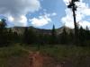
Spending the night sleeping on a cot at a remote trailhead under starry skies and tall pines gave me a few hours of sleep, enough to feel somewhat rested in the morning, especially given the long drive from Phoenix. When my alarm roused me I stumbled up, made a quick breakfast and checked my gear, and headed towards the start of Steeple Trail, dim skies still void of sunlight. There were plenty of miles to travel today in a new, undiscovered landscape, and I was anxious to get ground under my boots.
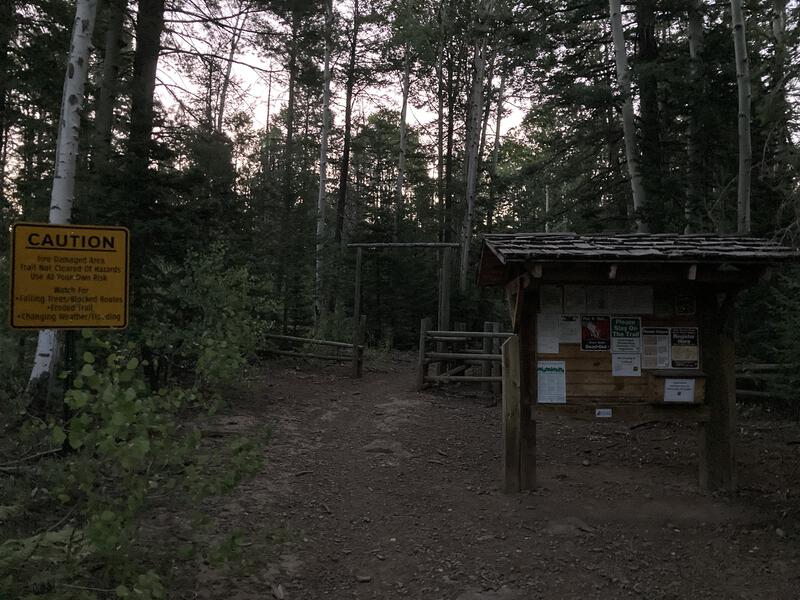
Early start at the trailhead
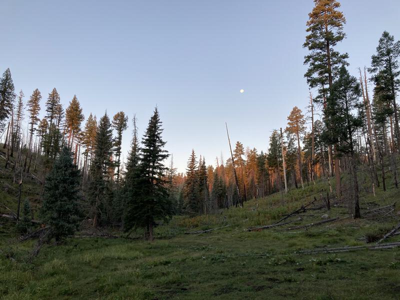
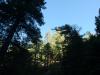
Sun filtering into the little valley
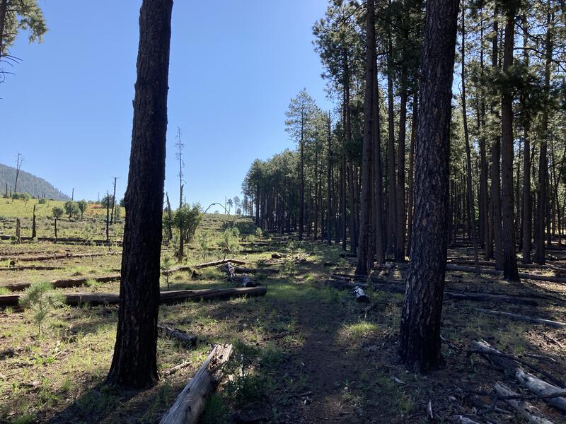
Burn damage was heavy for the first mile. As I dropped down into valley of Upper Grant Creek I was surrounded by the scorched remains of a once-thick ponderosa forest, now home to overcrowded underbrush and deadfall. At least the trail remained clear and well-maintained. I reached a junction with the first hints of daylight dappling the hillsides, turning with the creek down Upper Grant Trail, which was labeled as a primitive trail, and things began to improve, with only partial damage done to the forest. Wasn't sure how thorough the Wallow Fire had hit the Blue Range, and I hoped I'd be spending most of this backpacking trip under a healthy forest.
Blue Range Primitive Area is located in the far eastern corner of the state, near Gila Wilderness in New Mexico, and it shares many of the same features and pleasant alpine environments. Pine-covered highlands surrounds the Blue River, which flows south to join Gila River, giving this land rich resources for both native and ranching history. This range and surrounding area was hit hard in 2011 by the Wallow Fire, the largest wildfire in Arizona history. Aside from that misfortune, this is one of the oldest protected spots in the state, and the last remaining primitive area (a pre-wilderness designation), with lots of trails criss-crossing the land, and I was really looking forward to exploring it.
Grant Creek was a pleasant, busy little waterway, and the primitive trail along it, while more rugged than some paths I've been on, was not hard to follow. It bucked up and down the bank a few times, there was some deadfall to climb over, and I could count on one hand how many cairns I saw, and I still found it much easier than some of the unmaintained trails in the Mazatzals. The happy creek and the lush old forest was a joy to walk through and the fire damage stayed high above. When I reached some old cabin remains and the next trail junction I was reluctant to leave the creek, so I paused for a snack break next to a small cascade, enjoying the quiet atmosphere and cool morning air.
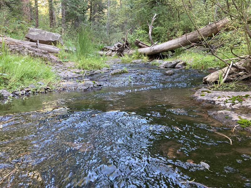
Trickling Grant Creek
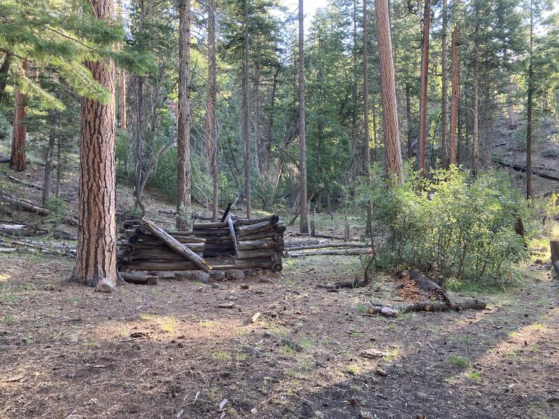
Old cabin site along Grant Creek
Such breaks were a luxury that I could barely afford. I hustled on, now on Paradise Trail, which climbs away from Grant Creek and heads north, eventually meeting (the real) Grant Creek Trail in Paradise Park. The little 300' climb felt like a rude intruder into my otherwise downhill walk and, after I huffed my way to a small break in the forest, I wandered a short distance off-trail to take a few photos (and catch my breath). The views down the Blue River valley and rising hills on the other side were expansive. Would I really be able to get all the way to the other side today, to my planned campsite in Bear Valley?
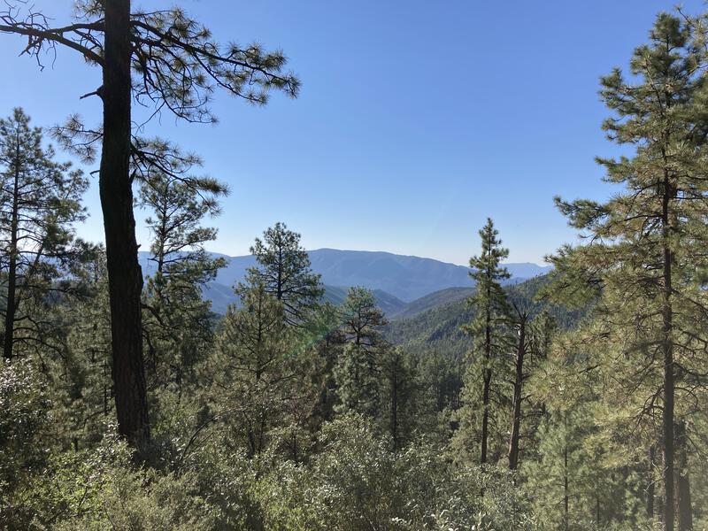
Looking down into the valley of the Blue
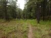
Back on the trail I continued on, still on the steady uphill tread, and made my way around a small valley. The pine forest was wonderfully thick and provided excellent shade from the warming sun. Every once in a while I would hear the flutter of wings or the brush of leaves; however, with the exception of my noisy passage, the area was silent, and most of the animals were apt to avoid something as loud as me. The trail climbed another 400' and ended suddenly in Paradise Park, which is normally the name for a nice stand of pines on flat land, though the fire seemed to have cut a weirdly sharp line and devastate most of it.
Sharp line from the burn
My route cut east, following the burn line with uncanny precision, and I can't help but speculate that the fire fighters used this trail as a stop, either doing a back-burn or laying a strip of retardant from the air. For a half-mile I followed the edge, sometimes walking in the cool shade and momentarily stepping out into the sun, before the burn swept south and I was left in the middle of an open, fern-covered, exposed meadow with a gradual downhill slope. It was difficult to track the trail here and I had to squint at my GPS a few times as I trotted along.
A big drop down to the river was coming, one I was not looking forward to, though I'd get the chance to water up first. Once I traversed the clear, sunny meadow I reentered a spotty forest, followed the trail along a traverse, found the old fenceline, and took a spur trail down towards White Oak Spring, which was a sharp drop over loose rock. I startled a group (rafter) of turkeys here before settling down for a mid-morning break. A third of my mileage finished, nine (mostly) downhill miles, and sitting down and guzzling water was a welcome respite from the hot, sunny walking.
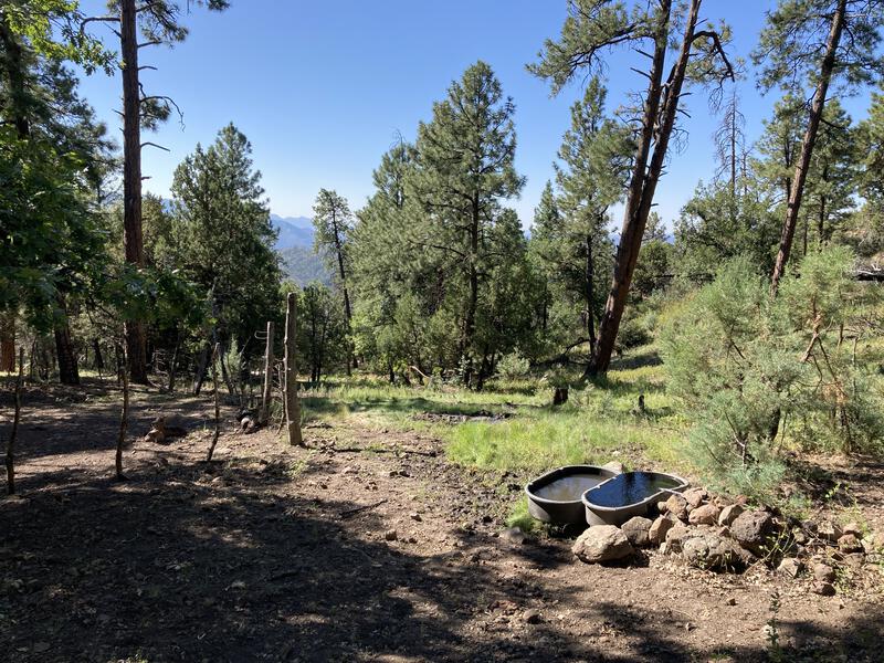
Pleasant scene around White Oak Spring
With the exception of the turkeys and a few deer my time here was very peaceful, and when I convinced myself to get up and continue moving, I felt refreshed, even with the extra water weight in my pack. This was the last clean water for awhile, as I didn't fully trust the quality of the Blue River, with multiple farms and ranches along its length. The refreshed feeling didn't last long. I had to haul up the spur trail to rejoin Grant Creek Trail and soon was dumped out onto a steep south-facing bluff, winding back and forth on exposed switchbacks, cooking under the hot late-morning sun.
Dropping down into the warm valley
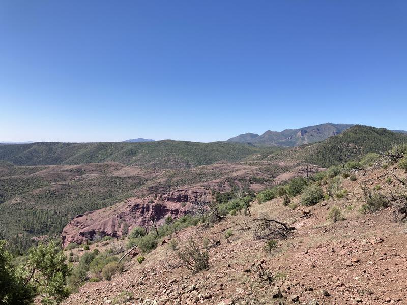
Dropping down the bare, rocky hill was tedious, and even with the expansive views that the open terrain offered, it was a long hour until I reached the bottom. Grant Creek, which I had last seen under pines far uphill, was, if anything, smaller this far downstream, and it trickled occasionally between long stretches of dry, rocky creekbed. There were a few large, green trees overhead, mostly cottonwoods, and plenty of fire damage on the hills above. I was not in the prime area of the Blue Range anymore.
The trail faded in and out, with slumps and deadfall complicating the way forward. I made decent time, tuning out my surroundings and pushing quickly, anxious to reach the end of this trail and start on the most mundane portion of today's walk before the furnace truly kicked in. I thought about pulling some water here, and there were a few decent pools, yet there was also ample signs of grazing cattle, and the smell of manure was thick and I couldn't stomach the thought. Hopefully the few liters from White Oak Spring would last me through the afternoon.
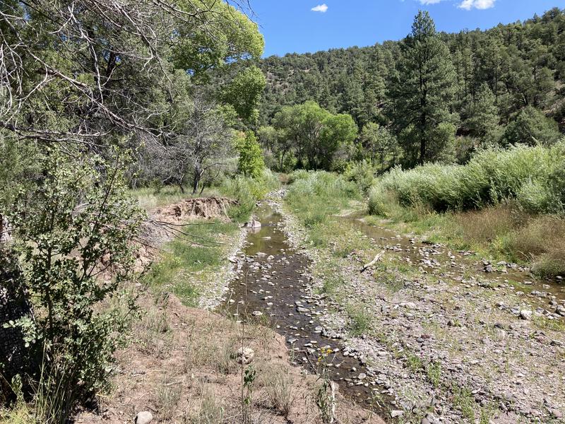
The tiny, smelly Blue River
As I reached the end of the trail it faded into a grassy nothingness and I emerged onto the bank of Blue River, blinking lazily in the hot, dry air at the bottom of the valley. It was far warmer than I had planned for, and I was not excited about that. With no tread or cairn to guide me I dropped heavily down to the pitiful flow, quickly stomped across, stumbled up the other side, and pushed my way through some brush, and, by pure luck, found the lower trailhead with a large juniper providing a circle of shade. Seems like a good excuse for a long lunch break.
The next four miles of travel would be along FR 281, a dusty road that provides easy access to both the valley ranches and some trailheads that climb up into the surrounding hills. If I pushed it I could cover that in an hour. I sat in the shade and drink some water and mentally walked through the rest of my route. Sure, I was a bit behind schedule, and I still had a decent chance of reaching my planned campsite, and it was really hot and I wasn't pushing enough water. I shrugged off the concern and, more driven by curious ants than desire, set down the road.
FR 281 was more taxing than I expected. After two miles I had to stop and find some shade, and I huddled under a rocky bluff, searching out any coolness seeping from the ground. Polished off most of my water here, leaving a meager half-liter to sadly slosh in my pack. Final two miles dragged, and I had to poke around a Forest Service camp and some private property to find the start for Lanphier Trail, passing a stinking pen of fly-covered, sluggish horses on the way, and once I found the trail, it climbed steeply and drained all the energy from my legs. At the Largo Trail junction there was a happy little trickle and a shaded rock and I couldn't sit down fast enough.
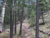
Longing for Bear Mountain
Trotting along the pleasant footpath
Lanphier Creek rejuvenated me, the cool, crisp water washing the dust from my throat and cooling my neck and head. I powered up the other side of the bank with a full pack, enjoyed the view of Bear Mountain to the south (which I'd have to pass by in order to reach Bear Valley), and then quickly dropped into a small park, letting momentum carry me along the spotty shade. There was 1600' of elevation to gain over 4.5 miles, and even though there were a few water sources along the way, I hoped to cruise through this section.
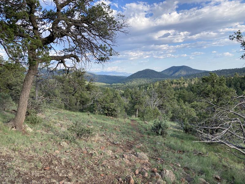
My afternoon was mostly pleasant. The shaded forest and a mild breeze helped with the heat, and I made a deliberate attempt to push more water. There were three marked water sources along the way, and I did refill a liter at Dutch Oven Spring, partially because the round cement trough was so darn scenic, and I passed my first hiker of the day near that, a hunter on his way out after a three-day exploration. Trail climbed steadily, never too steep, though the final haul near the saddle did feel tough. I crested the ridge at five with barely a hour of daylight left, pausing briefly for the vista before tumbling down.
Going down the final drop to Bear Valley
Going downhill felt good, striding along the flat stretches of trail broken up by large, grassy meadows felt better, and then Bear Valley showed up. The path seemed to wander here so I chose a direct way across, glancing around for any sign of other campers or water or even a fire ring, anything to signal a good place for me to set up for the night, and I didn't find much. Near the southern end there was a lone man with several horses who had a small establishment setup, and after a quick conversation he suggested the spring another half-mile along the trail.
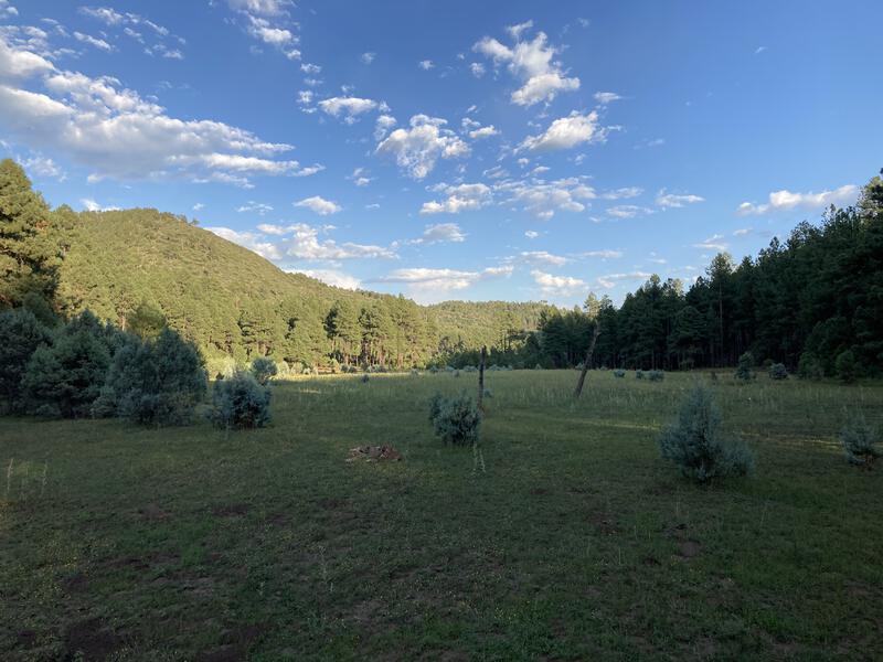
Afternoon light on Bear Valley
A curious elk watched me as I cleared a spot and put up my little tent above the spring. There was plenty of trickling water around me, so I didn't feel like I was in his way, though he seemed intent on showing me who was the boss in these woods. Easing my way through a few cramps I finished unpacking, filtered a ton of water, and eventually made dinner and rested. Over twenty-seven miles covered today and I was completely wiped out, largely because I didn't drink enough water during the hike, and all I wanted to do was get a good night's sleep and try to be better tomorrow.
Comments (0)