Hidden Valley of the Superstitions
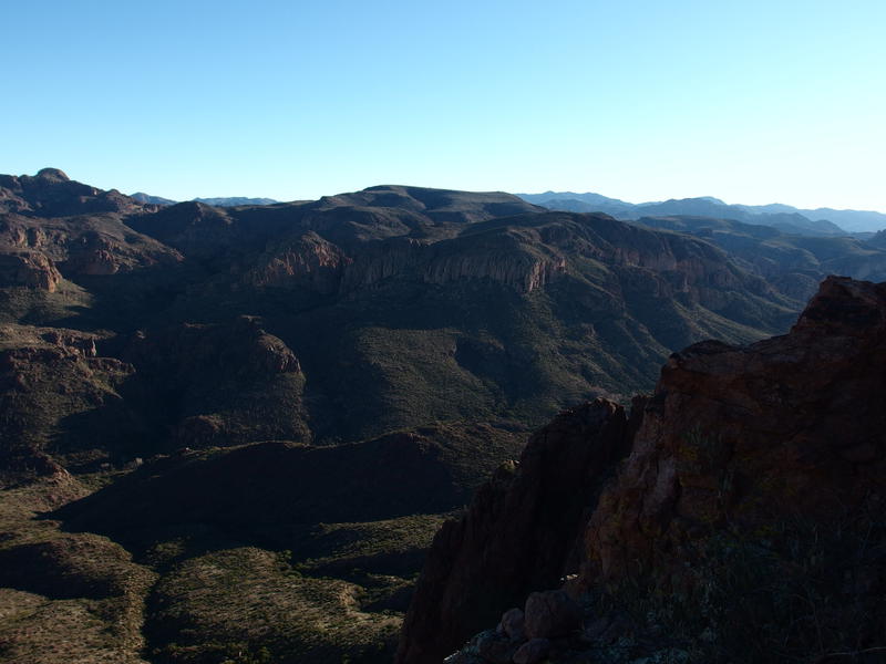
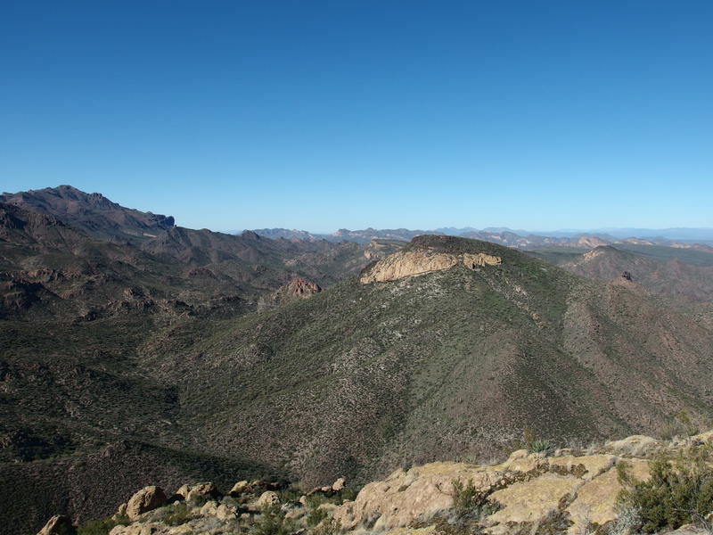
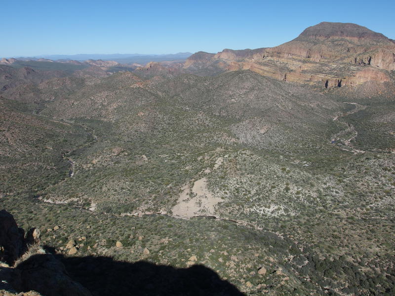
Light quickly flooded into the western Superstitions, changing the rock formations from a dull red to bright yellow as the sky woke above. From my perch on the summit of Bluff Springs Mountain I watched the scene unfold as I shivered and ate a hasty breakfast. It was beautiful, mountains and pinnacles and hills laid out in a visual smorgasbord, I was just too darn cold and tired to fully enjoy it. My legs had carried me many miles in the dark to this point and now a brisk wind and subzero temps was stealing the warmth from my body.
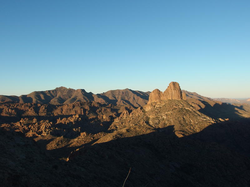
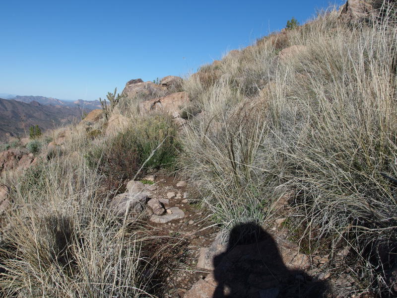
A fully woken morning on the Western Superstitions
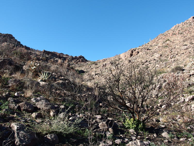
Bodies at rest tend to stay at rest, so I stood up, shoved my gear back into my pack, stowed the peak log under a few rocks, and began the rambling trek downhill. Under my sweatshirt I wore a down jacket, something I never bring out on desert hikes for fear of a stray needle or rock tearing a hole. Glad I brought it today. I also kept my wool hat and gloves on, basically wearing every piece of gear I brought, and still my teeth chattered as I shuffled slowly down from the peak.
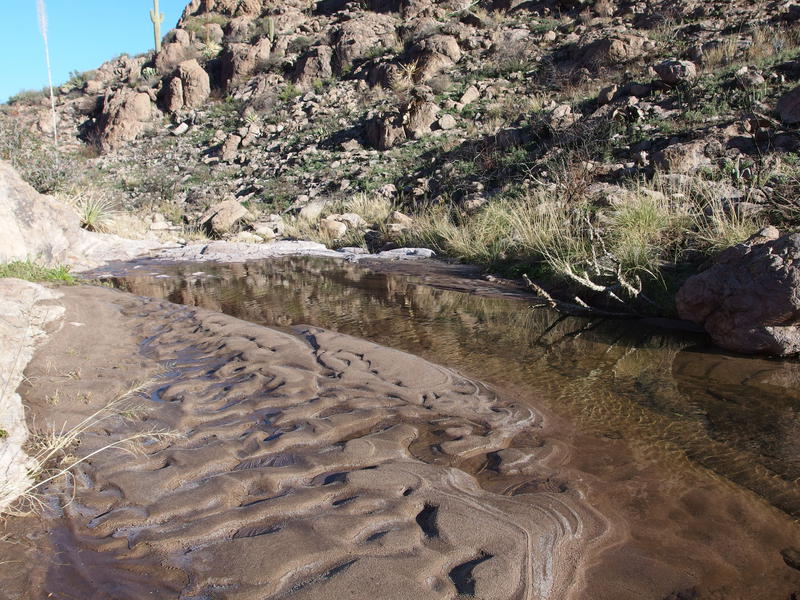
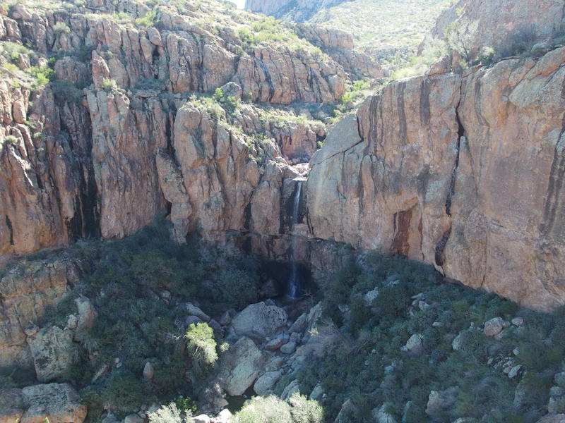
The few hundred feet down the peak to the flat mesa was all loose rocks and boulders, not the best terrain for my tired legs to handle. Man, I really could have used a longer break. Guess there was plenty of daylight left to waste on breaks if/when things heated up. Once I made it to the mesa and all those burnt shrubs I decided to alter course and head down a little canyon. See, the mesa sticks out to the north and has a great lookout, with a canyon on each side to pronounce the point. That was the plan, to follow the mesa out, but the canyon promised a break from the wind. I followed it down and was quickly rewarded with frozen waterfalls and flowing water.
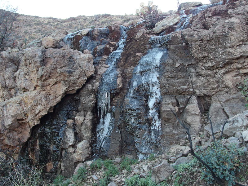
Frozen waterfall along the descent
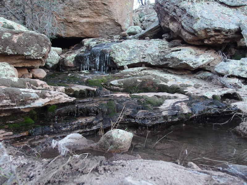
Dripping water pooling within the canyon
Water is always fun to play in, though water in the desert tends to attract thick brush and prickly things, so I crossed to the other side and made my way to an exposed ridgeline. I had dropped below the mesa and was somewhat protected from the wind, and as soon as I walked back into the sunlight I began unzipping layers. Down jacket was useful for maybe thirty minutes today, a very thankful yet short thirty minutes. The exposed ridge was fun to dance along, all big boulders that forced me to dance and swing around, and on the far side I got an amazing view down into Hidden Valley.
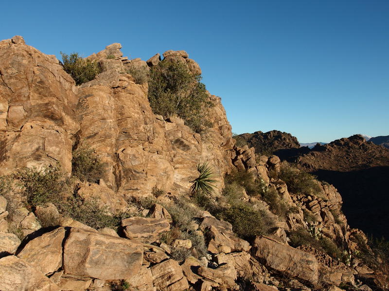
Craggy outcropping along the way
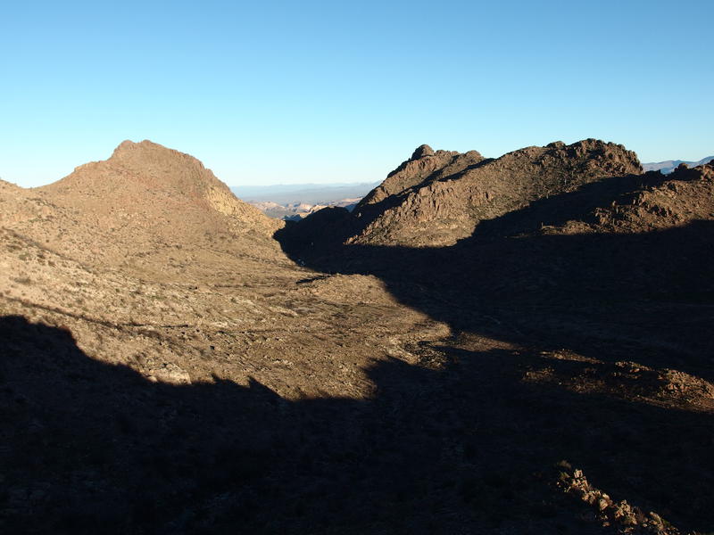
Shadows hanging over Hidden Valley
It was very different to see it in person compared to my topo maps. It was really a valley, a big swoop carved out from the side of the mountain, and the creeks that started up on the mesa behind me ran through it with wide curves. On the far northern side the sides of the mountain came together and towered hundreds of feet above, forming more of a canyon than valley. I had pictured a long valley running the whole length of this mountain and instead it was only a half mile in diameter. It really would have made an excellent little spot for a dedicated camp, well protected and watered.
I admired the valley for a few more minutes before deciding to continue down off the ridgeline. There was still a few hundred feet to drop, some of it over these large boulders and most over the gentle and sandy bottom. As I walked I found more and more signs of the strange fire, chollas carved to the bone and yuccas crisped down to their weird stalk. Charcoal even began to collect on my pants. Whatever happened had to be this year, which further confused me. A fire in the barren Supes would have grabbed some attention, wouldn't it?
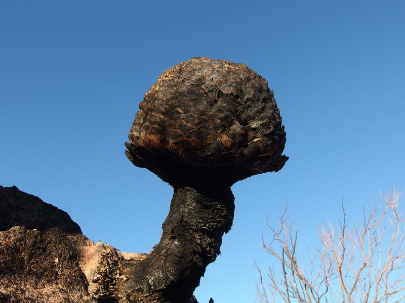
Reminders of past burns
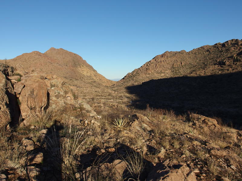
In Hidden Valley
Once I reached the flatter bottom of the valley I had those creeks and some catclaw to deal with. I didn't mind - it was nowhere as thick as that stuff up on Tortilla Peak had been. Crossing the creek was a bit annoying, soft sand warming up to form muddy banks. After the third crossing I decided to inch higher away from the creek and follow the side of the valley. Along the way I kept an eye out for any signs of a rusty old chair.
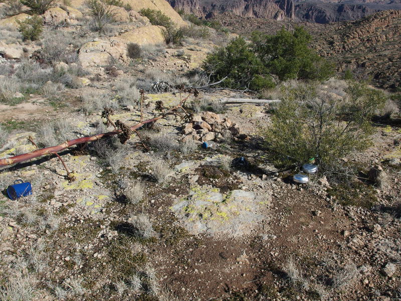
There was once indeed a dedicated camp up here, well, two of them. One was the old Al Reser and it was located right in this valley. There was supposed to be a few signs of that camp, old cans and bottles, plus a rusty chair. Magill's base was further to the north. Anyways, if I could find that chair than maybe I could find Reser's camp and a possible backpacking destination for the summer. Before I could find it a side destination showed up, a little climb to an eastern view, so I decided to pause on the camp search.
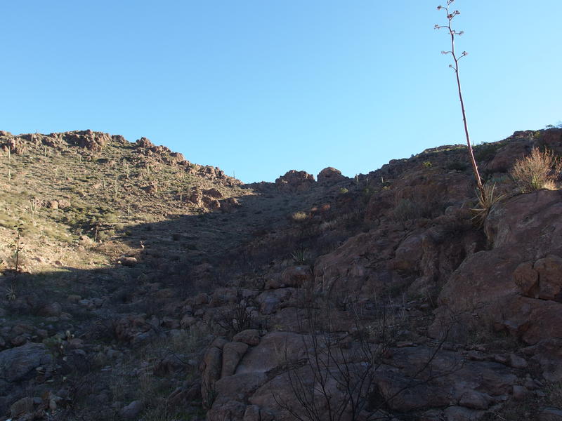
First climb up the eastern side
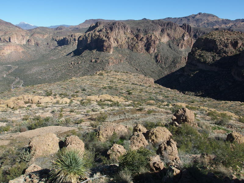
My legs were ready for the uphill change after the steep canyon and mostly-level valley floor. Three hundred feet felt like child's play after Cardiac Hill and Ely-Anderson, even if there was no trail to follow or cairns to find. First I followed a dry wash up, then I hopped up the north side of that and simply pushed up the slope. Only pausing a few times for orientation I made it to the top, heart freshly woken, and was faced with an awesome view.
Deep shadows on Music Mountain
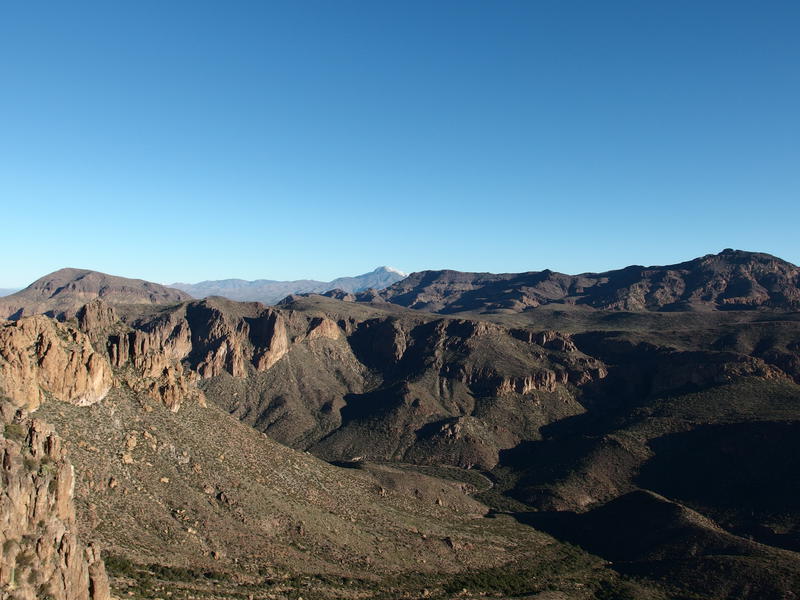
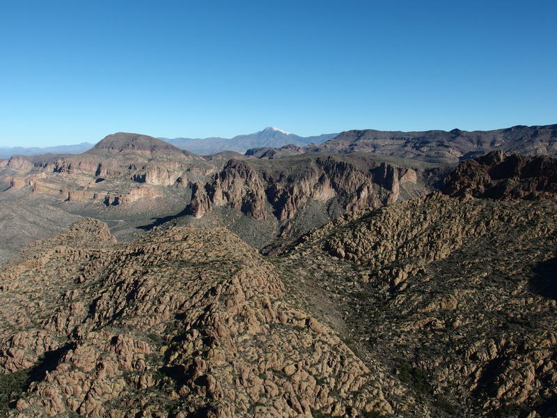
North views of Malapais, Four Peaks, and Tortilla Peak
To the east, across the thousand-foot drop of La Barge Canyon, was Music Mountain and Peter's Mesa. Directly below was the lush green around some springs and the trail junction of Dutchman and Red Tanks, where I had spent a night some months ago and been harassed by coatimundi. Northeast was incredible. Charlebois Canyon and Black Mountain was in the foreground, Tortilla Peak to the right and Malapais to the left, and Four Peaks loomed in the distance. Man, I really want to get back and try the Mother Lode again.
Leaning against a rock wall I enjoyed the view, picking out familiar formations and looking for hikers on the trails below. Not sure if they'd even hear me shout from up here. There was no one in sight anyways. Just me hanging out on top of a bunch of cliffs on a sparsely-visited mountain. I played around with the idea of following a ridgeline north to make a loop and decided against it. This hike was dangerous enough as it is without tempting a treacherous dance on a ridgeline solo. Instead I turned and made my way back down to the valley floor.
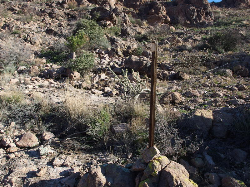
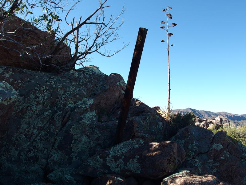
An old mining claim on the eastern hillside
On the way back I found an old mining claim. These stakes usually mark the corner of a plot, so without finding another two (or even one) markers I didn't have much to go on to find the source of the claim. Still, I did glance around with some hope. Bluff Spring Mountain has a ton of Dutchman Lore associated with it, including dozens of fruitless mines and shafts dug over the years, and I would have loved to find something today. Nothing showed up so I simply ambled to the bottom and resumed my hunt for Al Reser's camp instead.
I had an interesting choice to make soon. Most hikers who explore Hidden Valley will follow the creek to the north. There is a guy who describes an alternate route that stays on the western ridgeline northwards (this ridge is much safer than the one I just climbed down). So I could take the creek or the ridge. For now I headed downstream, looking for signs of an old camp, and procrastinated on the decision.
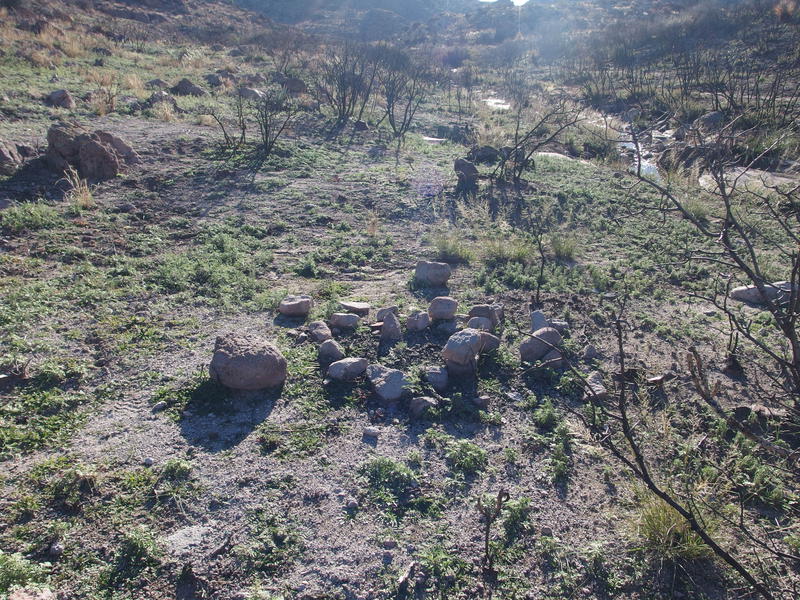
Few remains of Al Reser's Camp
Large collections of water in the valley
Never did find the rusty chair, though there was plenty of other camp remains to find. A few fire rings, metal canisters, even some glass jars half-buried. After circling around awhile I headed down to the creek, found a flat rock, and relaxed. Second breakfast was overdue and there was more than enough water for me to drink and refill. If only I had brought a few extra items I could have made a hot cup of coffee to make things perfect.
Tough climb up a wash on the western side
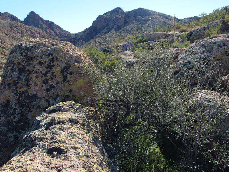
While I relaxed I made my decision - I was going to climb up to the western ridgeline. Fewer people had done it and the views should be great. Plus, there was a better chance at finding old mine shafts up there. Moving slowly, not looking forward to another climb, I packed up my gear and picked a clear path through the catclaw to the base of a rocky wash. The wash led me all the way to the top, complete with a few frozen waterfalls still hiding in the shade, though there was enough prickly stuff to make me bleed for it.
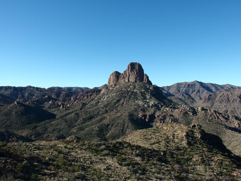
Weaver's Needle dominating the view
Up on the western overlook was a good view of Weaver's Needle, a slightly different angle and several hundred feet lower than when I had last seen it up on the peak hours earlier. It conveniently blocked out Superstition Peak behind it, making the needle seem all the more prominent. A sudden noise to my right startled me and I glanced over just in time to see two mule deer bound up and around Peak 3999. Dang, that's the closest I've gotten to these smaller cousins of the whitetail, and I didn't have my camera out in time. I snapped a few photos of Weaver's Needle and Peak 3999 before heading north along the ridge.
Peak 3999 along the western side of Hidden Valley
I really didn't know what to expect of the western ridge. It seemed doable from the topo profiles, and Carlson/Stewart mentioned doing it in their fantastic two-book guide of the Superstitions, yet no one on hikeaz (a website I use for scouting out many Arizona hikes) has walked this ridge. The one guy who tried turned around after a few hundred yards. Hoping to have better luck, I cut a diagonal below the highpoint. Ten minutes into it and I found a pleasant surprise - the remains of an old horse path cut into the slope. An abandoned horseshoe confirmed the path usage.
An old horse path along the slope
Al Reser had Hidden Valley, and Magill held this western ridgeline. Magill had a base camp up ahead and several mine shafts along the way. However, there really isn't a good way up to his base camp. There are a few access routes far to the north (more on that later) and then the Ely-Anderson trail. The shortest path from Peralta area would have been up the Ely-Anderson and along this ridgeline, close to where I've hiked so far today, so it only made sense that horses would have been used along here.
Sometimes tracking the path, sometimes picking more direct options, I followed the western ridgeline with no issue. An expansive northern view began to show up as the hillside rounded around. Once past Peak 3999 a little rounded nub to the right showed up and I just had to cut over. Sure enough, the nub provided an awesome view to the north and into the canyon below Hidden Valley. Intoxicated by the unique vantage point I played around on my phone a bit, trying to get panoramas and even shooting a quick video of the area, before sitting and dangling my feet over a precipitous drop.
A rugged view northwards
Another view down
Retreating back off the nub I began the long descent off the ridgeline. I was still high in elevation, around 3700', and I had 600' to drop before I was level with the waterfall. Oh yeah, there was that waterfall at the end of that creek that drains Hidden Valley. Anyways, the descent was rough. It was all boulders and thick growth, forcing me to weave back and forth and hop around, often climbing down twenty feet just to haul back up ten. At least I found another mining claim along the way. Again, there was no shaft or pile of poor rock, just a corner marker with little context.
Mining claim on the western side
Black Top Mesa, with lots of yellow
Remains from a more recent camp
When I finally reached a decent saddle I was disappointed to see the more recent remains of a camp scattered around. There were mess kits and a coffee percolator, multiple empty jars of peanut butter, and even a pad and sleeping bag stuffed under a bush. Suppose it's not that different from the remains of Al Reser's camp, just trash strewn about with a few decades of difference. Somehow this felt so much more junky. I thought about picking up some of it and instead bundled up some tangled mylar balloons. There was only so much room in my day pack for trash.
On a trail far below the mountain's cliffs were two hikers dressed in bright clothing. They seemed to be digging along Terrapin Trail, as weird as that seems. I hollered down at them, though they didn't stop their activity. Maybe they were cleaning up some trail damage, or burying a carcass, or looking for Dutchman gold. Eh, I'd be down there in a few hours for an up close look. I turned from the hikers and the discarded camp and continued downhill.
Looking down the last descent to the tip
Boulders and brush complicating the descent
I made the mistake of trying to dance along the ridge for the rest of the descent and ended up on top of a maze of huge boulders separated by thick brush. The boulders were too spread out to hop across and the brush too thick to hack through, so I had to do half of each. There was one drop where I had to squeeze down a narrow chimney and had no option except to let go and hope the bottom wasn't too far down. It wasn't, though the sudden shift pulled something in my knee that would complain for the rest of the day. After that it was a level stroll over to the northwestern tip of the mountain and I had a sweeping vista of the valley below.
Looking down at the Little Bull Pass area
Down there, below these cliffs, was my exit. Part of it, anyways. Little Bull Pass is a retired trail that cuts off a corner of Dutchman Trail, and if I could find that than I'd have an easy way back up to Terrapin. It was a simple matter of dropping another 600'. This drop would be a lot more sudden. I didn't want to think about that yet. Instead I wandered east over to the waterfall, that scenic and sudden ending to this mountain that drains the lands around Hidden Valley.
The waterfall draining Hidden Valley
So now I had three options. I could backtrack up the mountain and take either the northeast or northwest option, so named by Carlson/Stewart. Northeast exit would be harder to find and was pretty overgrown, and northwest would add miles and a lot more climb to my day. Or there was the rope, if it still existed. I've heard that there is a rope that drops down near here and offers some appreciated help down a more direct and treacherous descent.
Looking for the rope couldn't hurt. I poked around the edge of these cliffs, enjoying the views of that waterfall and making my way down a few dozen feet at a time, until I saw the long, straight line of a rope making it's way through a desert slope. That's not that steep. I ventured over to it and verified that it was sturdy and well-anchored, then followed it down the slope. The rope guided me down the slope, veered right along a rocky ledge, then suddenly dropped down an overhang.

The rope that might help me down
Well, shoot. I was too committed to turn back now. Moving quickly, racing against my nerves, I bundled my trekking poles into my daypack to free up my hands and braced myself. It's been years since I repelled, let alone worked with ropes, and I grabbed at it like an amateur. Taking things a few feet at a time I found footholds, slid down the rope, and did my best to ignore my body's screaming warnings. There was one point where the rope zig-zagged awkwardly around a formation that really spooked me, and then a final eight-foot drop that the rope ended above that I had to slide and jump down. If I was climbing up this I don't think a rope would be necessary, but for a first-time descent it was invaluable. Looking back up once I was done gave my stomach all sorts of flip-flops.

A most frightful descent

Sun shining bright over the waterfall
Still trembling from the frightful ordeal, I clambered down through brush and over rock quickly, looking around for a flat spot to sit and rest. Not only did I need to regain my composure, it was time for an overdue lunch. I found a pleasant spot next to the creek and crashed hard, whipping off my boots and lounging backwards with haste. I needed to eat, needed to drink some water and filter fresh, and all I was interested in was calming down. I let the rare sound of trickling water in the desert soothe my frayed nerves.

Comments (0)