Haystack Mountain
Of the three volcanic plugs in the Ottawa National Forest (see an earlier post about Ottawa volcanic plugs), I enjoyed Haystack Mountain the most. It's relatively remote, virtually unknown, and involves a short but challenging hike. A recent trip to the Upper Peninsula brought me close enough to the mountain to stop by for a quick climb.

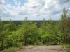
South from Haystack Mountain
Parking my car at the gated two-track off of Lake 13 Road, I quickly hopped the steel gate and waded through the tall grass. There were a few raspberries scattered along the track to sweeten the trek and none of the thistles that had plagued previous visits. Familiar with the area I took the right fork without referencing my GPS. According to older topo maps this fork in the road eventually loops around but I knew from my last visit that the right fork simply ends after a short distance.
The summer undergrowth was very thick in the woods. I struck a bearing roughly 30° to the left of the track, wandering through the sun-speckled undergrowth up a slight incline. The famaliar rocky outcropping started to appear from behind the trees, although the leaves were too thick to make out a definitive shape. Sharp rock cliffs rising up from the steep dirt slope in the form of a giant, half-buried cylinder, marking the rough shape of the old volcanic plug.
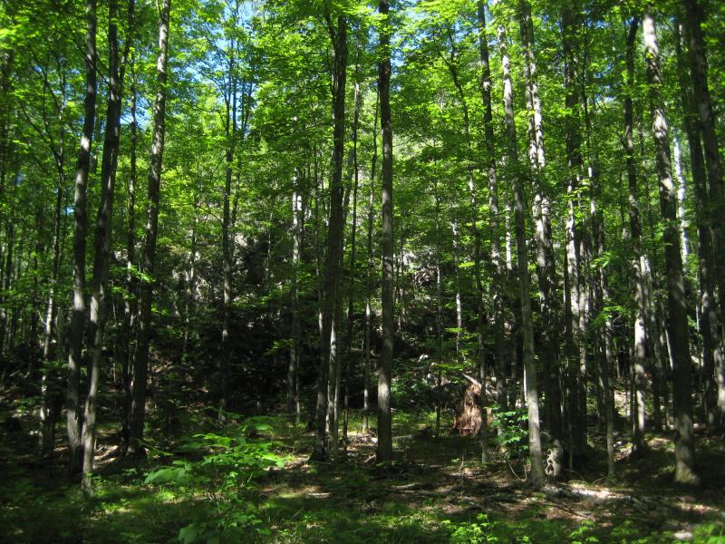
Haystack Mountain hidden by the woods
One of the coolest things about this mountain is the actual climb. Over time huge slabs of rock have fallen off from the upper half of the cliffs, creating a two-layered cake appearance. The bottom layer is not level but slowly climbs upwards in counterclockwise swoop, creating (with a bit of imagination) a giant circular staircase around the plug. I climbed up this ledge from one of the many rock spills reaching to the forest floor. Wide enough for grass and some small trees to grow on, this ledge gave me an easy climb until I was over half way up. The second half is not as easy to climb.
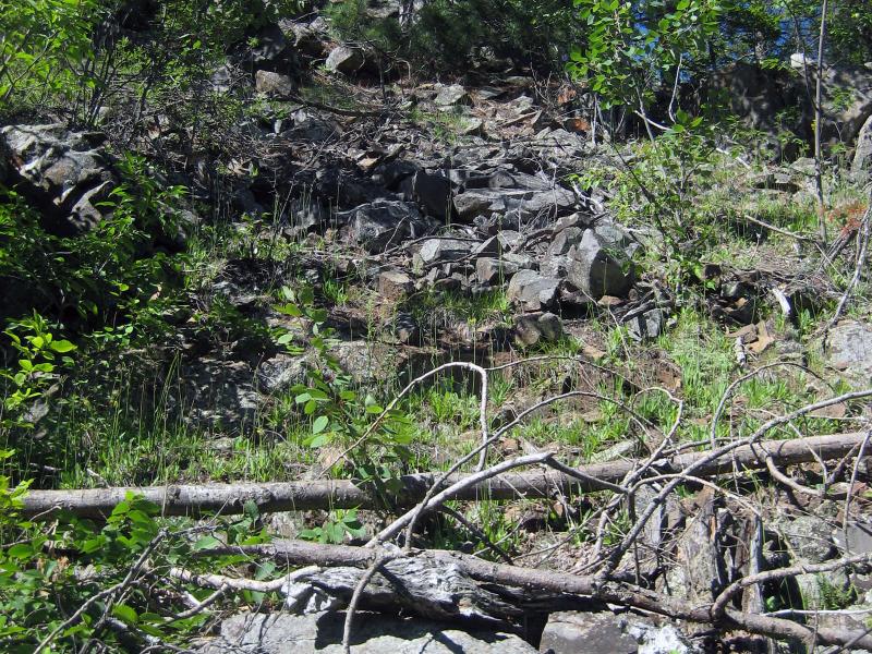
Rock slide up Haystack Mountain
The ledge ends at the base of rock slide from the top of the cliff. Roughly the size and shape of poor rock, the slide makes for a dangerous, shifting slope to the top of the mountain. Dropping down to a crouching stance, I carefully scurried higher, very aware of the angry clunks of rocks breaking loose and crashing down to the leaves below. Once I reached the top I sat down for a while to enjoy the view and cool breeze, a welcome break from the hot forest below.
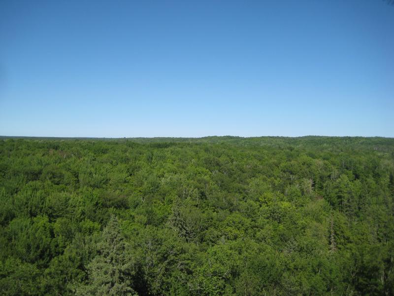
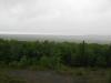
East from Haystack Mountain

West from Haystack Mountain
The top of Haystack Mountain is roughly flat, though it does have a slight dome. The center is overgrown with smaller trees and it is much easier to go around the outside, on top of the cliffs, than to cut straight across. There is some very nice views in most directions, with the deep green of the Ottawa National Forest stretching out as far as the eye can see. Only the western view is obstructed by small trees. While there is no prominent landmarks in this mostly flat area, the expanse of trees and solitude is well worth the climb.
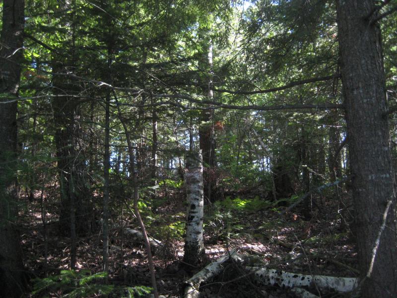
Overgrown peak of Haystack Mountain
A precarious crab-style climb straight down brought me back to the forest floor. Haystack Mountain is not tall - maybe 100' feet - but the difference between the breezy top and wooded bottom is stark. I walked back to the car and took off for my next destination. This stop always feels more like an enjoyable rest stop than an actual hike, and with the unique mountain and short walk, and I know it's just a matter of time before I return to this volcanic plug for another fun visit.
-
Jacob Emerick
Jun 22, '15
It's an fun stop and a nice surprise in the deep forest. Much easier to find/hike when the woods aren't summer-overgrown, though. A previous fall visit was particularly nice, with the colors spread out all around.
-
Andy
Jun 23, '15
Found it! Super easy - the left fork of the road off of Lake 13 goes right to the base. No gates anywhere in sight with a newish looking area cleared near the base to park in. (I've heard there's exploratory test drilling going on near Haystack, so maybe that's why the road is clear now) Thank you for hipping me to this neato spot I never knew about. Now if I can just find that damn Duppy Falls. Spent 2 hours back in there and nothing. Your directions seem more accurate than the maps I was given by the rangers. Maybe I'll try again if I have the time.
-
Jacob Emerick
Jun 27, '15
Awesome that you found the (little) mountain! Hopefully the berries will be coming out soon back there... I got so many pokes and pricks along that road without ever tasting a single berry.Duppy Falls, eh? It's nasty to find for the first time. I kept getting confused when the trail led to a tag-alder snarled creek. You have to cross that little creek and keep heading west/south until you find Jumbo Creek. Then follow the water upstream. That first creek is nothing to follow or get excited about.
Add to this discussion