Ascending Ives Hill
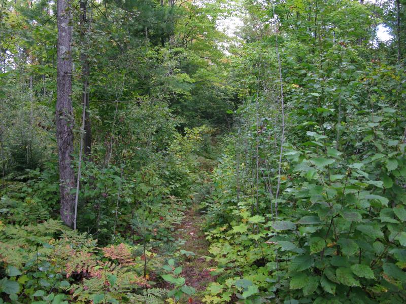
Damp sand gave easily under my insistent footsteps. The logging track was smooth from a recent grading, a soft and even surface that hid years of ruts and potholes underneath. I envied the tires that got to enjoy such a road. Only loggers and the guards of the Huron Mountain Club were allowed to drive up here on the Longyear Tract.
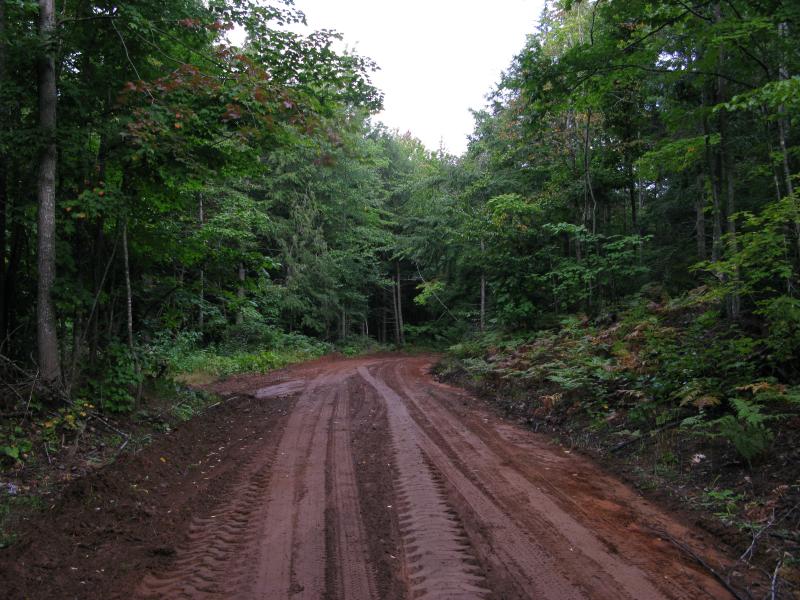
Muddy, graded track north of the Northwestern
I was on my way to Ives Hill, a monstrous pile of rock that shelters the eastern side of the Huron Mountain Club (HMC). There is one only way to reach the mountain without trespassing, which is the route I was on today. It's a long walk from the Northwestern Road past the red gates through commercial forest land, a long maze of changing tracks and trails that published maps don't even try to keep up with, but it's the only legal way to visit Ives Hill.
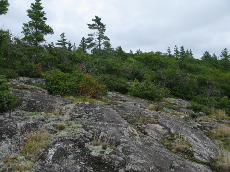
Most of the hills of the Huron Mountains are relatively simple peaks, like Bald Mountain or Marquette's Sugarloaf. There are a few more complex ones, mountains that have a few shoulders or multiple highpoints, like Hogsback and Bear Mountain. Then there are the lumpy monsters, the gnarly jumbles that defy typical definitions. Curwood, Ives Hill, and Mount Benison are all confusing piles of outcroppings stacked on top of each other like a madman's layered cake. Climbing these mountains is difficult and finding views is not easy, yet I found myself inching closer to Ives Hill today in hopes of conquering the crazy pile.
One track gave way to another and I passed swamps and forks and thick woods. The air was brisk, warming from an overnight low of a dozen degrees above freezing, and the sun was not strong enough to pour through the clouds above and burn away the remains of an early morning rain. Every once in a while I'd catch a bright splat of color, a vivid reminder that fall was on it's way, and then the wet, lush green would crowd around me again.
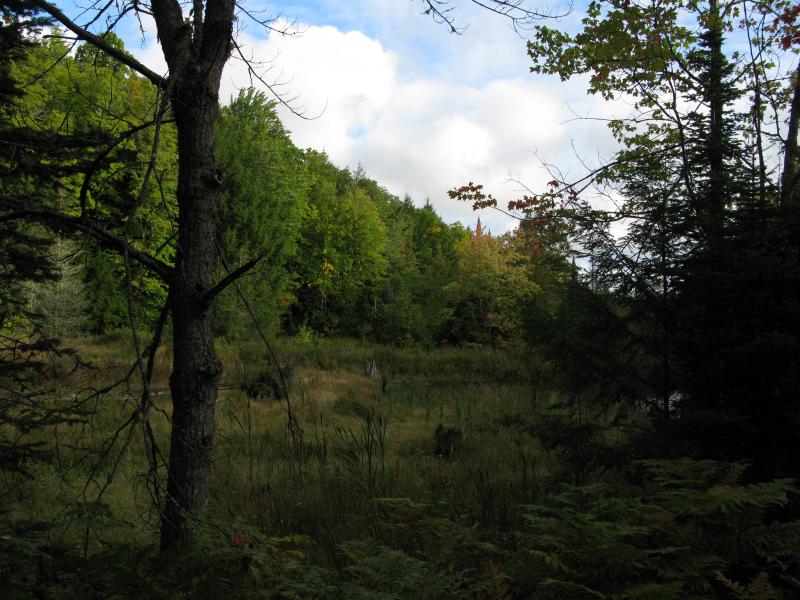
An open swamp along the road
When I bumped into the straight road, the odd line that extends south from Ives Lake and the Stone House, I paused for a minute. This was not my first time on this path. A while back I made the long trek to Breakfast Roll and had used this road. Today was a little different, though. I turned south and headed away from Ives Lake. My journey today would take me further southeast, closer to the sacred Salmon Trout River, and I had little interest in the straight road.
Eventually I had to leave the smooth graded tracks and follow overgrown ones. A few trees lay across these old roads and drivers chose to make wide circles through the ditches instead of clearing the way. Each fork I bumped into now seemed a little worse, with my route seemingly taking the least traveled path. I hoped it would make a difference in the end.
Downed tree on the track
Heavy overgrowth
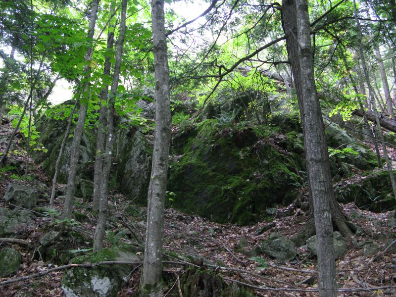
A few clearings started to show off the upcoming climb. A tall bank of trees above a distant gray rock outcropping poked up in the distance, towering hundreds of feet above me. I got a bit scared. The land around Ives Hill, the ground I stood on, was maybe 800'. The peak I had to climb was around 1500'. Seven hundred feet (not counting the inevitable dips and valleys nestled up there) was significantly more than my Midwest legs were used to.
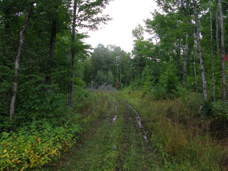
There was something off about the way ahead. I slowed down, suddenly aware of just how much noise I was making crashing through the overgrown roads. I was on an old two-track, one that hadn't seen a vehicle for years and had no trail or tire mark on it. The next trail was very different. It extended north-to-south, with my current track ending abruptly on it, and was really old. Saplings sprung up where tire ruts once ran, reaching ten or more feet up in the air. Between the saplings was a well-worn footpath. Footpaths don't just spring up out of nowhere. This was the trail to the Upper Falls on Salmon Trout River.
Footpath to Upper Falls on Salmon Trout
Sneaking up to the trail like a cat towards a spider I listened to every hint the forest would give me. A slight breeze soothed overhead, rustling branches and brushing through the leaves. No sound came from the trail, no voices or cracking twigs. I was alone. Part of me wished that a club member would come strolling down the path, a friendly voice to swap stories with, maybe a few half-joking warnings to keep an eye out for the property markers (I wasn't on HMC land but I was close). I didn't know how friendly they would actually be, though, so close to one of their favorite locations. I turned quickly and headed north, away from the falls, though I would love to one day visit them.
It wasn't long now. A short distance down the HMC trail, a few random overgrown roads east again, and then I was at the foot of Ives Hill. I picked a steep approach and tackled the climb vigorously, quickly gaining elevation, and soon found myself at an open outlook. I looked around eagerly, barely out of breath, and gazed over the green forest.
Mossy spur of rock
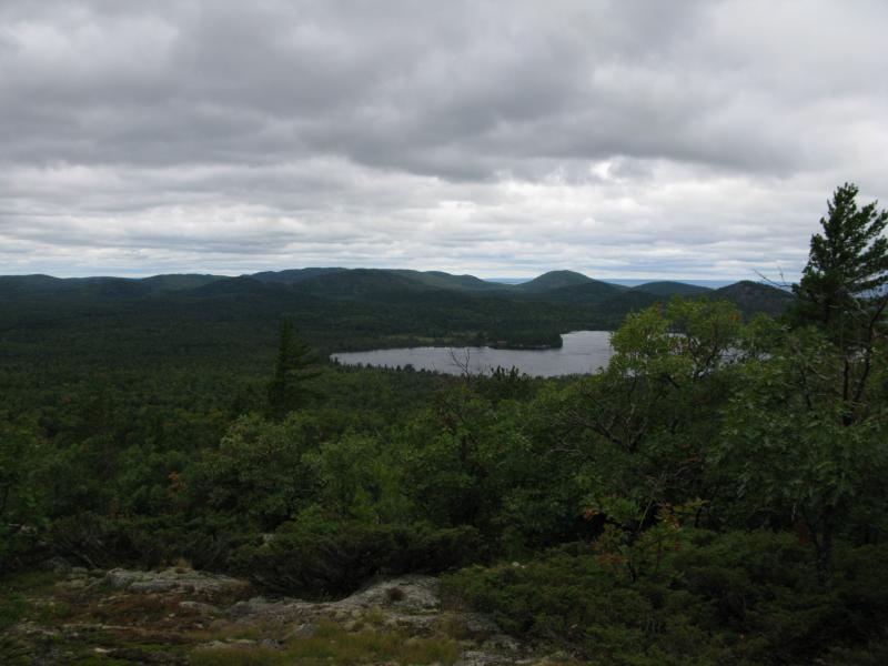
First view towards Section 17
Up the Salmon Trout River
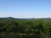
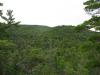
Outcroppings on the hill of Section 17 stood out to the west, a bare patch of brown and gray surrounded by green. I could also see the twin peaks of the hill just northwest of Salmon Trout River, though the bare rock up there was hidden by the angle. The most interesting view was up the Salmon Trout River valley, though. I couldn't trace the river, which I expected to be marked by deep green pines or cedars, and there wasn't much of a slope either. If I had to guess I'd say that the river is small and has plenty of minor rapids along it, like Cedar Creek to the west, and that the series of waterfalls (which was less than a mile from where I stood) was a rare occurance.
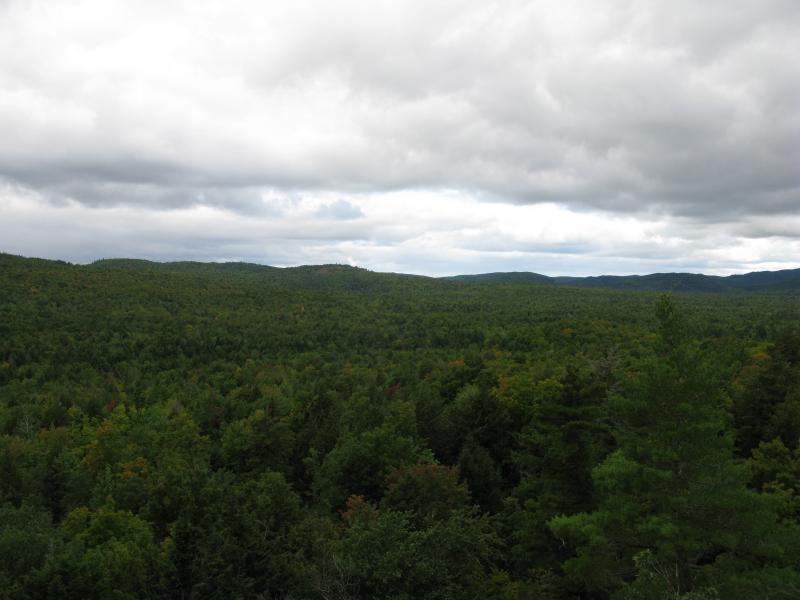
I turned and climbed, scaling the open rock, looking for more views as I gained fifty, than a hundred, than two hundred feet. Rock gave way to forest gave way to more rock. When I finally stopped and truly gazed out the views had opened up. I could see far to the northwest, over to Homer Mountain and even Huron Mountain near Mountain Lake, and the hills of Snake Creek showed up to the southeast. Now this was a view.
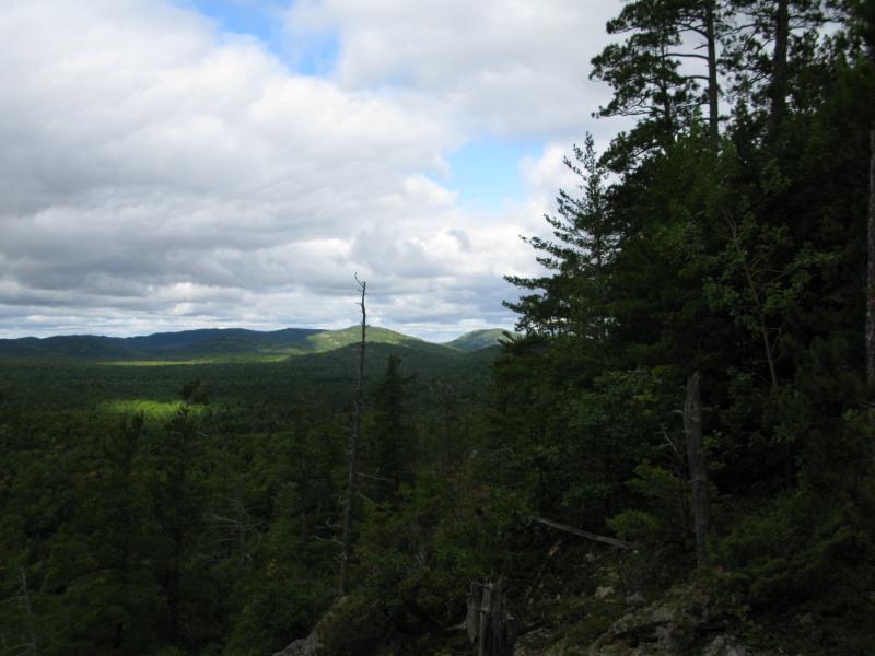
Sunshine over Homer Mountain
Up the East Branch
The steepness of the cliffs I stood on were surprising. There isn't too many truly steep cliffs in the Huron Mountains, especially cliffs that extend for hundreds of yards and tower two-to-three hundred feet in height. Could the Salmon Trout River have carved this cliff, sweeping away debris below like Mulligan Creek, or was this purely glacial? Either way I kept a respectable distance from the edge, aware of just how remote and along I was out here.
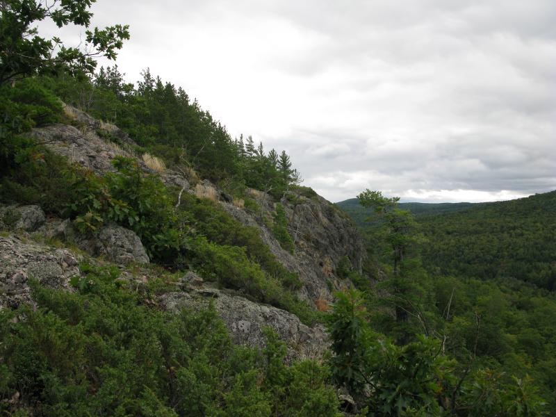
Steep southern cliff face
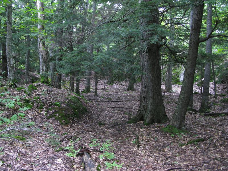
It was time to leave the cliffs and start north towards the peak. I reentered the woods, making my way through the thick green and tall pines, picking my way around muddy spots and up narrow channels, eventually coming out to open rock again. This outcropping was nowhere as pronounced as the first break. The gentle slope was speckled with tall brush and the occasional tree that forced me to loop around to get unobstructed south.
Narrow route up
Gentle, cluttered outcropping
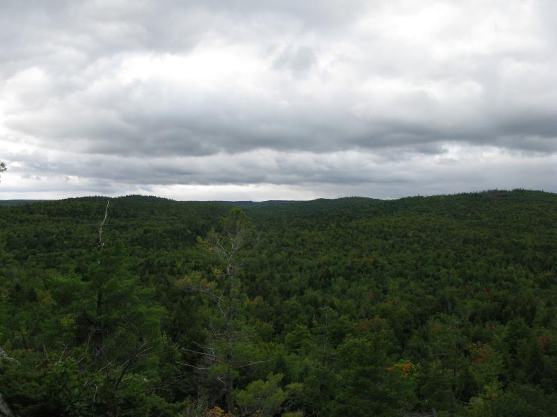
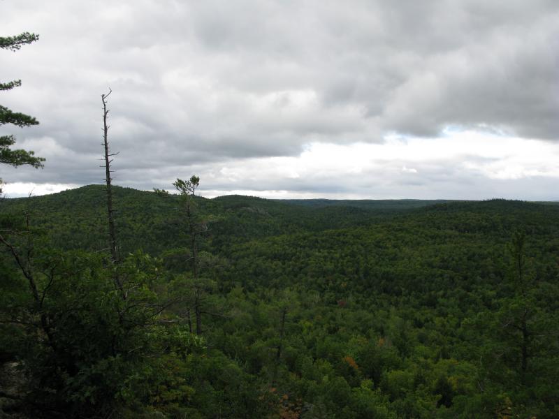
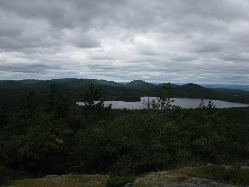
The view, though, was incredible. By now I was over 1400', a clean hundred feet higher than the Yellow Dog Plains five miles to the south. I could see the plains, a solid line of green, something that I've seen from other hikes in this area, but today I could also make out a jagged line beyond. The Peshekee Highlands poked up above the plains, a second line that seemed incredibly rugged compared to the plains. To the southwest I could even make out the distant rise of Arvon and it's surrounding children. To be able to make out all these spots from Ives Hill was pretty awesome.

Yellow Dog Plains in the distance
Happy I turned and headed towards the peak. This hike was turning out to be well worth the long and relatively dull walk in via the logging roads. I did not know what to expect at the peak, with most of the mountains in this area have overgrown tops with little to no views, but since I was a mere hundred-or-so feet below it I figured it was worth the extra walk. Big trees and needle-strewn ground made for an easy walk northeast and the yards passed by behind me quickly.
Large trees near the peak
When a clearing opened up I made a beeline, wondering if there was another outcropping near the top. Instead I found a tower. Well, the remains of one. Four metal posts grounded in cement made a square that once supported a lookout tower. So that's why some people call this Lookout Mountain. Near the foundation was a benchmark, another unexpected find.
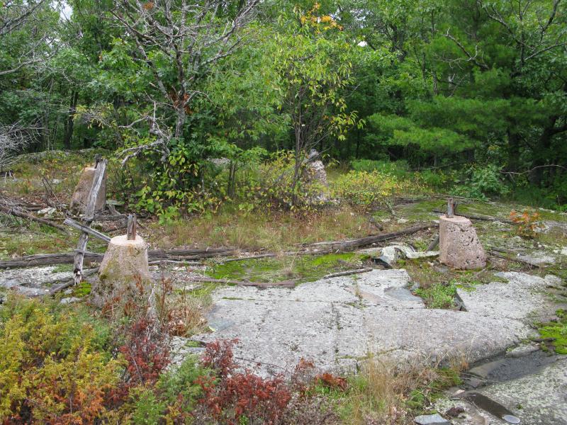
Remains of the lookout tower

Ives Hill Benchmark
I circled around the peak slowly. There were no views here (though the vista from the tower must have been epic). The remains of the tower were long-rotted, hinting of the age of this place. No trails, either. If anyone from HMC climbs up to the peak they must cut their own route through the brush like I did. Hints of Ives Lake glistened through the trees to the west. I left the peak, slowly wandering north, hoping to get a better view of that lake.
Large trees and rugged ground
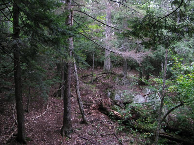
The path I took was not straight. I checked on a few possible views on the way, veering east and west on my northern path. This roughly followed the ridgeline of Ives Hill, which slowly drops from the highpoint towards Breakfast Roll over two miles. A few of the outcroppings held some promise, large patches of bared rock, but the slope up here was not enough to break free of the tall trees around. After climbing a significant slope I looked back south, back at the peak of Ives Hill, and did get a good view of trees behind me.

Thick trees near the cliff

Looking back at the highpoint of Ives Hill
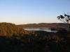
Continuing north I started to focus more on the next destination, a set of cliffs that I had discovered on my last visit to this area. There is a wide, open view over Ives Lake ahead, one that sits at a mere 1350' yet offers a fantastic view over the lake to the mountains in the west. Last time I approached it directly, climbing up from the roads below. This time I snuck up on the cliff from the rear, breaking through the scraggly brush above the outcropping, and came up above the cliffs. Even though this was my second time up here the view still took my breath away.
South end of Ives Lake
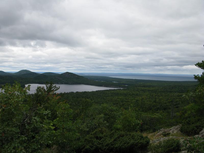
Over towards Lake Superior and the Keweenaw
The deep green and dark clouds above painted a very different picture from the vivid fall colors I had seen on my trip to Breakfast Roll. A brisk, cold wind whipped around me, emboldened by Lake Superior's waters, and I shivered as I traced the Keweenaw Ridge above the lake and named the mountains around Mountain Lake. Eventually I started making my way down, reluctantly dropping in elevation, not quite willing to tear my gaze off the view before me.
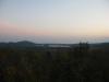
Last view of Ives Lake
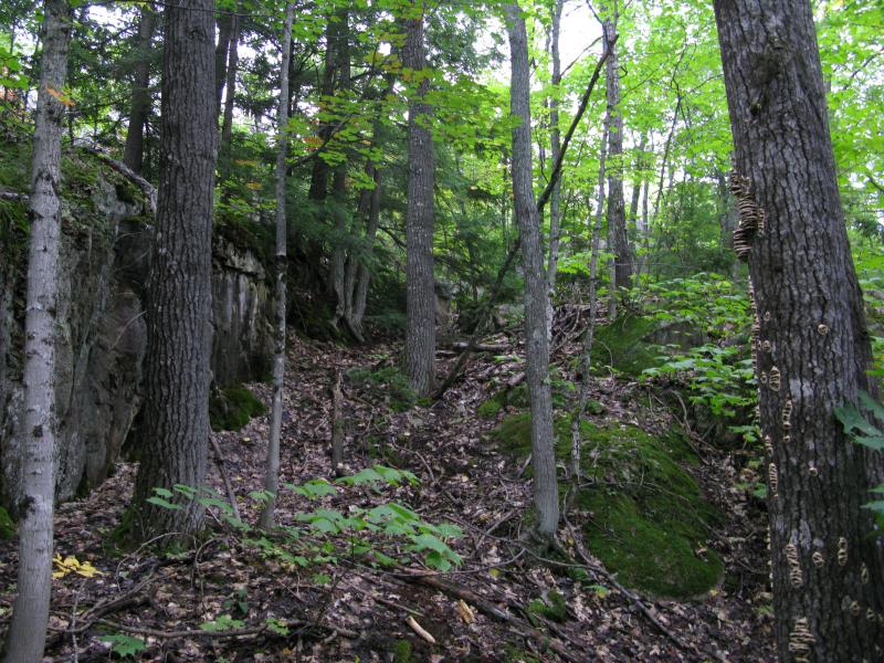
A few quick drops and I was back in the woods on the steeply sloped flank of Ives Hill. Deep channels were cut in these woods, probably carved during snow melts or clear cutting practices from the nineteenth century. Half trotting I bumped into an old road, right where I remembered it, and was back on the two-track maze.
Hoping to change things up a little bit I planned on cutting over to the straight road early. Right now I was standing east of Ives Lake, with most of the tracks leading north to Breakfast Roll and south towards Salmon Trout River. I couldn't walk directly towards Ives Lake (it is surrounded by private land) so I turned south. If I was lucky I would eventually find a road that cut west, over to the straight road, and I could cut a large swath out of my hike.
Up at the ridge
I did not get lucky. No obvious roads cut west. Too soon I found myself on the same tracks I had came in on, the HMC path to Upper Falls, and ended up retracing my steps.
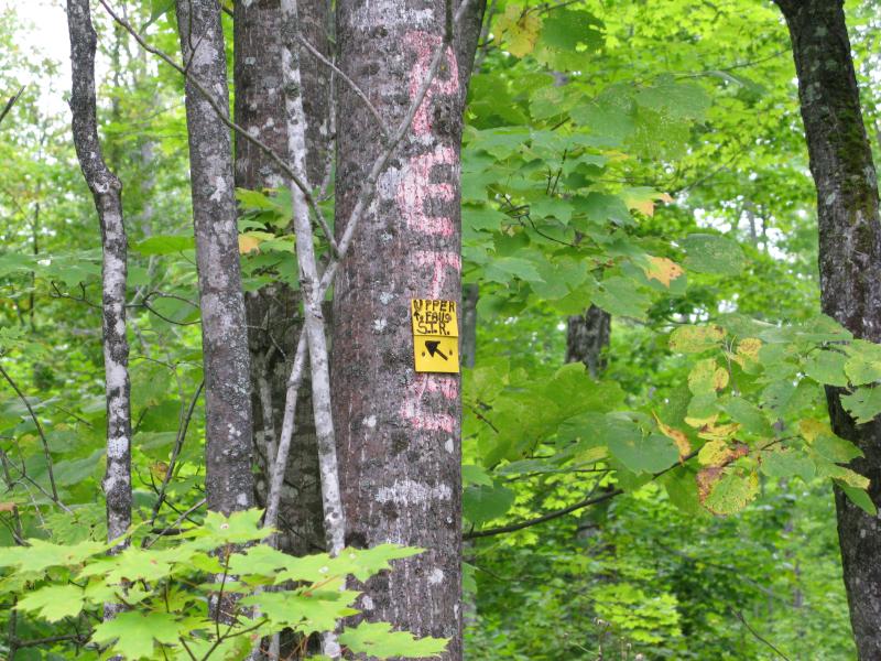
Small sign for the path
On the walk back my pace was torn a bit. After ten miles plus of walking and climbing (and now heading back uphill towards the Northwestern Road) I was slowing a bit. Also, I started to find blackberries, surprisingly still ripe, and stopped frequently to nab a few to nibble on. There were some more places to visit today, though, so I tried to push myself up the soft sandy road quickly.
As I walked, alternating my speeds, I thought about Ives Hill. A few years ago Breakfast Roll seemed like an impossible destination (and I sometimes can't believe that I actually made that long hike). Other places, like the shoulder of Mount Ives and Tokiahok Head, were also once-unachievable climbs. And now Ives Hill. Was this the last time I would step on the Longyear Tract? There wasn't much left to explore on the public land, a few spurs by Florence Pond, though Mount Ives itself was awfully tempting. When I finally stepped up to my car I had a bad feeling in my gut, a sad twist that this could have just ended my last hike in this area.
-
Jacob Emerick
Sep 26, '13
Hey Dave! Yeah, no hint of a track or trail or anything. I did noticed a few footpaths on the mountain, more overturned leaves than well-worn routes, but none near the peak (and I couldn't tell if they were animal or people). Not sure when they abandoned that tower, must have been a long, long time ago.Total hike was fourteen miles, relatively short compared to the Breakfast Roll. Over three-quarters were along some sort of logging road, not too much bushwhacking/climbing on the actual mountain. One thing to keep in mind is that Ives Hill is not the only climb... The Northwestern Road is actually a good three hundred feet above the sandy flats around Ives Lake, so the logging road has a steady slope on the walk back.
-
Mike
Oct 1, '13
I have pictures of a group of us that hiked to the top of Ives a little over 30 years ago during deer season . At that time the main poles were standing about 20 feet above the cement but the top platform was long gone. Even 30 years ago there was no sign of any trail up to it. One of the Old Timers that made the hike with us said that it was a manned fire tower up to the late 40s or early 50s. He also told us that there was a foot trail that came up the east face of Ives from one of the lower HMC roads. I have made several trips during hunting season to the top of Ives over that last 30 years and have yet to see any sign that others frequent the hill top.
-
Jacob Emerick
Oct 5, '13
Hi Mike - that's pretty awesome! Were you able to climb up the poles at all to get a view over the trees or was it too rickety/spread out to get up? And that's interesting about the eastern path... Ives Hill makes a heck of a barrier from the main club land to Salmon Trout, they must have a road that follows the river upstream from the guardhouse. That road could offer access to that (now grown over) footpath and for guards checking the river. Anyways, happy hunting, and hope you make it back up there this year!
-
Jacob Emerick
Oct 12, '13
The cliffs off of Section 9 do make for a great view! I was kinda hoping to find some more good views by following the ridgeline from the peak over to those cliffs and really didn't find much. It was cool to find the tower, but yeah, if you're just looking for a view of the lake and mountains beyond those cliffs make a much better destination.
-
Mike
Oct 17, '13
At the time of my first few trips to the top of Ives the trees were not much more than low scrub oaks and brush. There were many places from the top with great views back then. I like to hunt the top of Ives when it's snowing and blowing. Deer seem to like to head up there in the early snow storms if the oaks have a lot of acorns
Add to this discussion-
Jacob Emerick
Oct 5, '13
Ha ha, thanks sir. I sure hope I find an excuse to wander back that way... it'd be great to stand on Breakfast Roll again.
Add to this discussion-
Jacob Emerick
Nov 21, '13
Hi Neal!Well, I'm glad you found & enjoy the blog! Yes, that is the only way to reach the hill w/o trespassing. The HMC owns the land around the Salmon Trout River from Lake Superior over to the point where the west (main) branch bends south.This creates an effective 'wall' that blocks off access from Blind 35. I'm not sure exactly how far up the river they own (at least to Upper Falls), but it's far enough to make any other access routes (the roads up from Dodge City) fairly difficult.On a side note - technically Ives Hill (and Section 17, and the land in between Mountain Lake and around Ives Lake) is private, its just under CF. That's why its all gated off from wheeled vehicles (and snowmobiles). The tract is still accessible for hikers and hunters, though, as long as you're not on a four-wheeler or anything.Hope this helps!
-
Neal
Nov 22, '13
Just wasn't sure about the boundary lines. I do have a map that has the boundary lines but I do not have it with me currently. Was looking for a shorter route to possibly get to Ives Hill in the winter but it seems like that might not be possible. How far can you go down Blind 35 until you reach the boundary? Does the boundary just begin where Blind 35 ends? Looks like it would a relatively short hike from the end of Blind 35.Thanks, Neal
-
Jacob Emerick
Nov 25, '13
Hey Neal!I don't think Blind 35 is plowed in the winter. So if you went by that route you'd have to walk the whole distance, then hike over a hill and cross East Branch, then hike over another hill and cross the main (west) Salmon, then climb over that twin-peaked hill before circling back. So I think any sort of distance you'd save would get eaten up by the unplowed road.Alternatively, the Northwestern Road was plowed last winter to Dodge City-ish. Well, depending on your car - I drive a tiny Saturn Ion and can barely make it down that road in the middle of the fall and would never attempt it during the winter. That may save you a few miles, though hiking north from Dodge City is a long journey and you'd still have to loop around that twin-peaked hill if you wanted to avoid the Club.So, in short, I'm sorry to say that it's just hard to get to (if you wanted to avoid the Club property). :(
Add to this discussion