Waterfalls that don't Exist
Waterfalls were my first love in the Upper Peninsula. I'd walk miles and miles searching out little known drops deep in the woods, guided only by rumors and intuition. Most of these quests resulted in discovering an unnamed wonder far from the beaten path, even if it meant returning several times to scour the area thoroughly. Not all of them were successful, though, and some of these hikes ended in frustration or worse.
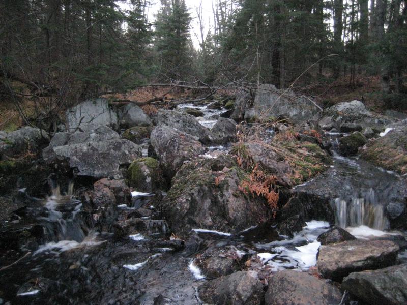
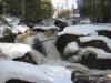
A disappointing jumble of rocks and small drops
Upper Sturgeon Falls was one of these waterfalls. Marked with a small tick mark and the enticing word 'Falls' on older topographic maps, this remote drop was located near the upper headwaters near the Tama-Siding line. I attempted to approach these falls from the south from US-41, the west from Herman-Nestoria, and the north from Celotex (spending a night lost in the woods), before taking the railroad tracks south and cutting in through the woods. After all these attempts I found the marked waterfall, several inches of drops over rapids between two sections of swampy lowlands. Needless to say, I don't consider this a spot worth returning to or recommending.
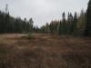
Other hikes didn't end with any sort of drop. Vista Falls on the upper reaches of West Branch Sturgeon River is marked on multiple maps. There are two forest roads in the area, both heavily overgrown, that follow the river upstream from S Laird. I've taken both of them multiple times and scoured the river up and downstream and found nothing. A huge swamp drains into an overgrown sandy channel to the north, never more than a trickle of water. I'm still tempted to revisit this spot in the spring with a GPS to ensure that I've checked it completely, since the area is so overgrown and confusing even with a map, but five failed attempts is very disheartening.
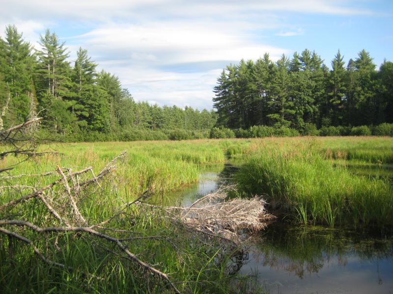
Lush grass clogging up West Branch headwaters
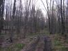
Another marked waterfall that has eluded me is Sandstone Falls on the upstream end of Victoria Basin. This one is very remote, miles from Burma Road in the black fly-festered reaches of Ontonagon County, but the few attempts at finding it have turned up dry. I haven't found a good resource as to where the waterfall is, Schatt or Johnson, both of which are tiny little creeks. Johnson is surrounded by logging and busy beavers, clogging up the area and creek with downed trees and brush, and Schatt is too small to sustain waterflow for most of the year. If there is a waterfall I'd imagine it'd be a small drop similar to Plover Falls in the east, but I've yet to find anything that resembles even that two-foot drop in this area.
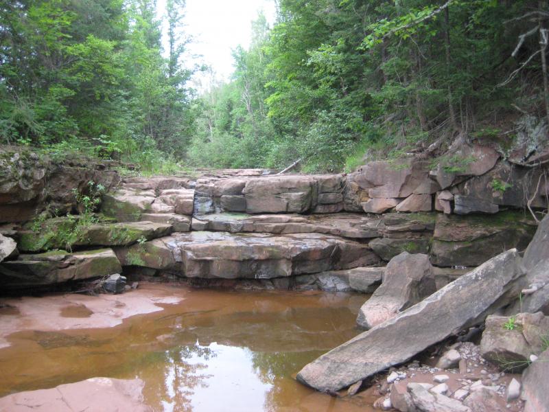
Waterfall or some damp standstone stacks
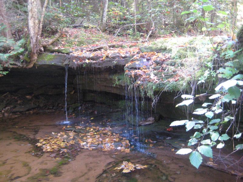
Trickling water over Plover Falls
There are also plenty of questionable waterfalls, like Tibbets Falls on Sturgeon River or Marquette Mountain Falls on Carp River, that resemble sets of rapids more than actual drops. However, the number of cool spots I've found on my adventures far outweight the occasional disappointment. Miles of hiking or even getting lost in the woods overnight has been a small price to pay for the hundreds of awesome adventures I've had in the Upper Peninsula.
-
Jacob Emerick
Jan 20, '13
Ha ha, I feel your pain. My tick record was set a bit to the north thought, up at Otter Falls, when I gave up counting after a dozen. I think I mentioned this to you before but I'm still tempted to head back with a GPS, just to scour the area beyond a doubt. On my last adventure (well, Nov '08) I finally made it past the swamp to a shallow, brush-filled creek but got distracted checking the (then dry) tributaries in case the falls weren't on West Branch after all but an unnamed inlet. Maybe a spring trip, armed with a GPS and topo map, and I'll be able to put this one behind me :P
Add to this discussion-
Jacob Emerick
Mar 3, '13
Ha, that's a good one! Remember you telling me about that trip. Definitely will be avoiding that one.
-
Phil Stagg
Aug 13, '13
There are a couple of falls with a perversion of the Ojibwa name for "chief". We call them Ogima or Ogemaw. Ogima Falls is on Copper Creek in Gogebic County, but I haven't been able to find it where it "should be". I assume it is the first of the drops about 1/4 mile further downstream. Ogemaw Falls is in Baraga County and is extremely easy to find. In fact, the visitor's center just recently put out a road sign for this one. What waterfall were you looking for, Joel?
-
Jacob Emerick
Aug 14, '13
Hi Phil,Thanks for the information about Ogima - I don't think either Joel or I have explored too much of Gogebic yet, though I'm pushing out that way slowly and will probably be leaning a bit on some more experienced waterfall hunters ;)As for Ogemaw I think what Joel is referencing is the topo maps. The real drop is pretty easy to find, it's just that older topographic maps point to a drop much further downstream in the real thick little valley. Both of us (at different times) have tried pushing that way in search for the tick mark's location, him much farther than I, and neither one of us have found anything. Like Vista, the map is a lie. But yeah, we've been able to find the 'main drop'. If you have any insight on the downstream section or, why not, Vista Falls I'd really like to hear it. Wasted many an afternoon in those black fly-infested swamps of upper West Branch!
-
Phil Stagg
Aug 14, '13
Vista Falls, ha! There is no Vista that I know of! Swamp, swamp, swamp... that's all that I have found. I have tried getting in from every side of that square mile or so all to no avail. I also tried for the phantom Ogemaw Falls down river. I gave up after about 1/2 mile I think. It seems like the initial drop plus the little one below is it. Except when the river is high there is an overflow drop into a tangle of undergrowth just downstream.BTW, there are no ticks or black flies in September/October. That's my favorite time to go. The tradeoff can be lower river levels, but fall color trumps EVERYTHING!I think you'll like Gogebic/Ontonagon Counties now that you live closer to that end of the state. There are a lot of interesting waterfalls over that way. You'll love Shining Cloud in the PM's. Nokomis was tough, but a blast to finally get to.
-
Jacob Emerick
Aug 15, '13
I hate to say it but I may head back to Vista next spring. I've been there a number of times, coming in from both sides of the river, but the one thing I haven't tried is canvassing the area w/ a GPS. All my visits were in '08, pre-GPS, and I still wonder if maybe there is something just a little bit farther down the river. The swamps do sorta narrow as the water heads north, into a brushy nasty little valley, and maybe, just maybe, there is a tiny drop buried on a tributary or deep in the brush that is only noticeable in the spring. Maybe :PI prefer Sept/Oct too. Completely agree on the low rivers, though. I usually head up to the Longyear stretch or Mulligan Plains at that time, land that is usually teeming w/ insects, and catch the colors there. Gogebic/Ontonagon are possibilities this year, though, especially since most of the falls on my radar in those counties are fairly large (Black River, Presque Isle, etc). Nokomis is on that list, does look fairly remote though.Oh - if you've been to Nokomis, how crazy of an idea would it be to hike the length of the Presque Isle? Seems to be an awful lot of drops along that river.
-
Phil Stagg
Aug 15, '13
Let me know how the Vista project works out. The Presque Isle hike? A crazy idea? Since when has THAT stopped you? :) It is a deep gorge at Nokomis. I hiked there from Copper Creek, but looking at a topo I think that if I would have followed Copper Creek down stream a bit further I could have then cut across a "short" swath of forest to Presque Isle and at that point the river has relatively mild banks. I don't know if the riverbed would be walkable, however. In the spring I doubt it. It might make a nice fall hike, though. The two BIG falls up river I have not been to yet. I think they are on private land. The caretaker, John, told me he would take me there if he wasn't busy. But the two times that I have gone to check on his whereabouts he wasn't home. So... I still haven't made it to those falls.Phil
-
Jacob Emerick
Aug 18, '13
Ha ha, good point.Looks like it'd only be a 7-or-so mile hike (one-way) to walk from Lake Superior upstream to Nokomis. So, definitely doable. Continuing up to those big (private) drops would add quite a few miles. I never even noticed them before on maps - do you know if they have names? But yeah, hopefully the banks are walkable, else that would be a long tough trek.So I chatted with a friend of mine who is a ranger for the Porkies. She mentioned a 'Phantom' Falls down by Manabehzo and that Manabehzo is the name of a 'trickster' god. Wonder if the overflow drop on the east fork is that? Have you been there in the spring to see that drop flow?
-
Joel
Aug 24, '13
Hi Phil!I'm a bit late to comment, but Jacob is correct- I was talking about the topo map that places Ogemaw Falls (in Baraga County) an additional half mile or so downstream from it's actual location right off Baraga Plains! Keeping near the creek so as to not miss anything, the entire hike consisted of thick Alders, groves of small Hemlocks, fallen trees and swampy ground to serve as obstacles. Arriving at the rough coordinate, I was not too happy to see a sluggish, unimpressive stretch of creek...Similarly- if you head south on the topo map to Canyon Falls- you should notice there is an "Upper Fall" marked about a half mile or so downstream from the canyon area!?! I haven't bothered to check this out, but why would an "upper" fall be listed well DOWNSTREAM from the well-known series of Canyon Falls?? More topo BS, I say!As for the new sign for Ogemaw Falls- I'm of the opinion that they are going to ruin the character of the area with all of the signs I've seen going up over the last few years. If somebody needs a sign to find Ogemaw Falls, maybe they shouldn't be traveling the back roads anyway.....Joel
-
Phil Stagg
Jul 16, '14
Joel,I forgot to get back to this discussion. Time does fly!I also looked for this elusive Lower Ogemaw Falls (Baraga). Nothing but creek. I have looked for the "Upper Falls" on the Sturgeon River. There is a small waterfall as the river exits the canyon. I call it the Lower Canyon Falls. Upper is ridiculous. I can only assume that it refers to an upper drop from the much lauded Sturgeon Falls further downstream. But it doesn't make any sense with the Canyon Falls in the immediate vicinity. The USGS isn't God, even though it really is helpful!
-
Jacob Emerick
Jul 27, '14
Ha, I've come to the same conclusion on 'Upper Falls', Phil! Either its the 'Upper Falls' for Sturgeon (or Tibbets) or above 'up' on a long stretch of slow river... It's still much closer to the well-known Canyon Falls. May have to rename it on the site...
-
Phil Stagg
Jul 27, '14
I don't know what else to do but rename it. A non-sensical quasi-named waterfall - "Upper Falls" -doesn't deserve to be further ensconced in Michigan's waterfall lexicon. The other consideration with the USGS's "Upper Falls" is that it occurs further downstream from the waterfall that I call "Canyon Falls - Lower". So it either refers to (1) a waterfall that was, but is no more, (2) nothing, (3) the lower Canyon Falls. For now, I will assume the third.
Add to this discussion