The Ives Exploratory Trip
This exploration turned into the best camping experience I've had in the Upper Peninsula. When I started the hike I was only interested in doing some exploring around Mount Ives area, a large chunk of land I previously thought to be within Huron Mountain Club borders. What I found was a beautiful campsite with captivating views that I eagerly look forward to revisiting.
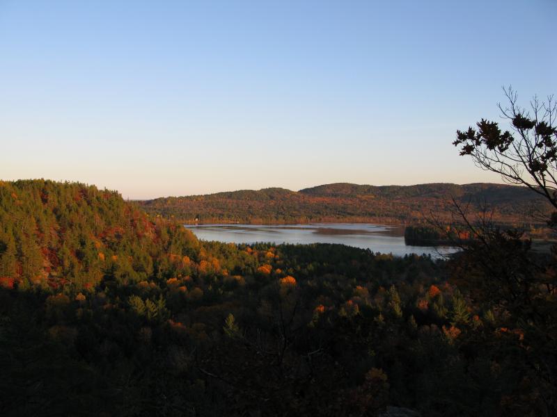
Sunset over Ives Lake
After a long drive west from Dodge City, I parked off of the Northwestern Road at a gated logging road. I was less than two miles from where Faith, Bryan and I parked for the Burnt Mountain hike, but this short section of road is impassable to most vehicles. Thanks that previous hike I knew there was some logging north of me, so I shouldered my gear and headed up the road. My hope was to follow the recent logging clearings northwards and set up camp once until I got tired.
While the Huron Mountain Club owns both Ives Lake and Mountain Lake (or at least the majority of the surrounding shores), there is a narrow finger of public CF land that separates the two lakes. Bordered by Ives Lake to the east, Mountain Lake to the west, and Mummy Mountain to the north, this land is relative flat with a few small rocky hills cropping up. To reach this finger of land I had to cross an unnamed tributary of Elm Creek several miles to the north of the Northwestern Road.
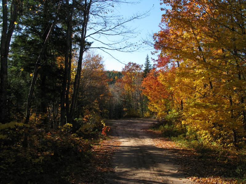
Fall colors on the logging road
The recent logging gave me smooth, sandy roads that were easy to follow. Clear skies and no wind provided a nice backdrop to the brightly colored fall leaves. After an hour of easy walking my road started to bend westwards. There is a good chance that they would bend back north after curving around by Burnt Mountain and Canyon Lake but I didn't want to venture that far out of my way and take that chance. I cut off of the road to the northeast and bushwhacked across several tiny creeks, following overgrown ghosts of logging roads before stumbling upon another smooth, well traveled road. I'm still unsure if my new road was connected to my previous roads, connected somewhere to the west, but my adventure through the brush had been a relatively quick (if difficult) mile and probably saved me some time anyways.
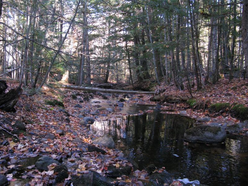
Small tributary of Elm Creek
I continued north on my new two-tracks, which appeared to be well maintained and not as rutted as normal logging roads. I'm assuming that the Huron Mountain Club uses these roads to easily get around their property, especially since they seem to have a rather strict policy on building service roads on their own land. These roads had several interesting features nearby, including an old gravel pit, glimpses of the massive western mountains, and some Club signs and trailmarkers. The sun was starting to lower by the time I had to cut off the road for the second time, this time to reach my end destination.
There is a rocky hill on the west shoulder of Mt Ives. This was my stretch goal for today's hike - its as far north as you can get in this area without trespassing onto HMC property. To reach it I had to cut off the logging road, cross a deep woodland creek, and climb a steep southern slope. After the six-mile-plus hike with my gear, the hill was utterly exhausting. I had to stop several times, either to catch my breath or to carefully choose a safe route. While this is not the steepest hill I've climbed with camping gear, it was more than enough to knock the last wind from my sail and I was relieved to crest the last outcropping.
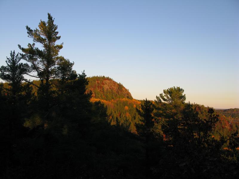
Sunset lighting up a fiery Mount Ives
The view that greeted me at the top was spectacular. To the east Mt Ives towered over Ives Lake, the fall leaves brightly lit by the setting sun. Numerous smaller, unnamed outcroppings rose to the south where I had come from, and three huge monsters rose from Mountain Lake (Burnt Mountain, Mount Homer, and Trout Mountain) reached up for the sun in the west. There were limited views of Lake Superior, Second Lake, and Mummy Mountain through the leaves to the north as well.
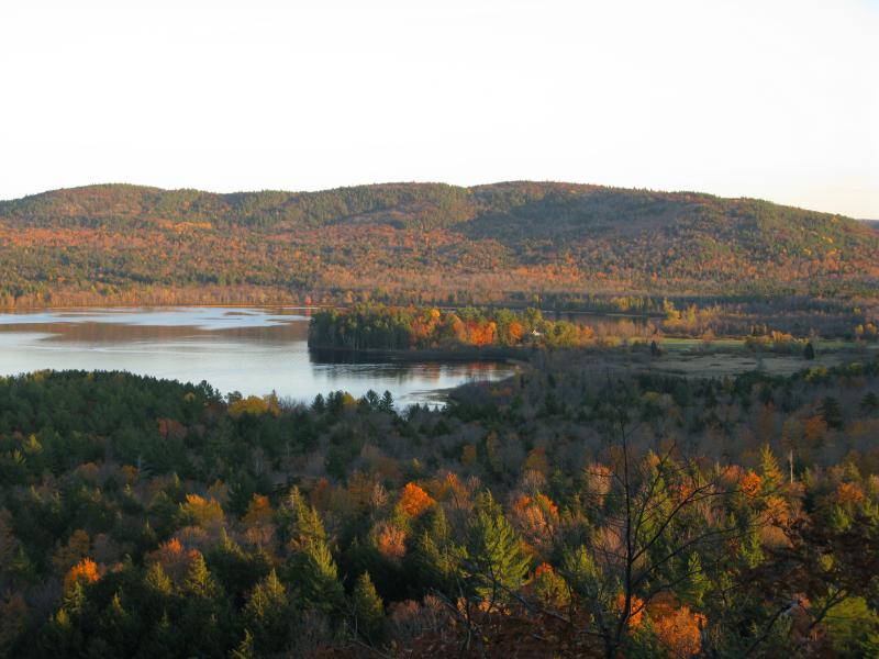
Ives Lake and Ives Hill with fall colors
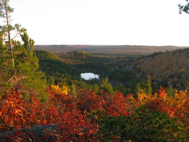
Florence Pond to the south
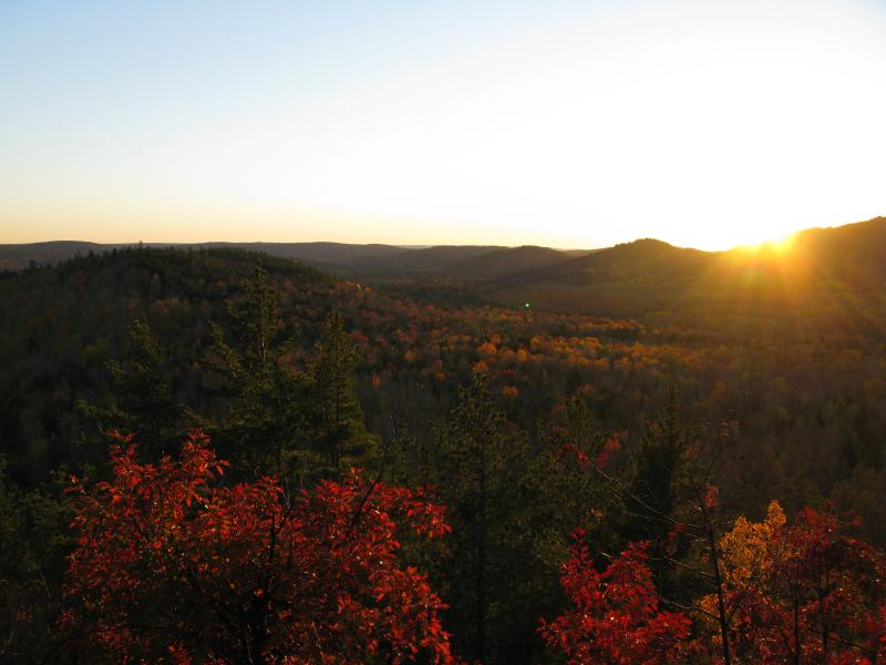
Sunset between Mount Homer and Burnt Mountain
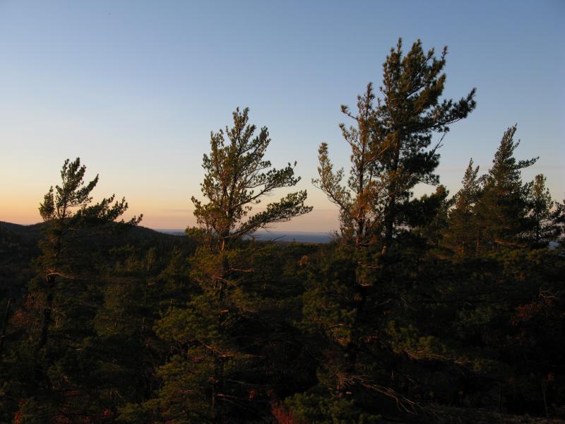
View of Lake Superior through the tall pines
Satisfied and exhausted by the journey so far, I quickly set up my tent and made up some soup on top of the outcropping, over 300 feet above the surrounding land. I took a few breaks for more photos of the setting sun, but the darkness falls quickly this late in the year. There was no sounds of motors or civilization floating through the air - just a few animals and the soft rustle of leaves. A huge, single house on Ives Lake was lit far below to east; otherwise, everything was quiet and empty. Sleep came quickly to me that night.
I woke up early the next morning, making a hot cup of coffee before the sun's light started to brighten the horizon. Sore from yesterday's hike I was in no hurry to start the return route. First, however, I had to take some sunrise photos, especially of the western mountains that had been washed out by the sun last evening.
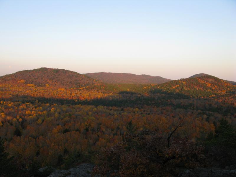
Mount Homer (left) and Trout Mountain (right)
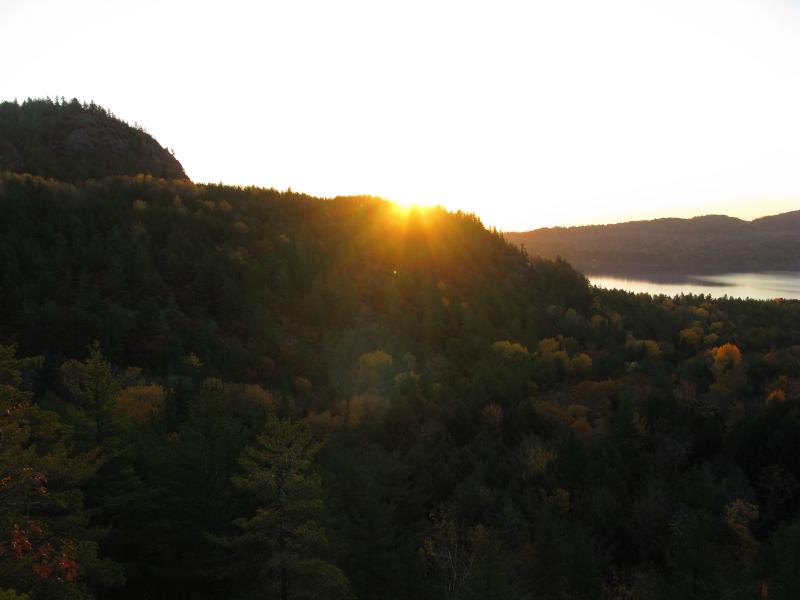
Sunrise peaking over Mount Ives
After packing and warming in the rising sun I headed back down the outcropping. I took an easterly route this time, past Florence Pond and down Ives Lake Road. Unsure if this track would take me out I cut back to yesterday's route when I got close to Elm Creek, bushwhacking again before another several miles of uphill road to my car. After looking at some maps of the area, I feel that I might have been able to drive most of this route if I had tried a two-track to the east of where I had parked, a bitter piece of knowledge after the tough thirteen-mile-plus hike with my camping gear.
Like I mentioned before, this was the best camping hike I've ever done. There's been more challenging and rewarding hikes before, but spending the night so far north, surrounded by the magnificent Huron Mountain Club land and watching the sun set and rise over the fiery leaves was an amazing experience. There are other hikes in this area I'm looking forward to now, including checking out some of the southern outcroppings and following Ives Hill around the eastern shoreline of Ives Lkae. This exploratory hike was, overall, simply amazing.


-
Jacob Emerick
Jan 20, '12
That's pretty cool, Mike! I don't know if I'll make it up Ives, but do you know how people usually access it? I'm guessing from the north, as the south access is a bit... steep.
Add to this discussion-
Jacob Emerick
Jan 20, '12
Bugger - comment save wasn't working correctly. Fixed now. Sent the coordinates - happy hiking to you both!
Add to this discussion-
Jacob Emerick
May 13, '12
Hopefully! I've been exploring more of the mountains around the club and am really surprised by how awesome some of these views really are. The only real inaccessible view that I'd like to catch one day is of Mountain Lake... Too many HMC mountains surrounding it to get a good glimpse.
Add to this discussion-
Jacob Emerick
May 13, '12
Couldn't agree more, Joel. These outcroppings are amazing and the views surprising, even if the hike in this deep is a long one.
-
Joel
May 17, '12
Yes! The hike in wasn't bad at all, the hike back out was another story, though....
Add to this discussion-
Jacob Emerick
May 26, '12
Coordinates sent. Good luck out there, Tom!
Add to this discussion-
Jacob Emerick
May 8, '13
Hi Blake - thanks for the compliment! I'm going off the DNR hunting maps [http://www.mcgi.state.mi.us/mi-hunt/] to make the guesses. I've also been lucky enough to see a map of the club boundaries and even bumped into a guard (we were both on Longyear property at the time) who was able to verify that this shoulder (and Breakfast Roll) were indeed public land. Hope that helps, and good luck on your trip!
Add to this discussion-
Jacob Emerick
Mar 20, '14
Thanks Jim and Nancy! Glad you enjoy them - I'll do my best to keep exploring!
Add to this discussion-
Jacob Emerick
Nov 28, '16
Hi Josh,I'm pretty sure I parked here: N 46.79912 W 87.90341, though it's been a long time :) Not sure if this is still drivable from the east in a passenger car. Dodge City should be good, but everything past that depends on logging.
Add to this discussion-
Mike
Nov 4, '18
If you read Michigan cfr public land use law, the land is to be used for hunting and fishing.... Nowhere is camping and hiking even mentioned... Telling people to go misuse "public land" is what keeps private land private.... You are your own worst enemy
Add to this discussion