Peshekee Overlook Trail
After a tough hike up Mt Baldy I was torn about staying in the Peshekee today. On one hand I was in the area, close to the McCormick Wilderness and all those other good spots off the Grade. Yet the snow was deep and nasty. I decided to give it one more chance, one short nearby loop. If that was too much than I'd head east for milder destinations.
The loop I headed for is called the Overlook Trail and is connected to the Van Riper park. It's a short distance away from the Peshekee Grade off of County Road Ida. The quick drive from Michigamme took little time and soon I was standing next to my car looking at the deep snow. Eh. I hoped the trail was groomed.
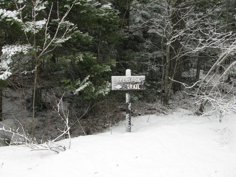
Snowy sign for the trailhead
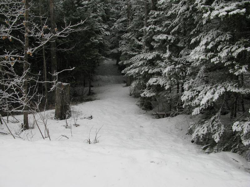
Deep snow under the clustered pines
It wasn't. Once I got past the plowed build-up my snowshoes and I sunk down in the slush. This was going to be a fun hike. I slowly trudged up the slight incline, letting my legs get used to the overlarge strides, and kept my gaze fixed forward.
After a few laborious minutes I came upon a sign. The loop started here. Judging from the painted and carved sign I could either walk along the river or tackle the overlook right away. I was a bit surprised to see this, expecting the overlook to be on the river, not facing south. The climb to the overlook looked crazy steep. I decided to tackle the loop clockwise, aiming for the river first.
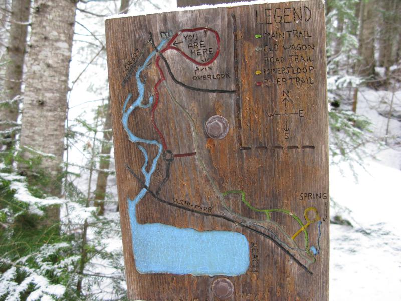
Nice wood-carved sign

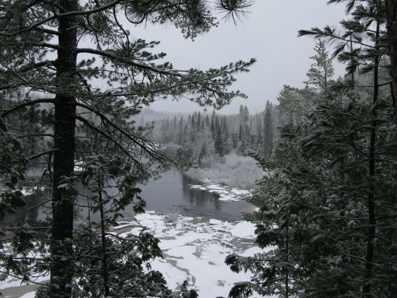
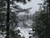
Cold view of the Peshekee River below
The river ran deep and cold, snowy tufts of brush barely holding its own along the shores and islands. An involuntary shiver shook me as I looked into the dark, stained waters. I'd hate to take a spill today.
My trail seemed to want me to topple in, though. There may have been some traffic at some point in the winter. Maybe. With a bit of imagination I could tell a difference in the snow underfoot, areas more packed than others, but it may have been wishful thinking. Blazes were sporadic and led close to the water's edge, along steep banks and unstable piles of snow, and as I crept and plodded along mere yards from the rushing river I wondered if I was going to be taking a dunk this morning.
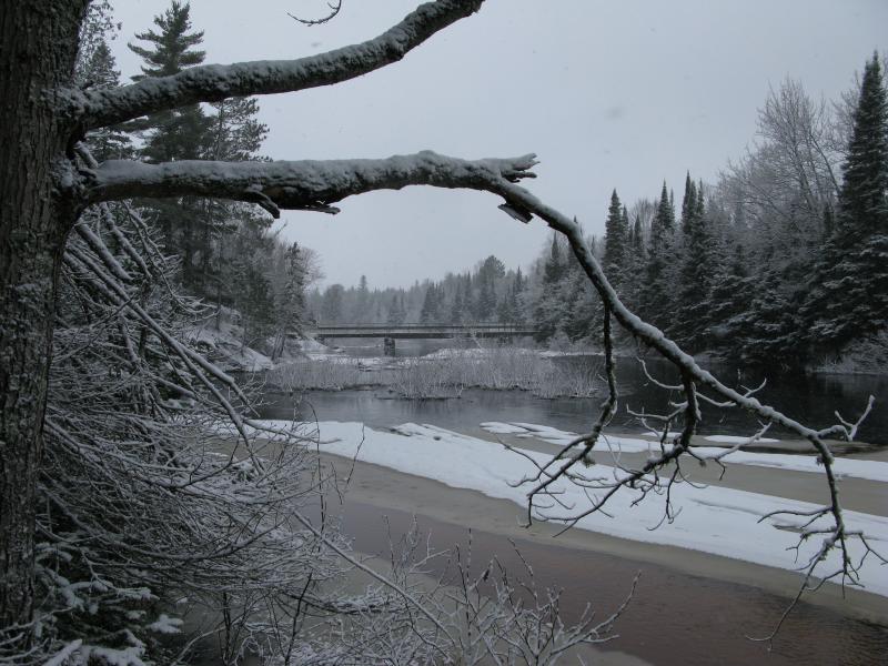
Ice and old bridge over the river
The path, at least what I guessed to be the path, bucked up and down a few times. The hill which housed the overlook was steep and not uniform, pushing me around. I was starting to grow weary of the deep snow and uncertain path when a final rise marked the end. A last view upstream opened up to the left and the trail slunk down to some flat land before me. I stopped and took a picture, happy to be done with this leg of the loop.
Peshekee river, looking upstream
For some time the trail ran over flat woods, than through some swamp, and finally started to twist south. The swamp was particularly hard to find a way through, with the erratic markings hiding under tufts of snow and knobby branches. A few trees had toppled over during the winter too, forcing me to make lengthy detours in my clumsy snowshoes or attempt to hobble over. I wondered how much easier this loop is to walk in the summer, with a beaten footpath to see and undergrowth cleared.
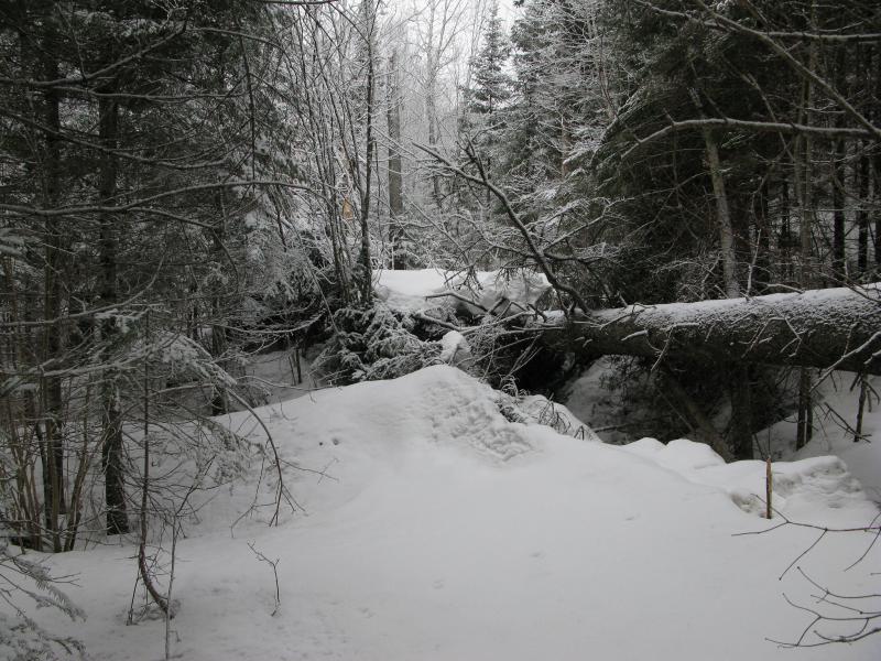
Large downed tree on the path
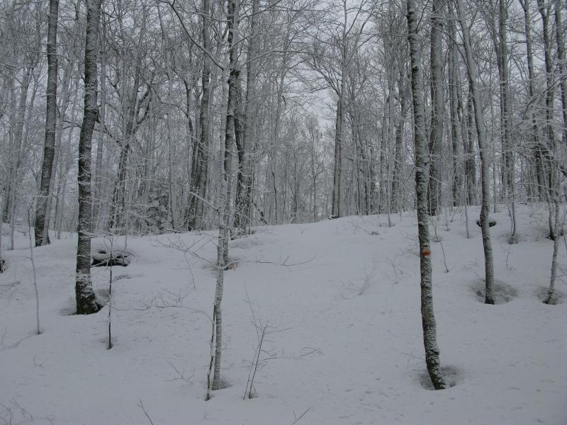
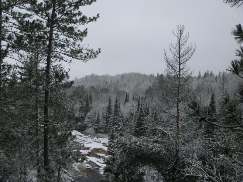
When the trail twisted west, closing the loop, and finally began to climb I got pretty excited. What kind of view would the overlook offer? Would Lake Michigamme or a section of the Peshekee River lay below? The woods had taken a very different look back here, snow clinging to the trunks and branches, forming one of those beautiful winter scenes that you have to wake up rather early to find. I ambled up the incline, gazing around at the woods and looking ahead for the overlook, and wandered right off the poorly marked path.

Beautiful snowy woods
Steep snowy climb
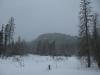
I wasn't terribly worried. This loop was about a mile long, if that, And some promising breaks in the forest lay ahead. I bee-lined over to one of them and broke out of the snowy woods onto a bare rocky outcropping. Just as I came out two overlarge dark birds swooped out below me, possibly startled by my presence, and their dark shapes made a stark contrast with the snowy woods below.
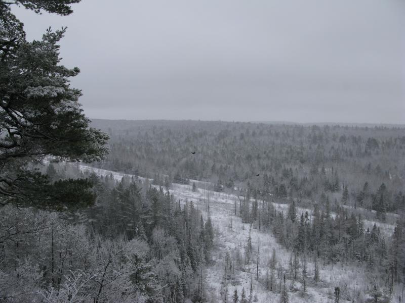
Dark wings far below the overlook
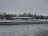
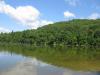
So the river wasn't visible here. If anything the view gave me looks at some broken, maybe swampy, ground below me and the county road ambling east. A slow rising hill on the other side of the hill blocked most of Lake Michigamme, though a few spots poked out if I leaned west. It was a limited, if wintry-pretty, scene below.
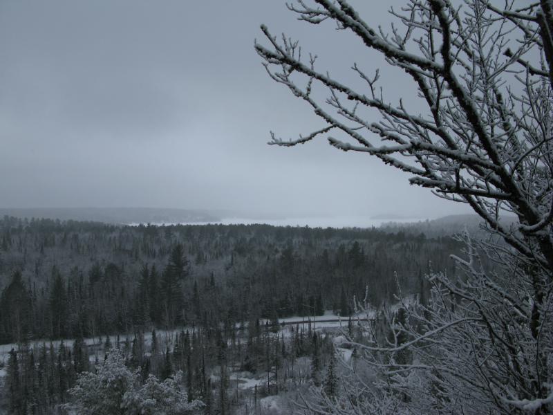
Narrow slice of Lake Michigamme visible to the southwest
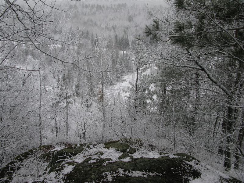
After a brief pause I turned and reentered the woods. The trail was here. It must have slipped south while I was climbing the hill, taking a more gradual ascent. Now I followed it west, along the ridgeline, looking for more views to my left. There was a few saddles to deal with, a few minor dips in elevation. I was more interested in the land to my left. Pines and brush clustered around the cliff's edge, masking any views, and it didn't look like I'd be getting any more views of the woods below.
A slick slide down
Scrub and pines on the small saddle
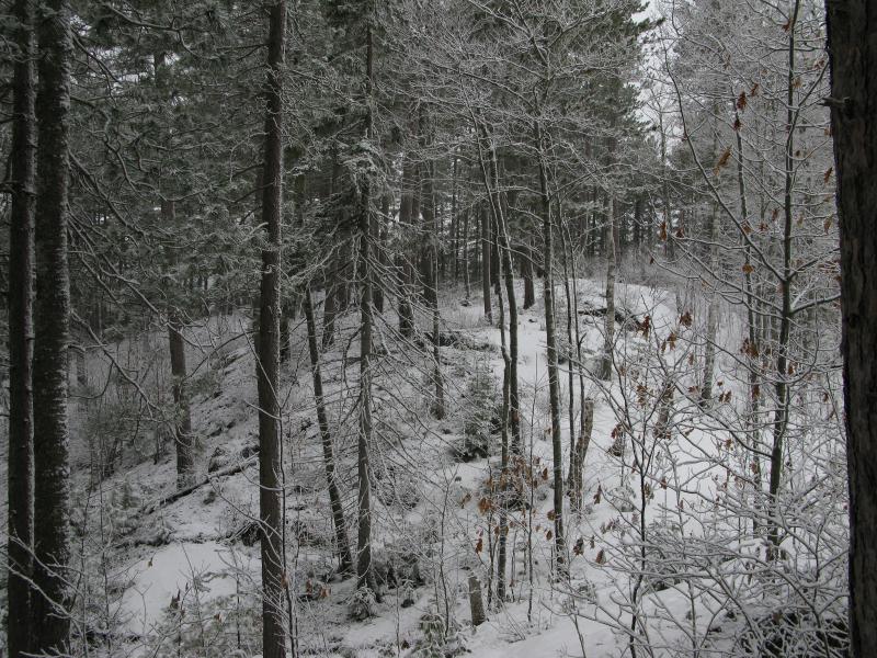
As I neared the end of the loop the woods aged, tall pines shooting up around me where the once was younger hardwoods and low brush. It was a pleasant change, opening up the woods and reminding me of what this land may have been like many years ago before the clear-cutting. A small bench cropped up next to the trail. This end of the trail had it nice.
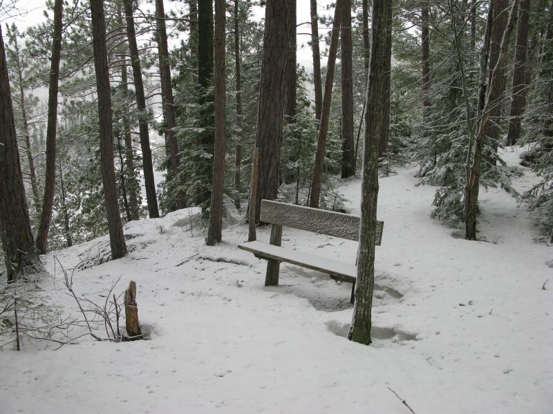
Bench near the steep climb
Open views along the trail down
The bench was located right at the top of the steep climb. It must be there to offer a break after that leg of the trail. I easily clambered and slid down the slope, noticing just how close I was to the trail I had taken in. The two paths parallel each other a bit here.
In a few short minutes I was back at my car, tired but glad I had stopped here today. My boots were even more soaked and my showshoes caked with icy slush. I knocked some of it off and jumped in my small car to head east. The deep slush had cemented my decision. There was too much wet snow on the highlands today. It was time to head for (hopefully) milder destinations in Ishpeming.
-
Jacob Emerick
Jun 15, '14
Hi Kay - thanks for the comment! The area further to the east was completely unnoticed by me until this hike, to be honest. I've been on the bluffs near Diorite, but not the other the ones north of Champion. They look incredible - sheltered from the noise of 41 by the big hill, overlooking the swamps of the upper Escanaba River, and maybe even housing some waterfalls along Kippel Creek. I'd love any advice you have of this land further to the east, any particular land to avoid or favorite lakes.Your snowshoe adventures sound like they were a lot of fun, if difficult. Been in the same situation so many times... One minute striding in six inches of fluff, the next minute buried up to the waist. Good times.
Add to this discussion