Norwich Bluff
A cold, misty morning wrapped around Norwich road like a tunnel as I barreled south from Ontonagon. I was meeting a friend at the North Country Trail parking area near FR630 and was running late. It turned out that Emily was also behind schedule, and we met at the small parking area at the same time. We both donned extra clothes in hopes of keeping dry through the slow drizzle before jumping into my car and driving up Victoria Road.
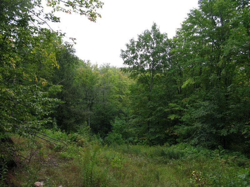
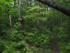
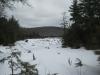
Misty two-track on the way to Gleason Falls
The Norwich Bluff hike had been on my radar for several years. Most of my hikes tend to be circular - I dislike backtracking and usually have access to a single vehicle. This adventure was a bit too linear to make a good circle. Starting at Gleason Creek, we were going to follow the the edge of a south-facing bluff over hilly terrain to Norwich Road. If there was a single vehicle, I'd have to either walk along Victoria Road for three miles or retrace my hike over the rough terrain. Thanks to Emily and her truck parked on Norwich, we could cut out several extra miles of hiking.
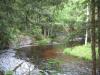
Parking near Gleason's Creek, we headed south from Victoria's Road along a few overgrown logging two-tracks. This route was a bit random, forcing us to cross the creek and circle around a few swampy areas. Before we knew it we were on a well made rocky road that was built into the side of a rocky bluff far above the creek. We didn't hear a waterfall, but seeing as the creek went from our level to over a hundred feet below us it seemed that we had passed it by. Climbing/sliding down to the creek and following it upstream a short distance brought us to the small, narrow waterfall, brown and flowing from the morning's rains.
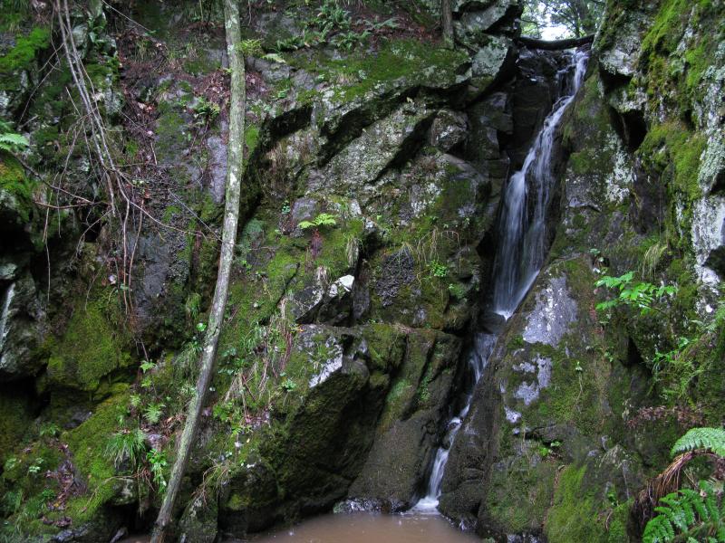
Gleason Falls
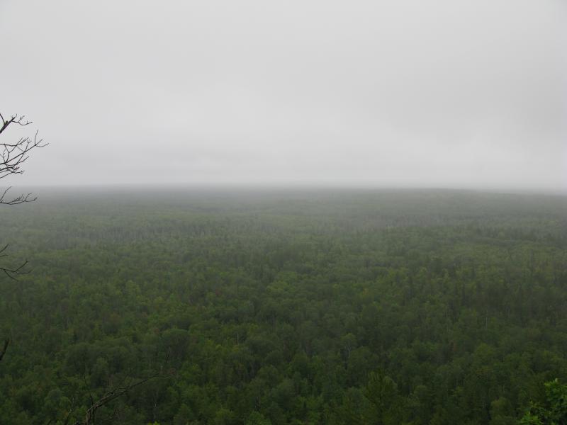
I knew that the North Country Trail (NCT) came near these falls so we headed downstream in hopes of finding some blue blazes. We didn't find them. We came out of the forest at the base of the bluff that Gleason pours down along another logging road, this one much wider than normal. Partially obscured by the mist, Norwich Bluff rose up to the west and beckoned us down the road. I had hoped to follow the NCT and catch a few good views along this leg of the hike but was not willing to venture through the thick, wet undergrowth trying to find it. We headed west along the road.
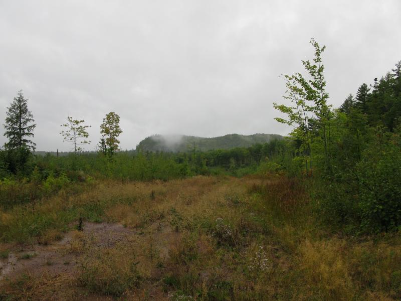
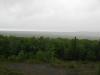
Shrouded view of Norwich Bluff, far to the west
It was along this part of the hike that Emily realized something - she had left her truck's keys in my car. My plan for a circular hike shattered. We decided to keep on our route for now and use the NCT to get back to our parking spot. The road didn't like that plan, though, and soon veered to the north. Our trail grew worse until we finally broke free of the thickening woods onto the shore of West Branch Ontonagon River.
We had bumped into the river near the mouth of Whisky Hollow Creek. There was a cabin and a few fishermen on the north shore of the river who greeted us and gave us some semi-helpful directions to the find the NCT. Following their driveway east for a short distance led us to a spur trail heading up to the north. By now Norwich Bluff was towering over us, the light grey rock peeping through the thick green leaves. We started climbing, past a gated shaft, until we reached a shrouded view from the top.
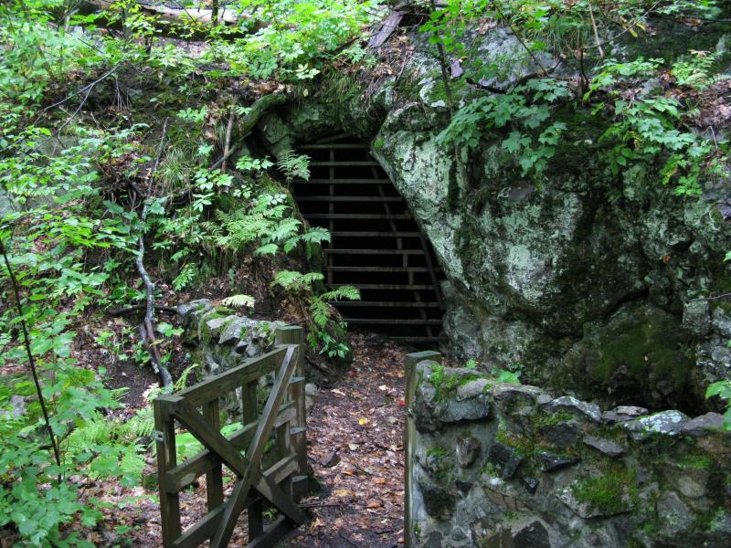
Gated mine shaft on Norwich Bluff
Green forest stretching south from Norwich Bluff
The trees stretched out below us like a rolling green carpet. To our sides we could see the steep, rocky edge plunging away to a sheer drop. It was magnificent. After catching our breath and enjoying the view we headed back east towards my car, plunging in and out of the thick woods, following the edge of the cliff. We were on the NCT now... the spur we had taken from the driveway had led straight to the blue blazes. This trail did a good job leading us along the cliff and showing off the better views. I was sad to see when it first curved north, getting ready to head down the bluff and into valley with Whisky Hollow Creek.
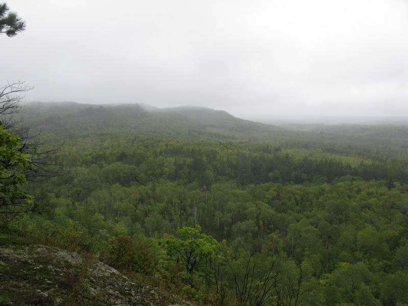
Looking east from the edge of Norwich Bluff
Our trail headed downhill fast, zig-zagging back and forth. We went from tall pines to thick, leafy trees and from rocky outcroppings to dark brown earth quickly. The valley was pleasant to walk through, even if the ferns and dripping trees soaked us even more than the exposed outcroppings did. Eventually the trail started climbing up the eastern side, up the highlands that Gleason Creek flows down. This was our last climb of the hike, and before it started leveling out we were treated to one last view of Norwich Bluff to the west.
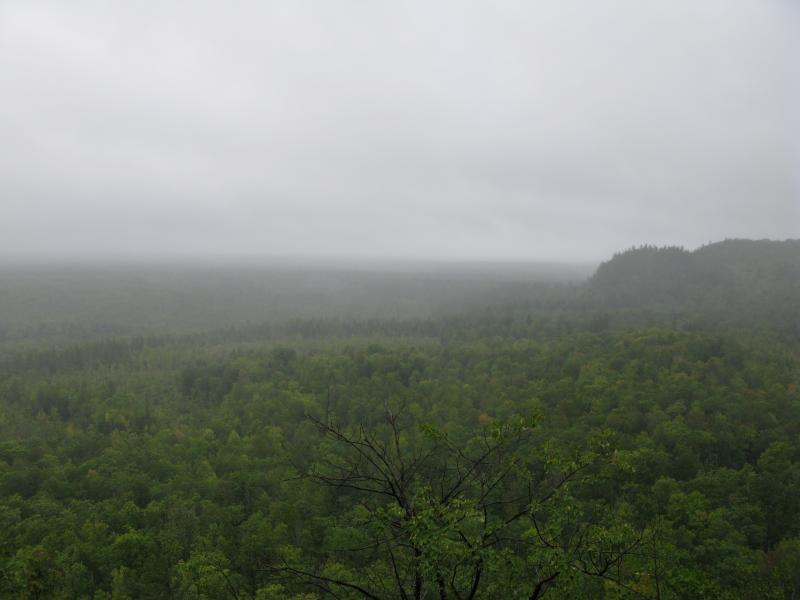
Looking west towards Norwich Bluff
We had done a pretty good job with sticking to the NCT once we had found it on top of the bluff. I was confused on how we had missed it when we were back on Gleason Creek. It turns out that we were too busy looking for a way down to the waterfall earlier - the trail intersected with our two-track just before we decided to head down the creek's gorge. It's not well marked here, so it made sense that we had missed it. The rest of the hike involved a short, slightly uphill backtrack to the car.
We did end up doing a circular hike after all and this adventure still turned out surprising well. If we had found the NCT near Gleason Creek and remembered Emily's keys, we probably could have gone farther west on Norwich Bluff and saved a few hours on the hike. We both had fun, though, and regardless of what approach you take, I'd recommend checking out Norwich Bluff to anyone willing to climb a few hills and able to follow some blue blazed trails.
-
Jacob Emerick
May 13, '12
Glad that you found it again, Dave! Norwich is an awesome spot indeed - I really enjoyed your write up on the forum. I've played around a bit to the east and west lately but probably should just return and explore it a bit more. Think I was a bit too focused on hitting up Gleason Falls first on this hike... By the time we crossed Whiskey Hollow Emily and I were too tired and soaked to really enjoy the bluff.
Add to this discussion-
Jacob Emerick
Feb 14, '13
Hi Leo,If I'm not mistaken the rocks on Norwich were volcanic. Very large and craggy. I do remember seeing some conglomerate rock near Gleason Creek a bit to the east, though, and over by Lookout Mountain by Victoria, but don't think I saw any of that on Norwich. Hope that helps!
-
dcclark
Feb 14, '13
Yep, Norwich is made mostly of basalt, with a few bands of conglomerate here and there (but not easily visible from the "front side"). Most of the copper range is basalt, with only occasional conglomerate bands. It's bookended on either end by sandstones, and the (sort-of) nearby Nonesuch was actually drilled into a particular bed of shale.
-
Jacob Emerick
Feb 15, '13
Ah, thanks for the clarification Dave. I was a little unsure, only hit the corner of Norwich Bluff proper on this hike, and you're the local expert on the region ;)
Add to this discussion-
Jacob Emerick
Jun 22, '15
Oh man, Andy, that route sounds awesome. I've barely touched on this area, know a lot of explorers more deeply entrenched in the history/area that have done more thorough visits, but this sounds like a heck of a fun time. If I venture that way again I'll have to check on that geocache for your sign (and try out that epic route you describe).
-
Andy
Jun 23, '15
If you do try "the route," I have to warn you it's been about a decade since I did this and I'm sure either the stump or the the old knotty rope down are either gone or beyond use by now (it was downright dangerous back then). I'd recommend a headmount light, grippy gloves, head protection, and your own rope you won't mind leaving behind since you can't go back the same way. And definitely don't fly solo through the mine shaft. One slip is almost certain death in there. Once you're in the hill, head diagonally upward hugging the left (exterior) wall until you see the light. I also remember there being a tight squeeze at one point. If I had to guess from memory, I'd say you're underground for about 100 ft horizontally, then up and out. That last 20-30 ft step up is a doozey...
-
Jacob Emerick
Jun 27, '15
Thanks for the advice, Andy!
Add to this discussion