Little Presque Isle
A cold wind swept off of Lake Superior and swept the trees around Kathleen and me. As the sand stung our eyes and the sound of crashing waves pounded our ears we exchanged an uncertain look. Little Presque Isle was not exactly an easy destination to reach, especially through a turbulent great lake.
Little Presque Isle
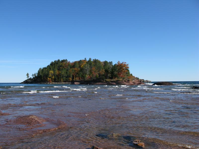
Unlike Marquette's Presque Isle to the south, Little Presque Isle is an actual island. It sits about two hundred feet off a sandy point on the north side of Wetmore Bay and Sugarloaf Mountain. The water between the island and the beach is a few feet deep at most and is a pleasant wade on most days. Today was a bit chilly, though, and I had second thoughts about attempting the crossing.
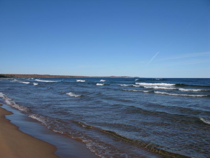
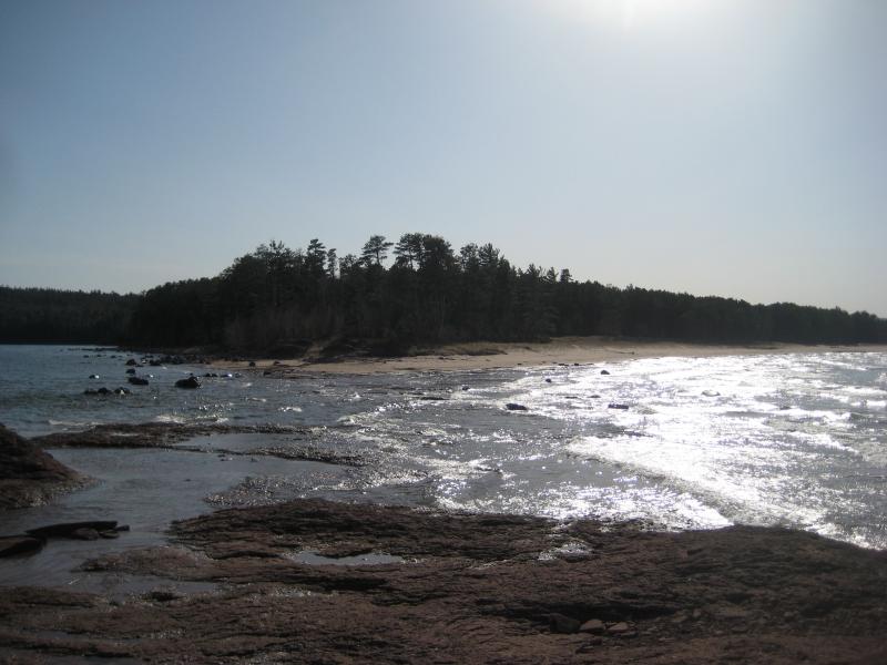
The northern beach
Together we strode along the beach towards the island. When we reached the tip of the point I looked out, trying to gauge just how difficult our route would be. The waves were not terribly high, even with the cresting peaks. The ground worried me. A few boulders were scattered below the water, random obstacles, and most of the bottom appeared to be flat sandstone. Potentially slick rock, coupled with shin-high boulders, and balancing against the waves? Kathleen and I turned south towards Wetmore Beach instead, ignoring the watery crossing.
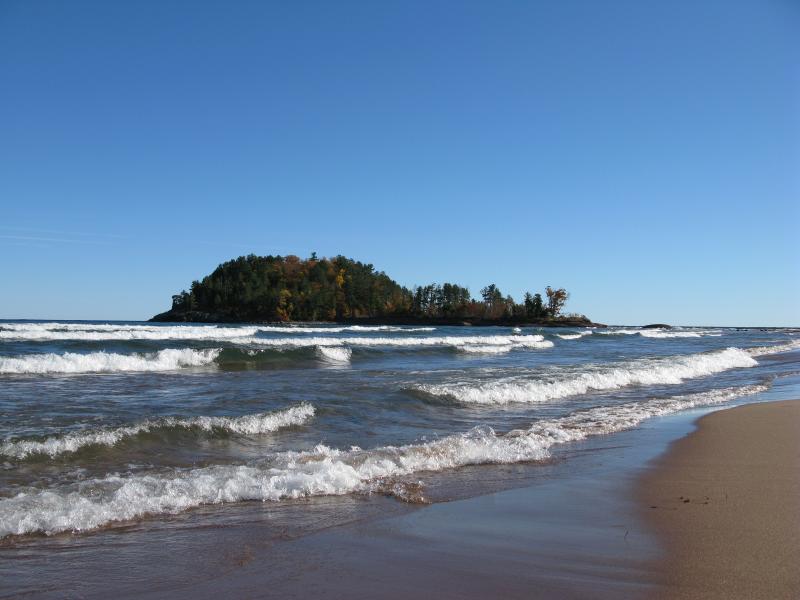
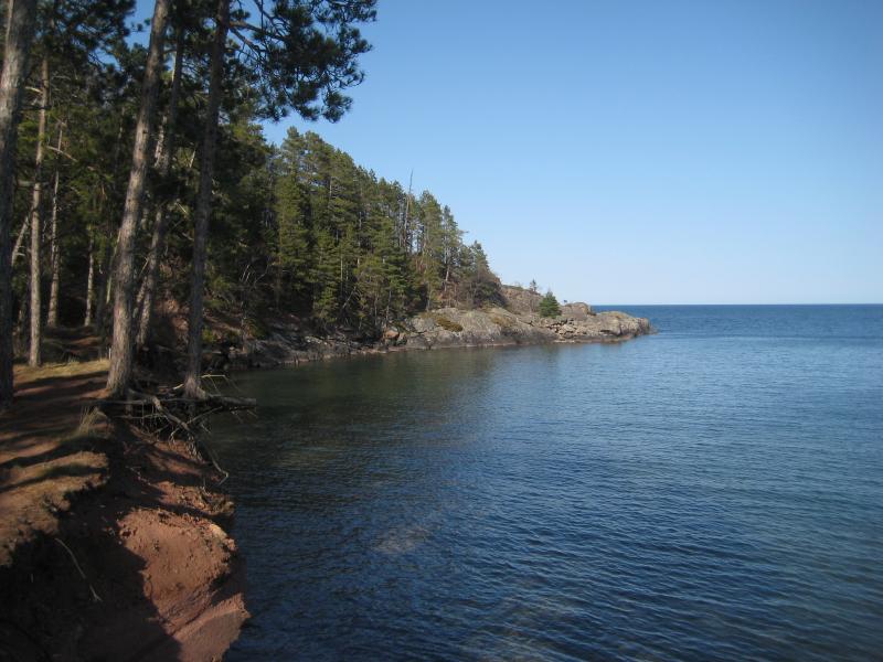
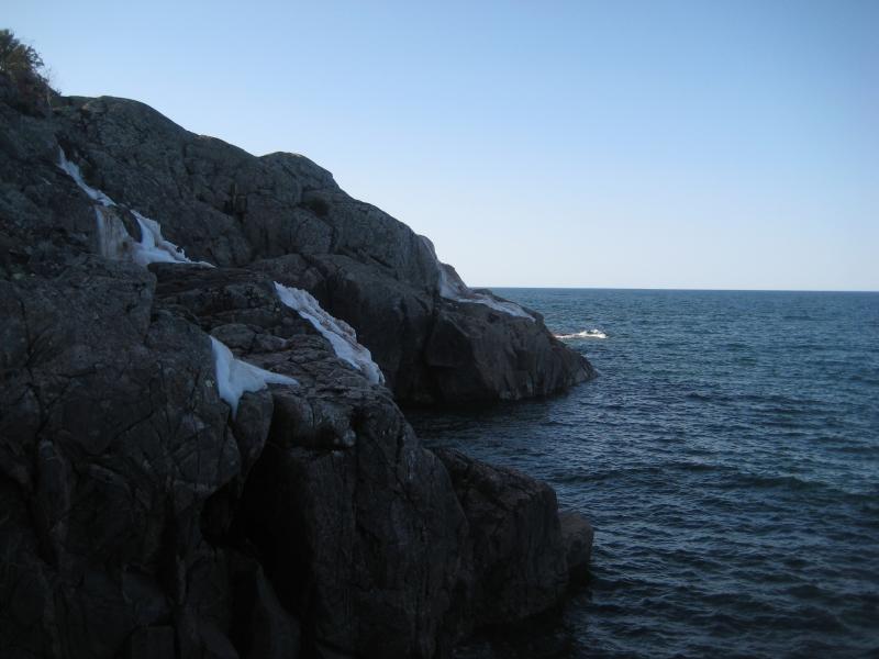
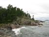
The island from the tip
The waves were higher against this shoreline, hitting the right angle as the marched past Partridge Bay and Sugarloaf Mountain and crashing against the sandy shore. We chatted and walked on the shifting wet sand, pretending not to care when the water splashed over our shoes. After a short time we bumped into the point when the rocks raised up and blocked our path, stacks of sandstone that eventually rose up to the steep Freeman cliffs. We were still a good mile from Wetmore Beach, and could have taken the North Country Trail up and over, but I turned us back around.
Wetmore Beach

Through the hole along the beach
When we stood on the point again, looking over at Little Presque Isle, I convinced Kathleen that it was worth a shot. We had come all the way out this way, after all. It'd be a shame not to cross the shallow water. I went first, a few hesitant steps, trying to get a feel for the water and the ground. The cold water seeped in and shocked my feet. Committed now I pushed forward, shouting encouragements back at Kathleen as I awkwardly shuffled forward, until we both straggled onto dry rock.
Water poured from us in streams. The water had came up to my thighs (and darn close to Kathleen's waist), thoroughly soaking our jeans. Boots were roughly tugged off and poured out, socks laid in the sun, and pants were squeezed and patted down in a futile attempt to dry off. Eventually we simply sprawled out on the rocks, hoping to let the sun and cold wind dry us. The elements only mocked and chilled us further.
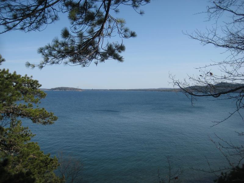
Looking back at the mainland
One mile. That's about the length of the shoreline of Little Presque Isle. Hoping to let our boots and socks dry more we left them at the western tip and headed out barefoot. The paths were wide, smooth, and well-trod, and a mile didn't seem too bad.
Up along the southern shore
As we walked along the southern shore it was interesting to see just how similar Presque Isle and Little Presque Isle were. A steep sandstone cliff rose up on the south side, forcing us to climb a relatively rough trail in bare feet, and beyond that was the black rocks. They spread out from the island, reaching out like grasping toes into the cold waters of Superior, jagged and well-worn from years of pounding waves. Sure, everything was smaller here than on the larger Presque Isle, but I felt like the fact that we were actually on an island made up for that difference.
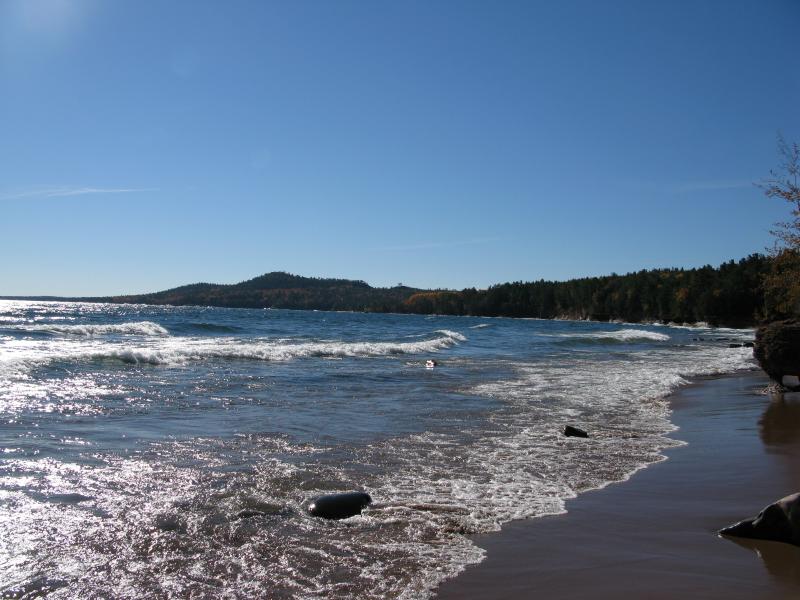
South over the blue waters towards Marquette
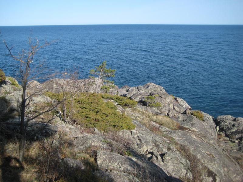
Down on the black rocks
The open black rocks were a welcome change from the gritty path. I brushed off the soles of my feet before clambering out on then, determined to climb all the way down to the water's edge. It took a bit of maneuvering, a few careful approaches, and I was there. The water seemed strangely calm by now, a few ripples on its surface compared to the earlier crests, and the blue waters very inviting. Felt like we were on a whole different lake.
Waters edge
I climbed back up the rocks and we continued with the black rocks, slowly making a circle of the island. There were obvious signs of previous visitors - paths, footprints, small campfire circles - yet we were alone today. No one bothered us as we cautiously made our way over the hard rocks and tiptoed on gravelly trails. In short order we were back on the western tip. This time we decided to just carry our boots over. No use in re-soaking them for the short walk.
Little Presque Isle is a pretty neat place, though I wish we would have been smarter about it. Barefoot is not the best way to walk on a rocky, forested island, even though there had been enough paths to make our venture relatively easy. It'd be a lot of fun to fully explore it, to crash through the woods and follow the rocky shoreline more closely, whether it meant carrying boots over or sloshing around the woods. Regardless, it was a fun visit - there's not that many islands on Lake Superior that you can just wade to.
-
Jacob Emerick
Nov 13, '14
Oh wow, yeah, I heard about that drowning. The currents up and down that coast are pretty dangerous. Definitely nothing to take lightly, especially with this year's higher waters.
Add to this discussion-
Jacob Emerick
Nov 13, '14
Thanks JT! This year may be a bit tough getting to the island but it's not bad on other years. Oh, and thanks for the worry :)
Add to this discussion