Huron Mountain Range
The Upper Peninsula of Michigan isn't particularly known for its mountains. While the terrain is more rugged than the Lower Peninsula, there are no vistas that compare to the Rocky or Appalachian Mountain states. However, there is one group of peaks collectively known as the Huron Mountains worth mentioning for their height and rural setting.
The Huron Mountains stretch northward from Marquette following the curve of the land toward Skanee before dissipating south near Alberta. They circle the Yellow Dog Plains, a sandy plateau mostly owned by the Mead Paper Corporation, and the Peshekee Highlands just north of US-41. The roads are windy and unmarked, used only by outdoorsmen and logging companies, and is not plowed or maintained for most of the year.

Rocky outcroppings near the Yellow Dog River
There are three main portions of this range. Starting in the east, near Marquette, is the Sugarloaf range. These mountains are known for their two main peaks, Sugarloaf and Hogback, as well as numerous waterfalls from the Dead River, Yellow Dog, and Garlic River watersheds. These mountains are formed from crumbly volcanic rocks and often have nice overlooks from their peaks. However, County Road 550 runs along the Lake Superior shoreline and has numerous cabins with private property in the mountains, making off-trail hiking difficult.
Further north, in between the Huron River and Big Bay, is the true Huron Mountains. The terrain here is too difficult to easily reach without several miles of tough hiking, with the only nearby road is the treacherous Northwestern Road. Also, the Huron Mountain Club owns roughly 13,000 acres of these mountains and is very strict on trespassers. There are a few peaks outside of their boundaries, though, including Bald Mountain and Mount Benison. The mountains in this area are simply huge mounds of glacier-smoothed bedrock covered in old growth woods surrounded by waterfalls and cedar swamps. Rocky bluffs at the peaks are common, especially facing south. Even though this area is arguably the most pristine and rugged terrain of the larger mountain range, limited access routes and large Club holding makes it difficult for visiting.

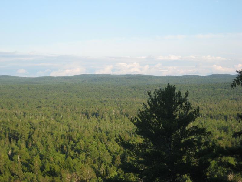
Tree covered mountains of the Arvon area
Heading southwest from the mouth of Huron River, the Arvon Mountains stretches slowly towards Alberta before dwindling down into the Baraga Plains. These mountains are the tallest, with the Mount Arvon being the highest point in the state at 1979 feet, but are also completely forested with no rocky outcroppings. The only evidence of solid rock is found in the waterfalls surrounding these mountains, which include the Slate, Silver, and Huron River falls. These mountains are formed mostly from basalt and slate rocks, but are completely covered in hardwoods and surrounded by thick, murky swamps. The area is crawling with two-tracks from logging, though, and most points of interest are within several short miles from a road.
Even though there are other mountain ranges in the Upper Peninsula, including the Porcupine, Gogebic, and Keweenaw, this area is by far the most rural and challenging to explore. If you can climb a peak and find a good rocky bluff, the view is incredible - miles of woods and mountains with few, if any, signs of civilizations. I'd highly recommend a trip to this area to any hiking enthusiast with a good sense of direction and a full canteen - just pick a peak and climb.


Comments (1)