Hills of Harlow Lake
An unseasonable warm gripped the Marquette area. I stepped out of my car in short sleeves and looked around curiously at the snow drifts piled up against the woods. I was parked just north of Sugarloaf Mountain at an old gravel pit. There were no signs marking anything special here but I was one of a half-dozen vehicles parked off the road. Part of the Harlow Lake trail network led out from the pit, and it was the Harlow Lake hills that I wanted to find on this warm spring afternoon.
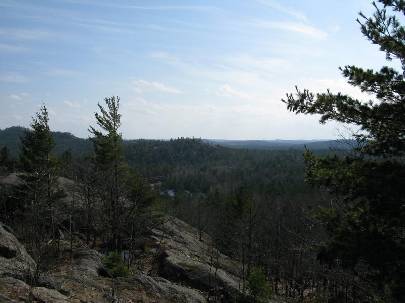
South from the first outcropping
Trails did not interest me today. There were a few of them that snuck their way out west, towards the foothills of Hogsback, so I turned and headed north into a young, scratchy pine forest. The trees aged slowly while the ground began to climb and in short order I was climbing a steep slope surrounded by huge pines. After fifteen minutes or so I came out on the first outcropping, with a view back at Sugarloaf and the gravel pit below close enough to reach out and touch.
County Road 550 was also uncomfortably close here, the roaring vehicles disrupting any sort of peace gained during the bushwhack, so I didn't waste much time in continuing on. Rocky outcroppings continued to rise up in the north and I followed them. Each new lump was higher than the last with better views of the area. Presque Isle and Sugarloaf dominated the views in the south but Hogsback Mountain didn't really stand out too much against the hills in the west. Eventually I came out at the highpoint with an impressive panorama of the land surrounding me.
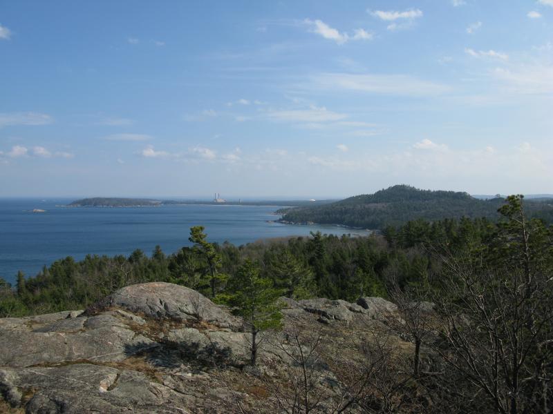
Sugarloaf Mountain and Presque Isle to the south
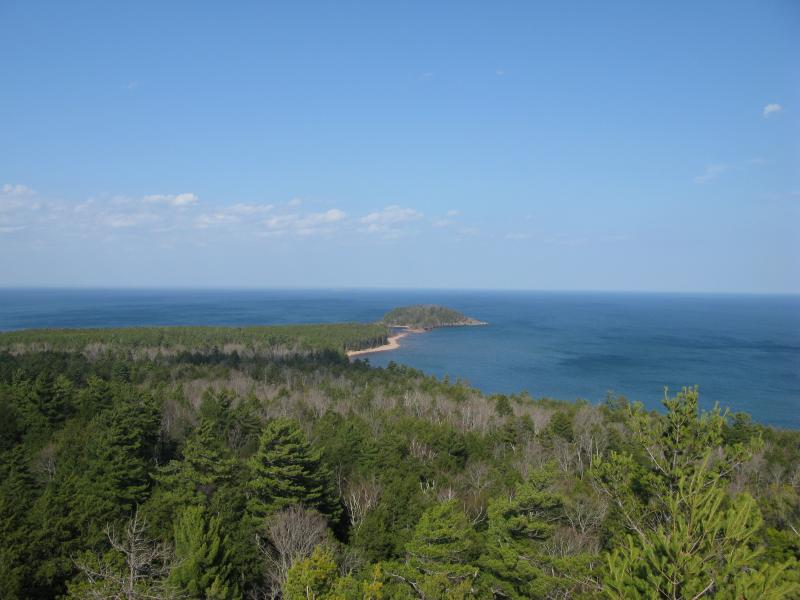
Little Presque Isle off to the east
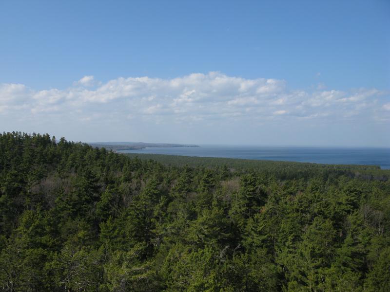
Looking north up the Lake Superior shoreline
There was one disrupting find on the peak of this hill. Somehow a bike path had found its way up onto this outcropping. Later research showed that the trail network that started at the gravel pit below looped over and climbed this hill from the west. Unsure what the rules were for hikers on the trail I maintained a wide berth as I headed down the north flank. I wasn't sure where the trail went, but I had one more hill to climb before checking down to Harlow Lake, and the last thing I wanted to do was damage a bike trail during the wet melt.
A couple of large, full melt ponds blocked my way. I slowly crept along the edge, using what logs I could, and unsuccessfully attempted to keep dry. Regretting my decision to stay off the bike trail I climbed the next hill quickly, trying to ignore the freezing water in my boots and creeping up my jeans. The last hill was lower than I expected but did offer some good views to the north and east. The other interesting sight was a couple of stone men that previous hikers had left behind. I was getting close to Harlow Lake.

Little Presque Isle closer, just barely peeking ov

Odd little stone men
This hill sloped gently down to the shore of Harlow Lake with only a few forested breaks in the rock. Still mostly covered in ice, the lake creaked and groaned loudly in the warm temperatures. I was slightly tempted to attempt a crossing… Even with the warm temperatures the ice looked thick enough to support my weight. Instead I followed the lakeshore west, getting some varying views of the changing shoreline and a few cabins on the opposite bank. There are a number of DNR cabins around this lake and I could make out at least three in the distance.
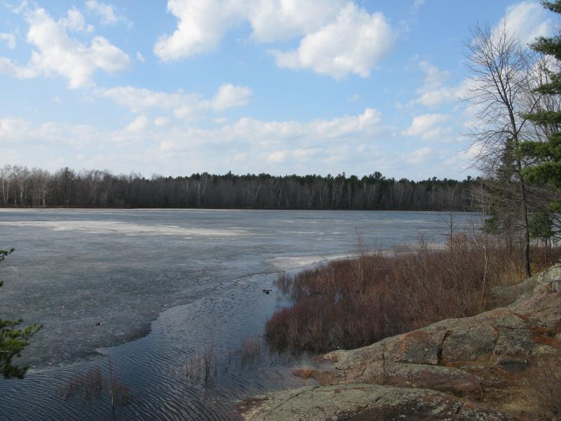
Looking across the lake to the north
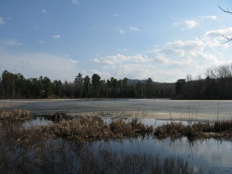
West across Harlow Lake
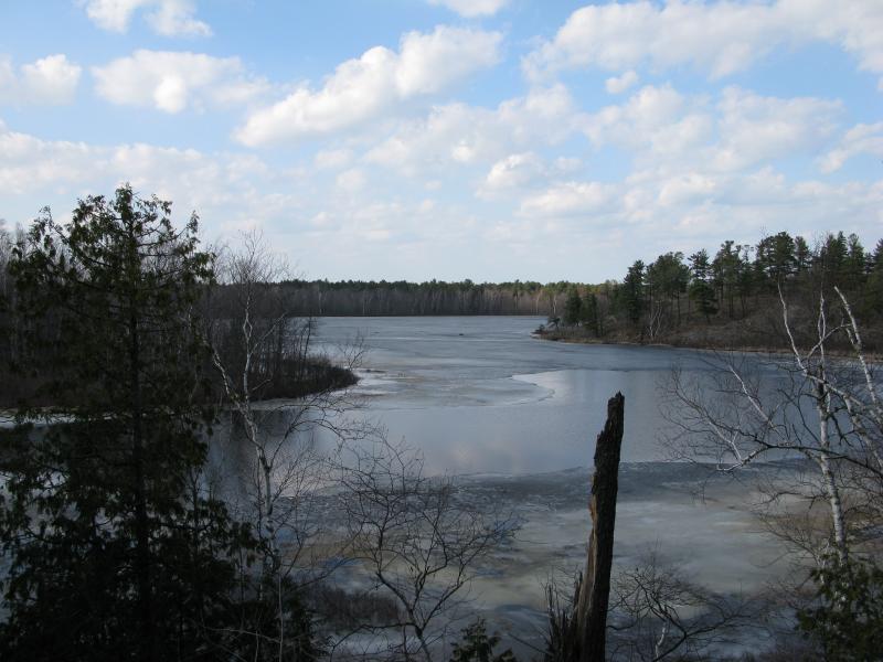
Some open water on Harlow Lake
The shoreline had some wild variety. At times I was climbing onto or walking on large rock outcroppings only to be forced to push through swampy lowlands a few yards later. After making my way around the big west bend I bumped into the biggest hurdle yet, a swampy creek swollen by the melting snow. Awkwardly I stepped from one tuft of grass to another and somehow made it over the cold water with only a minor dousing. On the other side of this creek lay one of the Harlow cabins, which connected to a trail along Potluck Creek. I happily took this trail back to the gravel pit, even though the snow this deep in the woods was easily knee deep at several sections. Slousing through the wet snow in short sleeves was a great way to end a quick climb over the Harlow hills.


-
Jacob Emerick
Apr 2, '13
Ha, so you're the culprit! I've mostly bumped into cairns (I think that's the term) in the northern Huron Mountains, just stacks of flat rocks. Not too many Inuksuks. Would love to find a dolmen...
Add to this discussion-
Jacob Emerick
Apr 2, '13
You caught me! I haven't been doing a ton of hiking this spring, with work schedule and baby prep, so I dug out this hike from last year. This hike was on that particularly hot spring day in mid-March of 2011. Hope to get up there within the next two weeks for a more accurate post on the current conditions :)
Add to this discussion