Grand Canyon: South Kaibab to Bright Angel
A cold morning wind rushed up from below and cut deep into my layers of clothes. Cold was weird to experience in Arizona during the month of May. Up here near Flagstaff the nightly temperatures still dipped down to forty, though, enough to justify my shivering. I tried to take a few decent photos of the Grand Canyon from Bright Angel Lodge before briskly walking back to the bus stop.
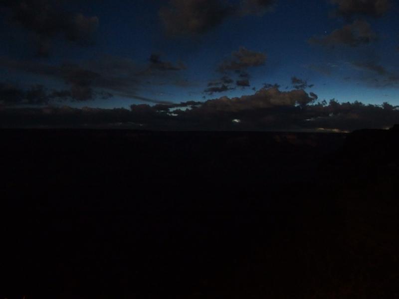
Dramatic night sky over Grand Canyon
Chris and I were going to do it - we were going to hike the Grand Canyon. Our plan was basically a cheap rim-to-rim. We would descend down South Kaibab Trail to Phantom Ranch and then climb back up on the Bright Angel. The route was close to twenty miles, would cross the Colorado twice, and was around 5000 feet of elevation difference. It was a crazy, stupid, and ambitious route to complete in a single day.
It took another thirty minutes before the shuttle finally pulled up. We had parked by Bright Angel Lodge, right next to where we'd be coming up from the canyon's depths, and needed a quick ride over to South Kaibab. The two trailheads started five miles apart. I had voted for just walking over there a few hours earlier, getting a predawn start and making our hike the length of a marathon, but Chris was more cautious. We were hiking the Grand Canyon today. There was no reason to add another five miles on just because.
South Kaibob Trailhead
5:45 AM, 7130'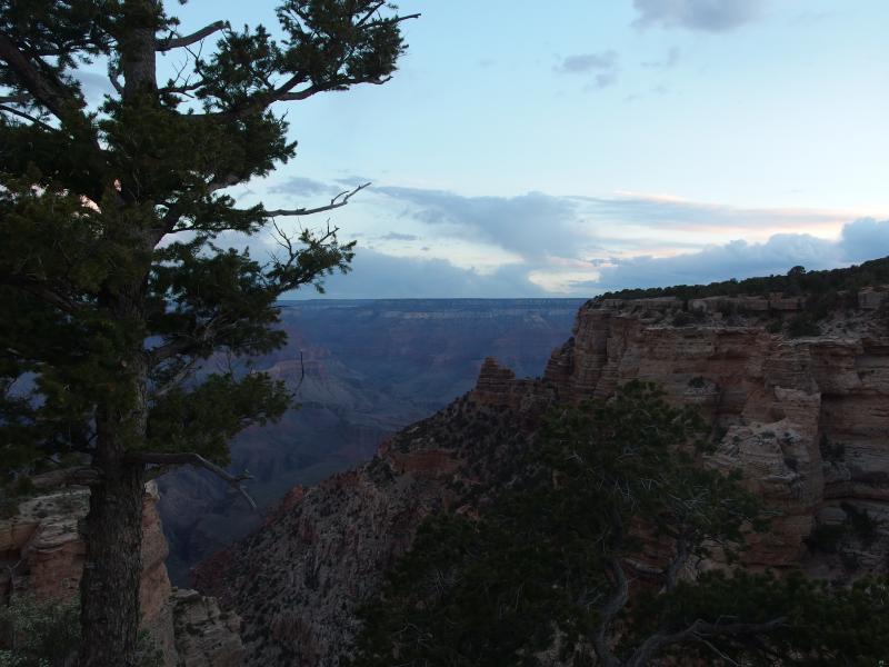
Dull light at the South Kaibab trailhead
The temperatures were only slightly warmer once we got off the bus. Technically the sun was up, though the clouds and terrain hid any warming rays from reaching us. We booked it over to the trailhead (after a quick coffee-related stop at the restroom) and looked out over the bleak gorge in front of us.
Our largest fear about this hike was the heat. Down there the temperatures were going to be much higher, right next to the river itself, and we didn't want to be caught in the sweltering highs of the afternoon. So our original plan was to start down this trail in the dark. That plan was already dashed because of the bus schedule. Now it was already morning and we'd just have to deal with it.
With little fanfare we started down the trail. It was a mix of loose gravel, dust, and rock steps. The easy path and downhill grade lulled us into a rolling trot. Most of the stairs were just deep enough to require two steps to cross and made for a weird one-two cadence. I tried to switch between my left and right knee taking most of the downhill stress. I didn't want either of those old injuries to flare up with today's long and inaccessible hike.
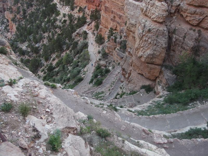
Dizzy descent down from the rim
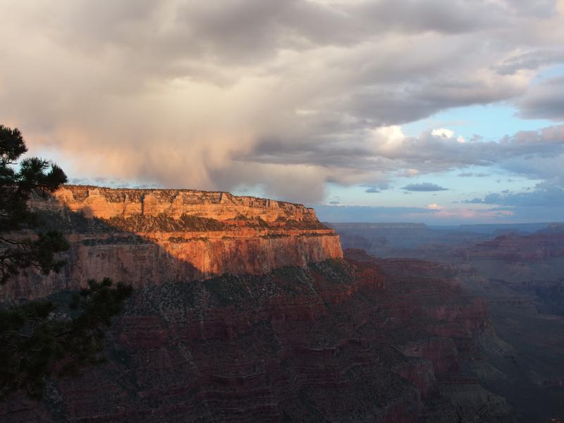
Early morning light on the rim edge
When the sun finally poked up from the clouds and shone a few rays into the canyon the different rock layers really came out. Deep reds and whites, speckled with green patches of hardy vegetation, made a sharp constrast with the grey and blue of the morning sky. I wonder how many of the crowds of visitors who stay behind the railings at the top of the rim get to see this fantastic display.
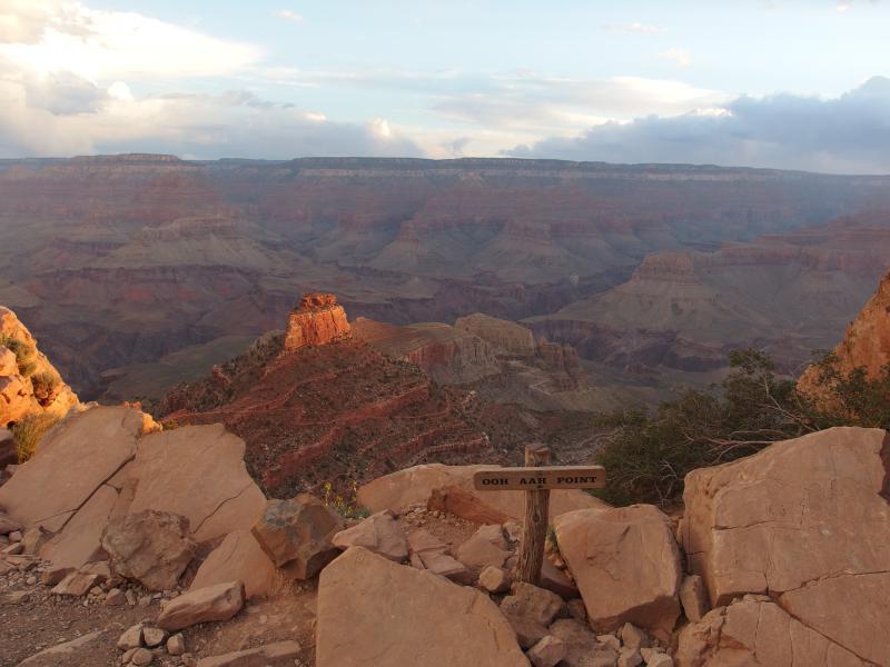
Morning light from Ooh Aah Point
Ooh Aah Point was the first named feature we bumped into within the canyon, a mere twenty minutes into the day. The view here wasn't bad, mostly featuring O'Neill Butte that we'd be passing under soon enough, but it was nice to hit a milestone. This was also our first view looking east into the rising sun. South Kaibab Trail drops down on the wrong side of Yaki Point and had kept us in the shadow for the first mile or so of our hike.
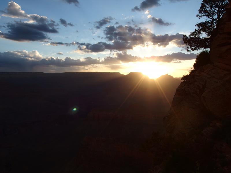
Bright sunlight to the east
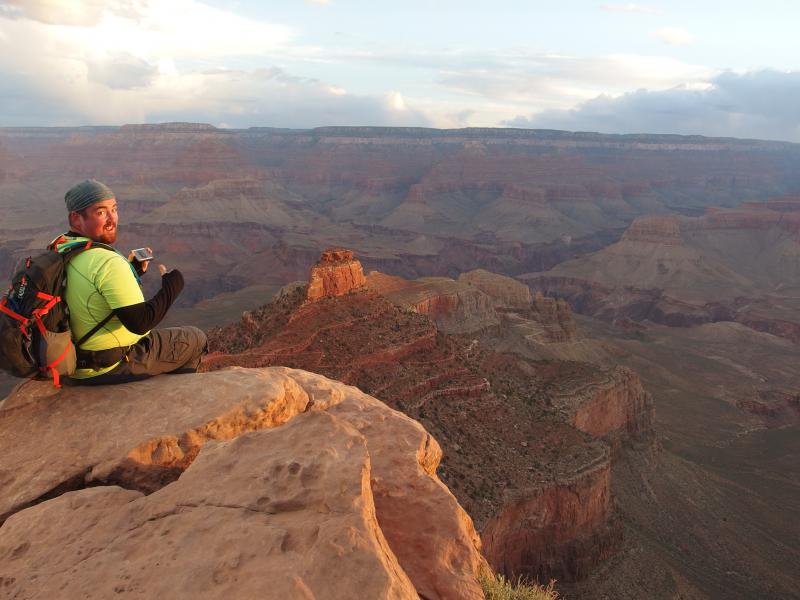
Chris look down from the point
After our brief stop we continued down the descending trail. The switchbacks had left us alone for now. On our initial descent they had gotten a little crazy, dropping like a drunken ladder down the steep wall, but now it actually felt like we were progress towards the Colorado River. We were heading out along the length of Cedar Ridge.
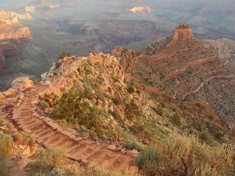
Winding trail leading down to O'Neille Butte
There is an actual stop called Cedar Ridge with restrooms and a small clearing. No water was here, though. That's the real catch about South Kaibab trail. It descends to the bottom of the canyon very quickly and is the shortest way to Phantom Ranch - but there is no water. Six miles without any water stations in this climate is a bad idea, especially if you're climbing back out.
A few scrubby trees occupied the small clearing at the stop. If the park wasn't so regulated I'd entertain this as a nice little camping spot. You could head down to this point the night before and watch the sunrise from here. There's no way that'd be allowed, though, not with the traffic or the rules here. As I pushed that idea away I noticed a small rainbow to the west.
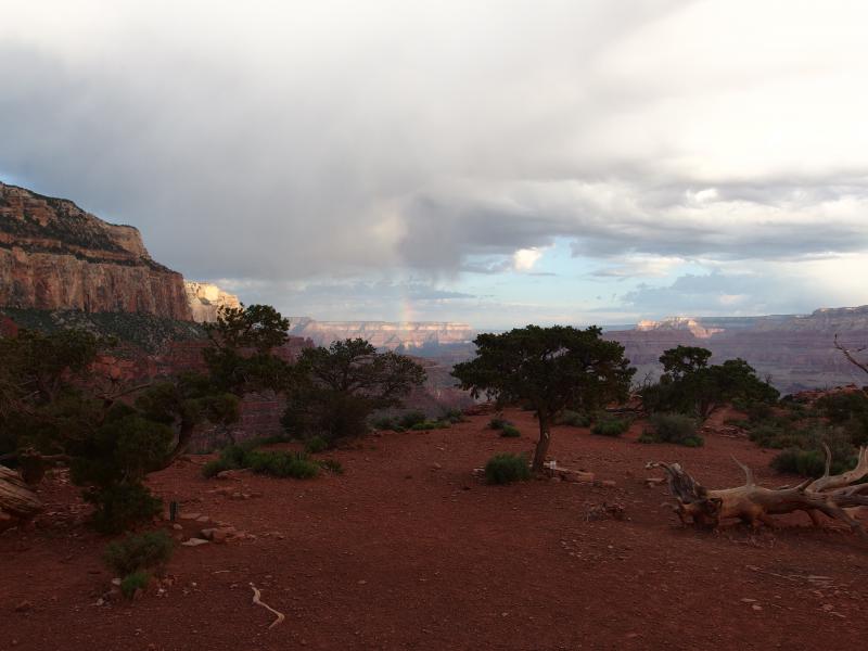
Scrubby trees on Cedar Ridge
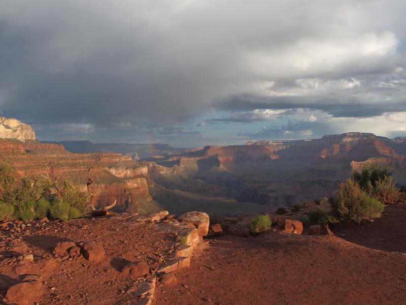
Small rainbow out to the west
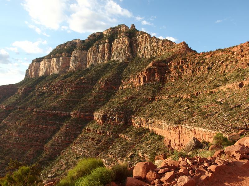
Green foliage on the ridge wall
The trail continued to drop along the ridge towards O'Neill Butte. I noticed a mule trail coming up behind us. Figuring that we could easily outrace a barren of mules we pushed on faster. Within ten minutes they were at our heels and we had to step aside to let them pass. They were tied up in groups of four, a cowboy leading each group, and all of them were heavily laden with gear.
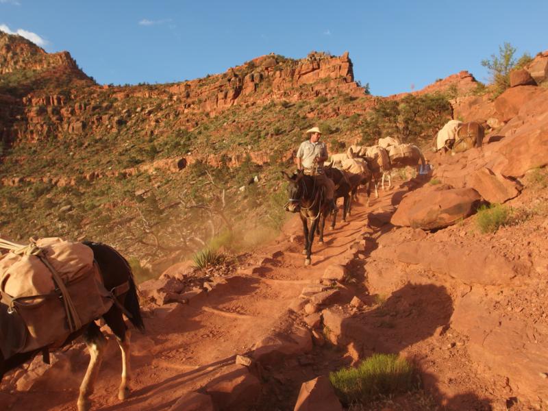
Mule trains coming down the trail
That's another thing to note about the South Kaibab Trail. This trail is used as the main supply route for the lower canyon. There's less traffic along it, because of the increased exposure and lack of water, so the park uses it to push supplies up and down. The dust and waste left behind from the train made for an annoying reminder of their passage.
Between the excitement of the mule train and the grand views opening up in front of us we missed O'Neill Butte passing by over us. The trail just kinda drops down the east side of Cedar Ridge and snakes along the side of the butte. When we looked back it was surprising to see how far we'd come. Yaki Point, Cedar Ridge, and the rim itself was dropping away in the distance. We were almost halfway down. We were at Skeleton Point.
Skeleton Point
6:50 AM, 5150'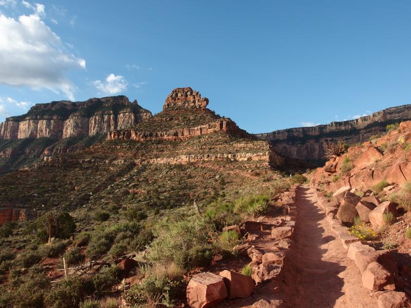
Looking back at Cedar Ridge
Skeleton Point was something we had dreaded coming up to. Well, I had dreaded Chris's description of it, and for good reason. Skeleton Point is the start of a major part of the descent down to the Bright Angel Shale, the long green/grey flats that most people associate with the 'bottom' of the canyon. The Colorado River cuts further down than this, into the hard volcanic rock below in the 'inner canyon', though this hard to see from the top of the rim.
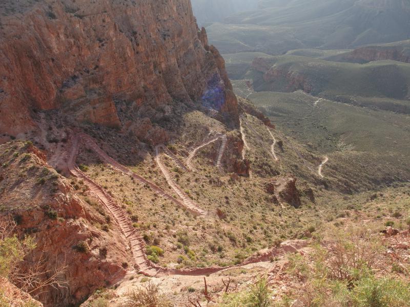
Piles of switchbacks leading down Skeleton Point
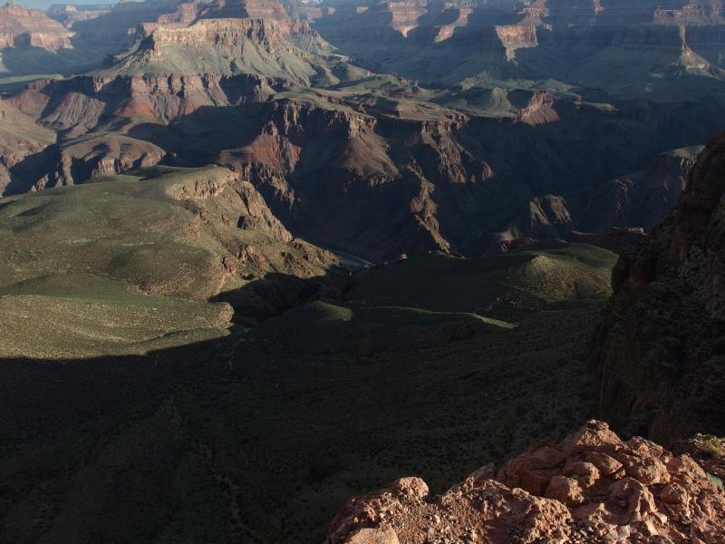
Distant glimpse of the river within the inner canyon
So now we had to descend down layers and layers of switchbacks, all exposed to the morning sun, down one of the steepest sections of the trail. The walk wasn't a ton of fun. My left knee began to complain from the one-two cadence steps and the dust coated my mouth and throat. I held off on drinking any water. Chris had goaded me into not refilling my Camelbak, of only drinking two liters of water today, and I was holding it for the hot climb up.
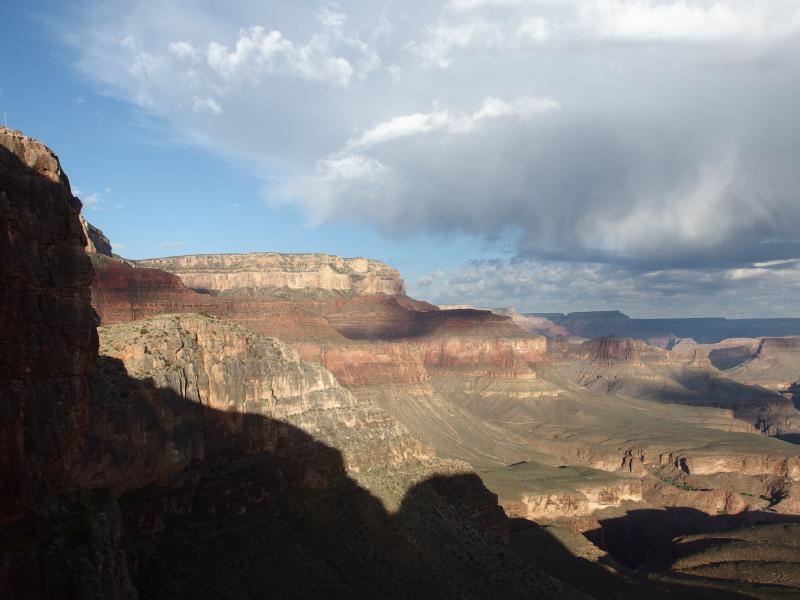
Looking west from Skeleton Point
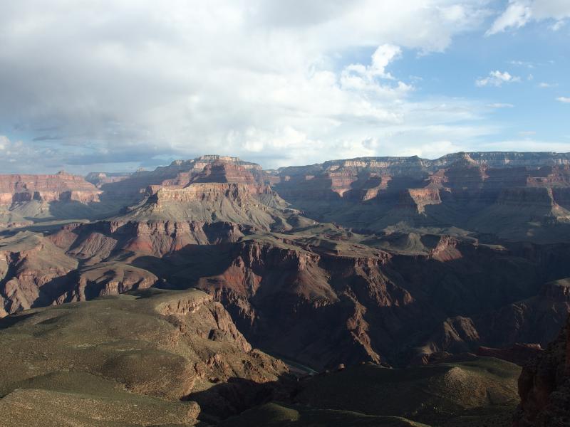
Looking over to North Rim
Chris and I separated for some time along this path. He needed to fiddle with some gear, and I was stopping a lot to take photos of the canyon, and it was just easier to buffer some distance between us. For much of the climb down Skeleton Point we were a switchback apart, me one level below him, almost passing each other with some twenty or fifty feet of height difference between. As we passed we complained about the steep downhill and then walked in silence for a minute before repeating.
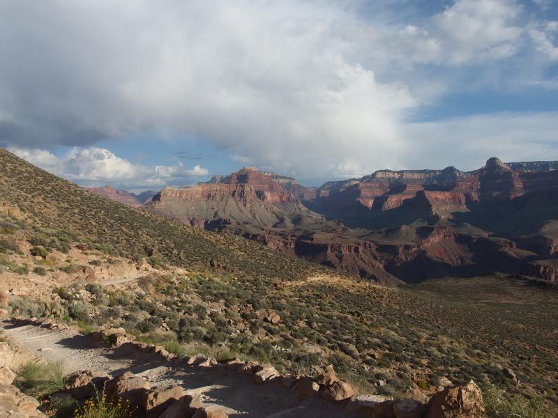
More reasonable path down
Eventually the trail straightened on the shale area and once again we were heading north to the river. Going up that section must be a real pain, especially with the knowledge that there is no water at the top and that the trailhead is a few thousand feed beyond. Unless someone was in a real rush or was really hoping for a relatively lonely hike I'm not sure why a hiker would ever go uphill this path.
Speaking of solitude, we hadn't seen that many people this morning. Most of the other hikers who had come with us on the bus, maybe five other groups in all, we had passed before Cedar Ridge. There was a few groups that had gotten an earlier start too, and that mule train, but altogether we had seen less than forty people since leaving the rim. We'd only passed two backpackers coming back up so far. The lack of traffic was a pleasant surprise for a place like the Grand Canyon.
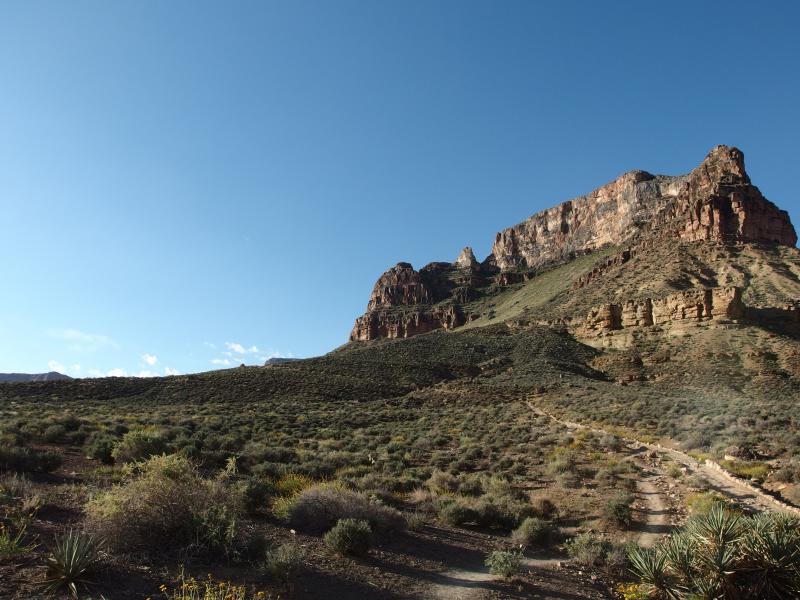
Interesting view back up the climb
A few minutes along the straight path and we reached the Tonto Trail junction and restrooms. This trail was of interest to us, as it travels east up the canyon for some distance and is known as a relatively remote backcountry experience. Could be a possible weekend trip for us, assuming that we get the right gear and register several months/years in advance. We didn't stop here, since there is no water or good views, and simply continued towards the inner canyon.
The Tipoff
7:30 AM, 3910'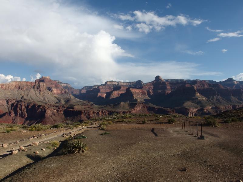
Flat clearing at Tonto stop
Beyond the Tonto stop was a spot called the Tipoff, where the trail sneaks down a little cut and the inner canyon really opens up. The rock suddenly changes into an iron-rich volcanic, probably from the Precambrian Era (I need to brush up on my geology), and everything gets pretty steep. Our path made a huge swoop to the east before zipping towards the river. We were getting close.
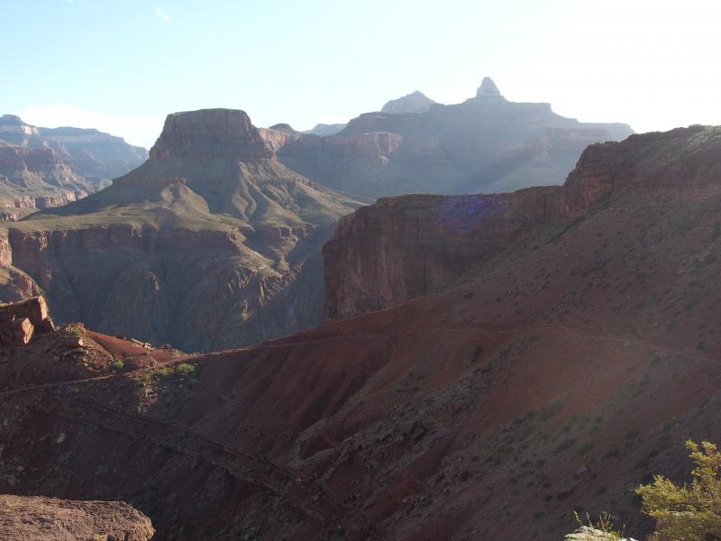
A long swoop down along the trail
It felt good to back in the shade. We trotted quickly along the dusty path that had been hewn into the side of the hard rock. On the way we passed another backpacker heading up, making painfully slow progress around the long swoop, and chatted with him briefly before he huffed further up.
We were making great time this morning and would probably reach the bottom within three hours. However, going down is easy. We were concerned about coming back up. Each person we had seen climbing back up this morning was sweaty, tired, and looked terrible. This did not bode well for the second half of our hike. Our legs were already complaining from the quick descent and early morning.
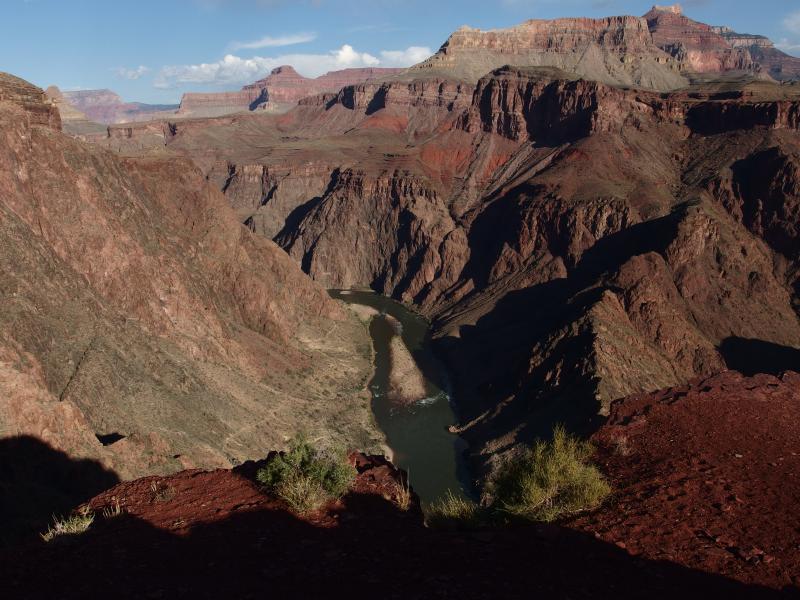
Colorado River straight below the trail
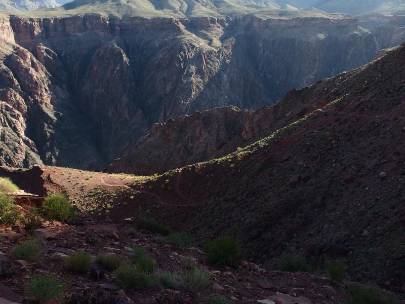
Trail zig-zagging down the red rock
Seeing the Colorado River directly below us helped. Eventually we also saw the Bright Angel Bridge, a bright and shiny metal footbridge, and later the older Kaibab Bridge. Our trail swung back and forth with increased furiosity, like a snack trying to shake us off its back, as we neared the bottom. My throat began to ache with the dry heat. A passing group of horses and their trail of dust pushed me to finally take a sip of water while Chris looked on smugly.
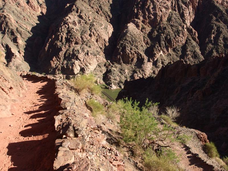
Dusty path down
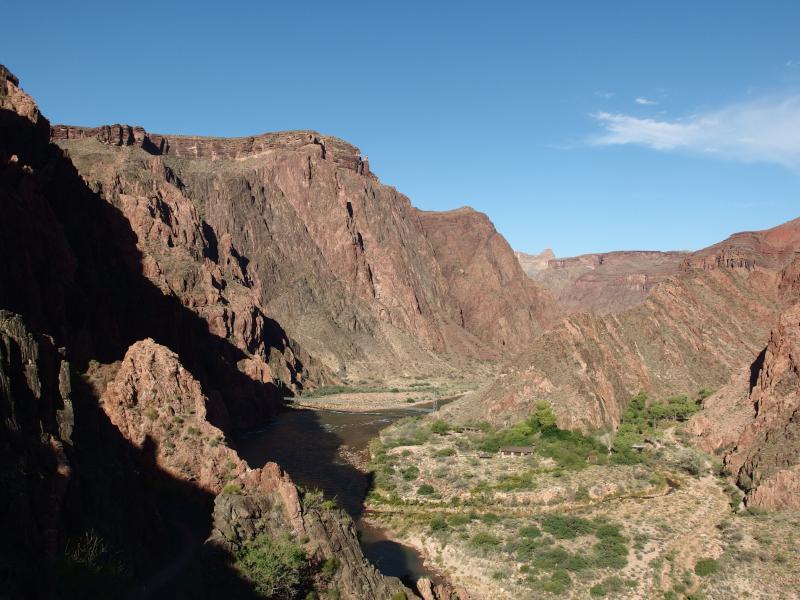
Looking across at the Bright Angel area
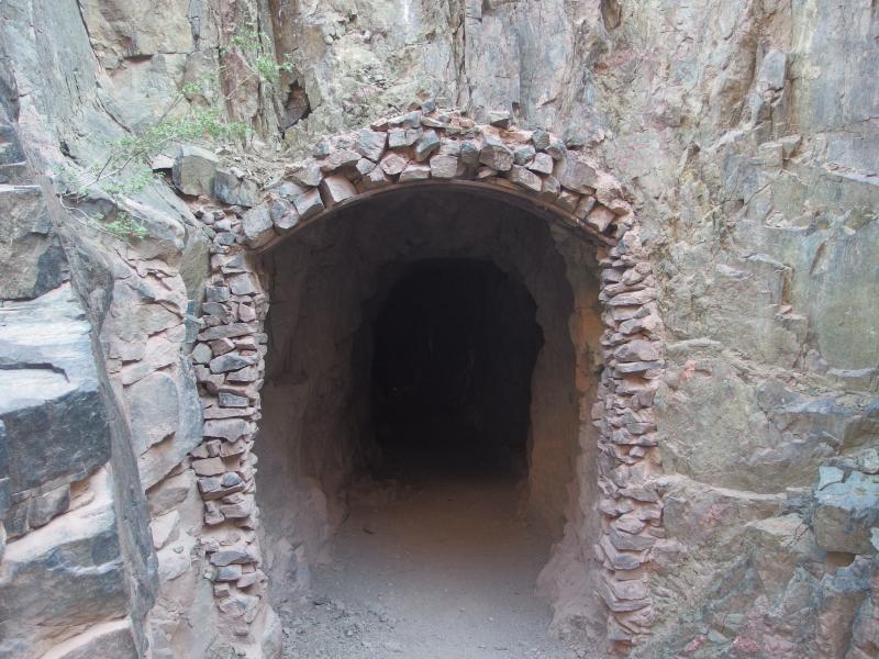
Dark tunnel to Kaibab Bridge
We walked, I talked about what I guessed the geologic history of the rocks were, and soon we were faced with a dark tunnel. The cool dry air was a welcome change and we stumbled forward into it. It's not a long tunnel and it dumped us out on the old metal bridge, wooden bottom worn deep by passing horses. We made it. We were at the Colorado River at the bottom of the Grand Canyon.
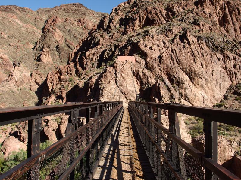
The old, grooved bridge across the river
I paused briefly at the apex of the bridge to gaze down at the river. It was a sick green color, probably from the upstream dam, and whatever thoughts I had of taking a cooling dip in the waters vanished. There was a break ahead anyways. Chris was already across and heading further up the trail so I had to rush to catch up. Our route was across the river and to Phantom Ranch, maybe a mile further on the trail.
Level walking next to the Colorado was a strange and welcome treat. It bumped up and down a little bit, nothing compared to the steep grade down we had just gone through. Our legs felt strange as we tried to walk normal again. A break would have been nice, as we hadn't really stopped for more than five minutes since we started this morning, but we were so close now.
The path bent north as it approached Bright Angel Creek and began to follow it upstream. More signs of fellow hikers began to show up here. A few yawning campers were stirring from the Bright Angel Campground, buildings and signs cropped up near the trail, and a water spigot sat near a junction. We passed it all by and headed up to Phantom Ranch. There was an ice-cold lemonade waiting for us there and a long break and nothing could slow us down.
Phantom Ranch
8:40 AM, 2550'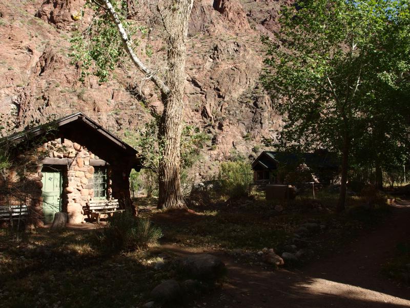
Small buildings of Phantom Ranch
It was a confusing walk through the camp area. We stayed on the main trail east of the creek, passing by multiple footbridges to the western campsites, and found many quaint little buildings made of rocks and logs. Few of them had signs, just trails leading to and fro. We knew that one of them was a little store that offered snacks and meals (pre-ordered meals only, I think) but finding that one was tough. Finally a prominent building showed up with an 'open' schedule posted on it. We headed in.
Two lemonades and a cold bagel later and we felt human again. Well, I did anyways. Chris was on a noticeable high after making it to so far. I was more reserved, thinking only of the long hike ahead of us. Bright Angel Trail up the South Rim was a good ten miles climb waiting for us, and the temperatures were only going to rise.
We rested for thirty minutes at Phantom Ranch, chatting with a few employees and letting our legs regroup. It was with some anxiety that we finally gathered our stuff and started back down the trail. On our way we passed a familiar group from the shuttle bus this morning. Two of the three hikers looked beyond exhausted. We wished them well and pushed forward. At least they made it this far. Worst case they could either spend the night here or get some help at the ranch.
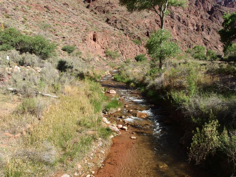
Busy little creek flowing down from North Rim
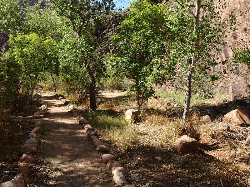
Easy path along the river
When we reached the junction we turned right down Bright Angel Trail. Technically we had been on North Kaibab after crossing the bridge… I think. Anyways, now it was time to complete our triangular loop. It was a long climb, though it would have several water stations and was a much more popular route.
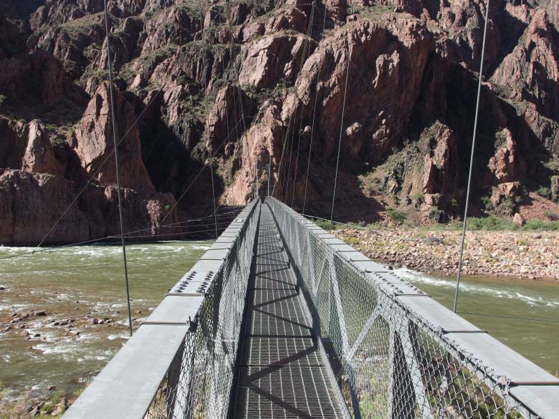
More modern bridge crossing to Bright Angel Trail
Crossing the Colorado on the bright and shiny metal bridge was weird after the more 'authentic' Kaibab crossing. There were a few boaters near here in the shallows looking up at us as we quickly trotted across. Along the way we had learned that there were agencies that would either drop you off or pick you up from down here. Between boating in/out and riding horses up/down there seemed to be a lot of different ways to visit this area. Boating in and climbing back out seemed like a good way to cut a lot of hiking out of a day.
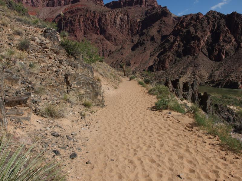
Horrible sand clogging up the trail
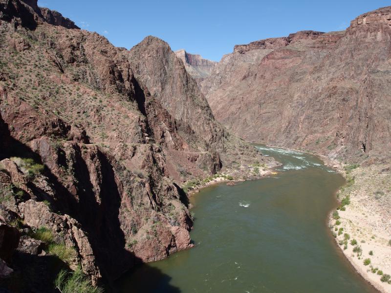
The wide, green waters of the Colorado River
Once on the south shore again we were faced with two horrible facts. First, sand sucks. For long sections between the bridge and Pipe Creek, where the trail turns south and begins the climb back out, loose sand makes up the trail. Second, we were much more tired than we thought. Our legs felt like jelly as we struggled through the sand and up the few small rises along the trail. This wasn't looking so good.
We walked up and down and wound around the hills. The view down on the Colorado was interesting, and the way our trail was hewn into the solid rock of the inner canyon wall was cool, but this leg of the hike was a real grunt. This was our first real taste of uphill today and it didn't feel good. The rises weren't even a hundred feet tall. As we neared Pipe Creek I began to wonder just how long of an ordeal this climb to the rim would be.
Pipe Creek
9:50 AM, 2440'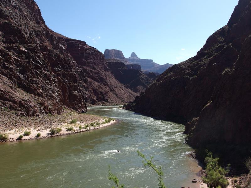
Looking up the Colorado
The trail dipped at the mouth of Pipe Creek before swooping around into the creek's deep gorge. The creek itself was small and pretty as it dropped from one pool to the next over hard basalt. On the far bank was a shaded enclosure tight up against the rock wall. We didn't stop to check it out, though. Our path had firmed up from the soft sand of earlier and we wanted to get some distance behind us.
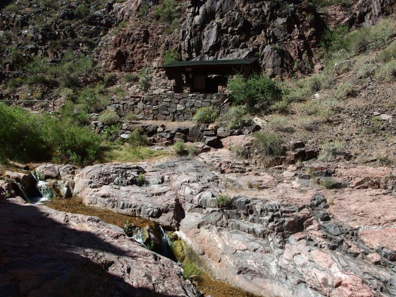
Pipe Creek resthouse
It took a good ten minutes of weaving around within the deep gorge before a good view of the rim showed up. It was our first good view back up from this trail and it was fairly humbling. But it didn't look impossible. We were heading south again, and the path felt steady underfoot, and it wasn't even noon yet. A little bit of optimism began to shine through.
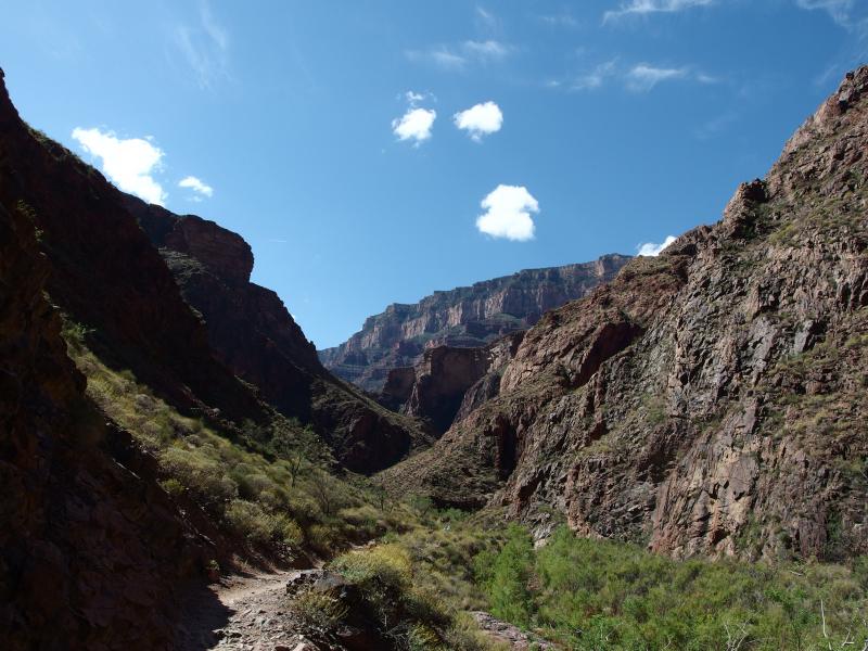
Towering South Rim in the distance
One thing I noticed with some interest was the closer wall. Relatively close to the gorge that we were in was a sharp wall of rock that looked like an inner rim. It was. The Bright Angle shale from earlier, that flat plateau within the Grand Canyon, was right there, and Indian Garden was right up there. All we had to do was climb that first wall and we'd be at a major milestone for the climb up.
Pipe Creek wound around and sometimes disappeared under thick layers of vegetation before running over exposed basalt again. It was kinda fun playing peek-a-boo with the little creek. Then it dried up to nothing with little warning. We must have missed some running tributaries or something. A short time after the water left us the trail suddenly picked up. We were no longer following the little creek. It was time to start climbing up switchbacks.
I let my legs stretch out and made good time on the uphill. Chris struggled a bit. I decided to go ahead to take some pictures and let him go at his own pace, though I kept a close eye on him. There wasn't a lot of traffic this far down in the canyon - we had only seen one other group since crossing Bright Angel Bridge - and I didn't want to leave him that far behind.
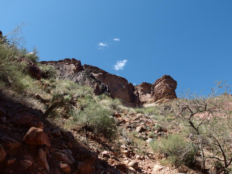
Sharp plateau edge right above
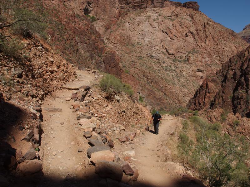
Dusty switchbacks
Along this section of the hike we bumped into a sturdy young backpacker. Turns out that she was going to be a ranger for the Canyon and, as part of her orientation, was hiking a rim to rim over several days (that is an awesome orientation). After a few minutes of chatting she made a suggestion to us. If you keep your legs underneath you and avoid taking too big of steps than you'll last longer on the uphill. Put all the climb on your legs when they're behind you. Smaller steps, but overall easier. We both used her advice for a while but I grew tired of the pace and continued on my loping gait.
We played leapfrog with this hiker for awhile and Chris put in his earbuds to help pass the time. When I reached a particularly good swoop I paused to take some pictures. The bottom half of Pipe Creek stretched out below and the formations of North Rim towered in the distance. Plus, I could see the annoying switchbacks and steep grade we had just came from.
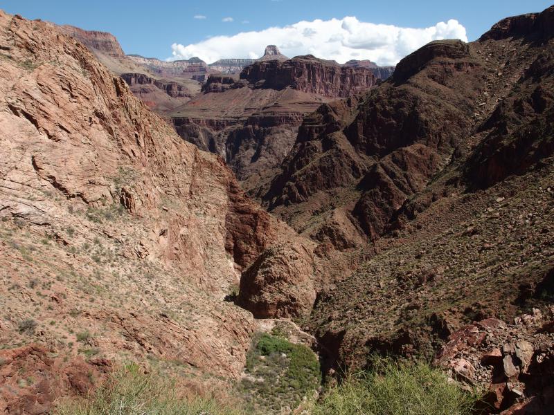
Back across the canyon
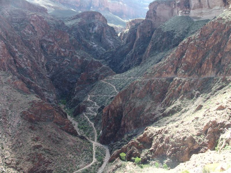
Steep climb from Pipe Creek
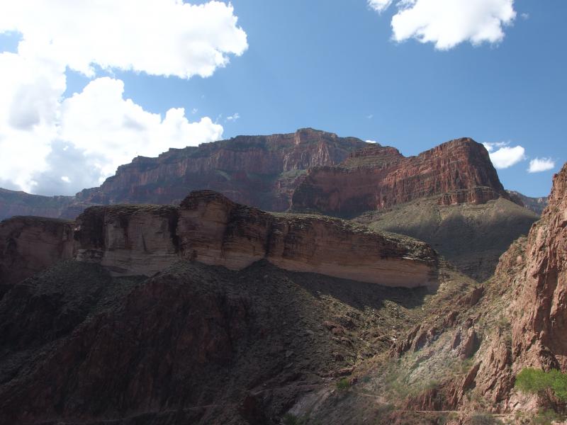
South Rim above the plateau
The top of the inner canyon was so close now, even if our path had backed away from the edge in order to smooth the elevation a bit. A new formation showed up to the side, a large red rise to the right, that I believe is called The Battleship. I stopped and drank in the view, then ducked over to check out the waterfall on a busy little creek, and let Chris catch up before we continued on.
So Bright Angel Creek must be what was feeding Pipe Creek earlier. It flows down from the west and meets up with Pipe downstream, back where we had came from. We'd be following it for a good long time. It's the main creek through Indian Gardens and it goes almost all the way to the rim itself. Our trail follows its little cut right to the top. Above the waterfall it was surrounded by lush green, turning our dry hike through dusty basalt into a cool, shaded stroll.
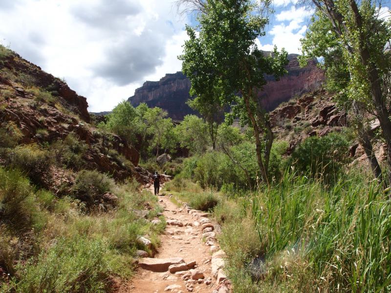
Lush section of trail
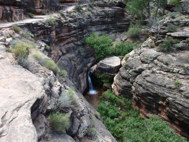
Little waterfall next to the trail
This is when I finally pulled out my water. We had climbed up Pipe Creek and were basically level with Indian Garden, give or take 500', and the lemonade from Phantom Ranch had completely worn off. Chris continued uphill while I re-adjusted my pack and took a few deep drags from the Camelbak. It was warm from my back but very refreshing. After the drink I took my time catching up, taking a few photos of the creek below, and chatting with some backpackers as I passed them by.
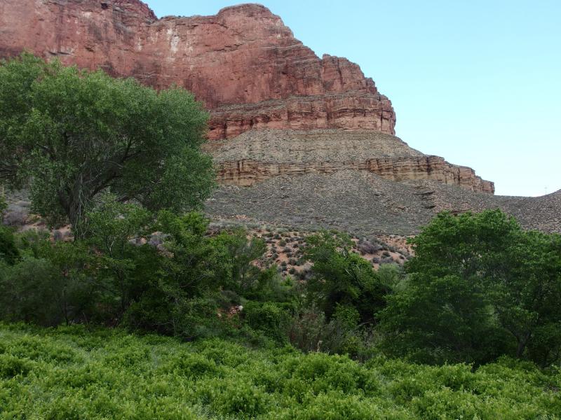
Getting close to Indian Garden
Even with my longer stride it took a while to catch up with Chris. Now that the switchbacks were done he was making very quick time on the trail as he listened to his earbuds. Our surroundings continued to green up on the plateau, with some thick brush and green trees that looked more suited to the Midwest than this desert, and then we were in Indian Garden.
Indian Garden Campground
11:30 AM, 3830'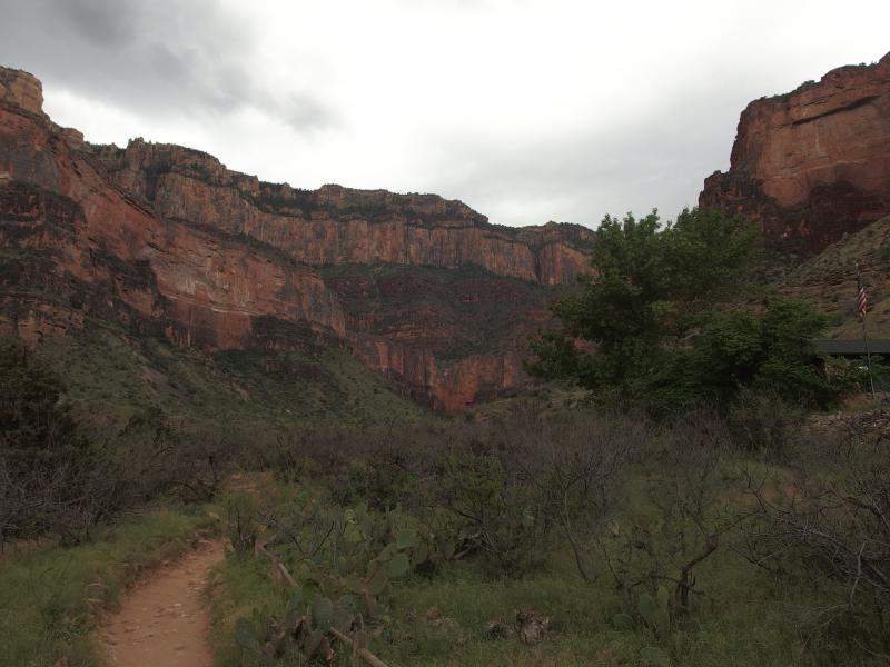
Looking south from Indian Garden
As we walked through the campground we kept our eyes peeled for two things. Chris needed to fill up his water and we needed to rest on a bench or rock or something. We found the spigot first and I ventured further up and found a small building next to the trail. There was already a couple in there, two French tourists with their gear sprawled across the table, so I sat on a window frame and flagged Chris down when he was done.
We sat for the better part of twenty minutes in that little building. The tourists were pretty interesting, having come to the United States for several weeks and wandering around visiting different scenic sites. It was like the exact opposite of the quintessential European backpacking summer… Well, except they were using a car to get around because the US is too darn big. Chris and I munched on some horrendous beef jerky (I wanted to try a new brand) and drank Gatorade.
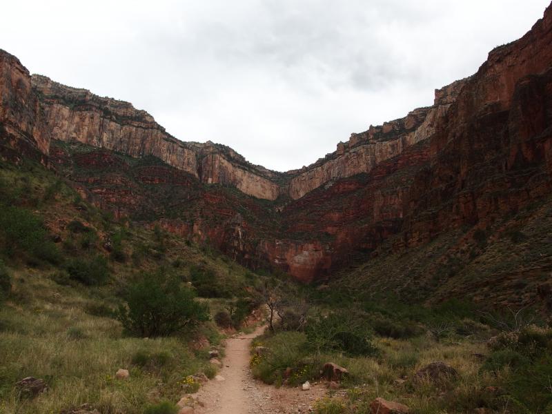
A long, deep gorge up
Eventually we had to continue. We wished the tourists good luck and started on the trail. For a good long time the trail was mostly flat with just a hint of grade as we continued along Bright Angel Creek. There was lots of green growth to our right, down by the creek, and more typical scrubby desert dirt to the left. And then the wind started.
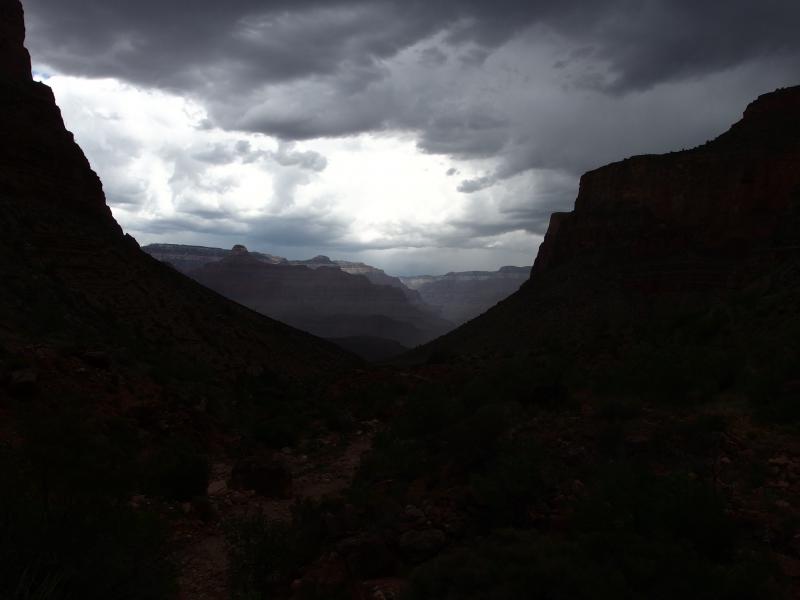
Dark colors from the coming storm
Since reaching Indian Garden I noticed a significant darkening of the sky. Hoping that it was a temporary state I had ignored it. After we left the campground the sky worsened and a stiff breeze began to pick up. Dust and grit whipped up from the trail and stung our exposed skin. I brought up a quick and tense discussion with Chris about sheltering from any possible storm. There was nothing out here, just rocks and dirt, so there was no reason to stop if things got bad. Doubling back was not an appealing option either. So we would just have to keep going up. He agreed and we pushed forward.
A few minutes later and the sky opened up with cold hard pellets. I'm not sure if there was sleet mixed in with the rain or not, nor did it really matter. The stuff just hurt. The grade picked up, the ground got muddy, and the watery projectiles came down. Thankful for my wide-brimmed hat I ducked my head lower and pushed on quickly.
There were a few slow backpackers covered in ponchos that I passed on the way and some other day hikers. I'm not sure if the hikers had only done from Indian Garden and back or if they had come from the Colorado River like we had. Either way I cruised past them. Now that the heat was gone I had a strong burst of energy that I took full advantage of.
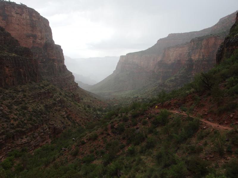
Hazy, watery skies
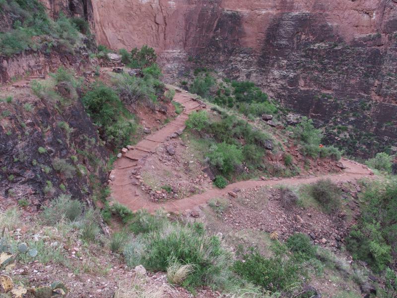
Down on the winding trail
A quick flurry of switchbacks and I was at Three Mile. It was a surprise to see it so soon. Chris was some distance back. I had stopped a few times on the far end of a switchback to make sure that he was still trucking along, but with the hard storm and my wind I just needed to stretch my legs. Now out of breath and on shaky legs I wandered up to the stop and looked for a place to rest.
Three Mile
12:10PM, 4700'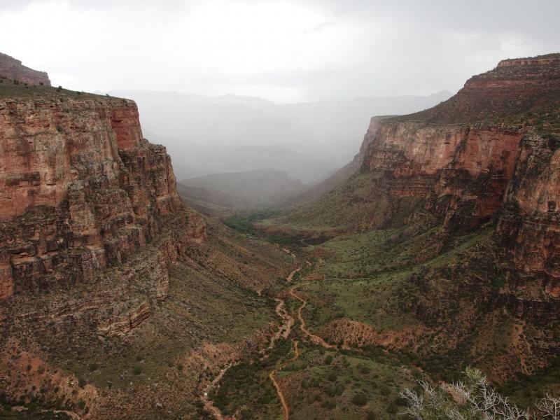
Misty rain deeper in the canyon
Thanks to the storm and the still-spitting storm the shelter was beyond stuffed. Hikers filled every corner of the small building, with ponchoed people milling around under the eaves and next to the half-walls. I wasn't too concerned. The cold felt good, and the downpour was slackening to a mere drizzle. I decided not to fight the crowd and instead headed over to an overlook down on Indian Garden.
Once I spotted Chris coming up the trail and meandered back to the shelter and found a place to hang out. The sky was beginning to clear and people were starting to filter out on their respective ways. I was just getting into a few conversations when Chris showed up in rough shape. He was starting to cramp after the last climb and wasn't too happy about it.
We rested for an additional twenty minutes before he was ready to continue on. A short distance up the trail and we split ways again, me heading up alone and him stopping to stretch out and handle his cramps. I wasn't worried, not with the amount of traffic that we were running into on the trail. We would both make it to the rim, just at different rates, and I kinda wanted to push myself.
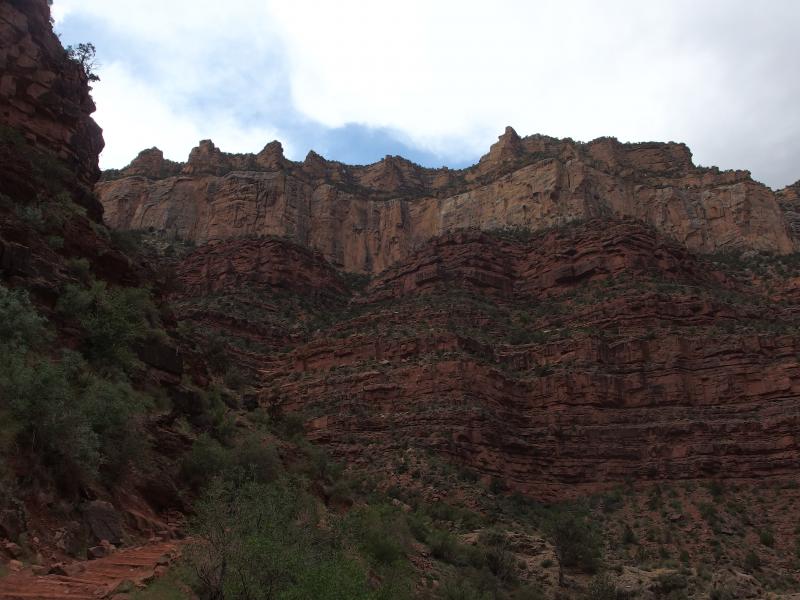
Tall stacks of rocks around the trail
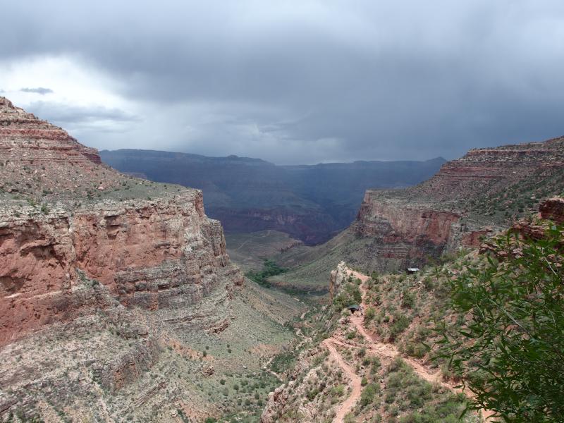
Slowly clearing skies
There was a long swoop and a quick flurry of switchbacks before I paused and looked out over the canyon. We were deep within the gorge of Bright Angel now, a long distance from Indian Garden and its plateau, and the skies were clearing above. The north rim looked pretty dark yet. The temperatures were heating back up now and I was starting to drink regularly from my pack. There was less than three miles left to hike. I wasn't worried about running out of water.
While the green vegetation was still pretty thick and hid many of the switchbacks above the trail under my feet was very red and drying quickly. Soon dust would be a factor again. At least there was no mule trains or horses on this route, at least none that I had seen so far. There were plenty of people, day hikers that had come down for a quick few miles and were now stuck with the uphill trek.
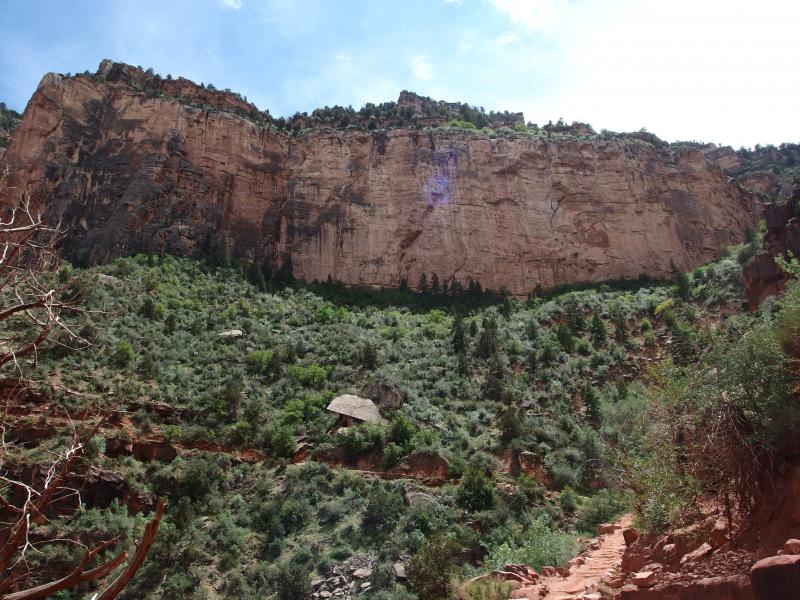
Getting closer to the rim
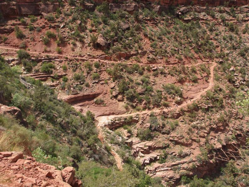
A long switchback with tiny people
A second quick flurry of switchbacks came and went. I didn't stop that often, just enough to take a few deep drinks every once in a while, and also to take in the scenery. It was very pretty down here, and the workout felt good as well. The trail was easy enough to not worry about watching your steps unlike many of the Superstition adventures I had been on this year. The easy grade and steps made it painless to glance around at the surrounding vegetation and canyon below.
Mile-and-a-Half
1:30 PM, 5700'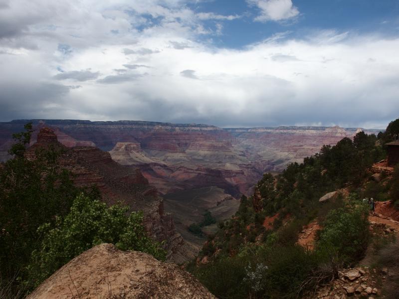
Sun over North Rim
The last rest stop on the trail snuck up with little warning. The bathrooms are tucked off to the left of the trail, up a little hill, and the water spigot and shelter sit just up the path. Chris was a good long distance behind me by now. I filled my water up to the brim and enjoyed the cool water. If he wasn't here then he couldn't make fun of me for drinking more than two liters on this hike.
With a full Camelbak I snuck up the path to the shelter and lazily sprawled out on a window frame. There was a lot of little goodies left in my bag. The nasty jerky, a Clif bar, and mooching off of Chris had kept me from getting too hungry so far. I had a relative feast left in my pack to eat through.
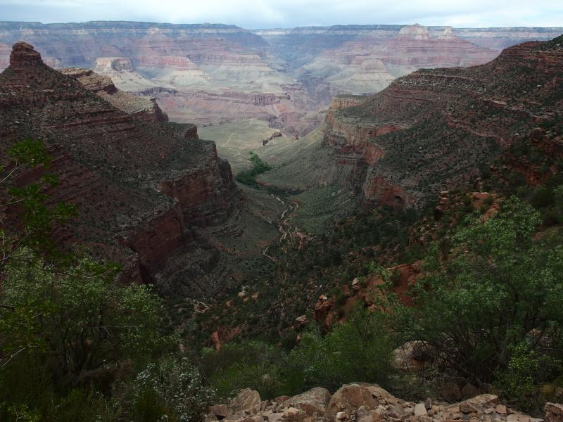
Down on the deep Bright Angel gorge
Twenty minutes of drinking water, eating trail mix and bars, and resting my legs in the shade and I saw Chris coming up the trail. He seemed to be doing much better than before, any cramping issues dissipated with the proximity to the rim. We chatted and rested in the shelter, which we had completely to ourselves. It is located behind some brush and there's at least ten stairs up to it, making it too far for other hikers to venture up when the trail has large flat rocks right there.
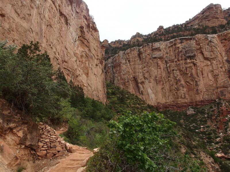
Narrow chute between steep walls
With stiffly rested legs we eventually tumbled up and back onto the trail. There was not much left to do. We were right below the rim, only a few more layers of rocks left. Chris gave me a little nod and I took off with my gangly legs. I wanted to make it to the top before 3, which would give me a time of around nine hours to hike the Grand Canyon.
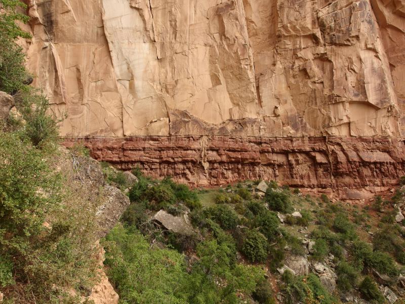
Sharp change in rock along the trail
The rest of the climb was very busy. I passed some people on the way up, other people passed me, and many more were still heading down. It was downright congested compared to the solitude of South Kaibab or the inner canyon. The sun, which had come back out after Three Mile and was downright hot at Mile-and-a-Half, began to slide back behind the clouds as the afternoon ticked on.
One of the reasons we were in a rush to get to the top was because Game of Thrones was on that night. I had told Chris this in half-jest, as Katie could always DVR it for us to catch later. Still, it was a nice thought. If we could both make it to the top of the rim by 4PM and there was no traffic then I'd make it home about an hour after sunset and just in time for the show. Better that than arriving in Phoenix after midnight.
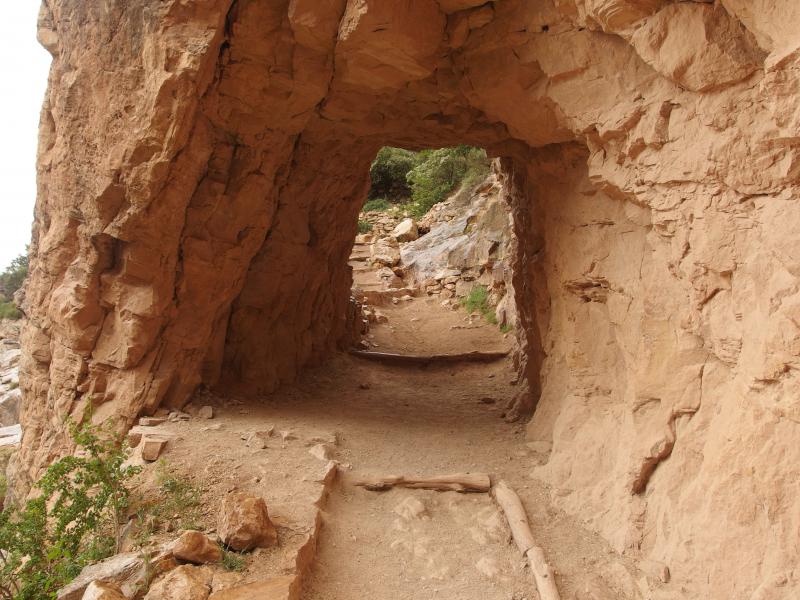
Little tunnel
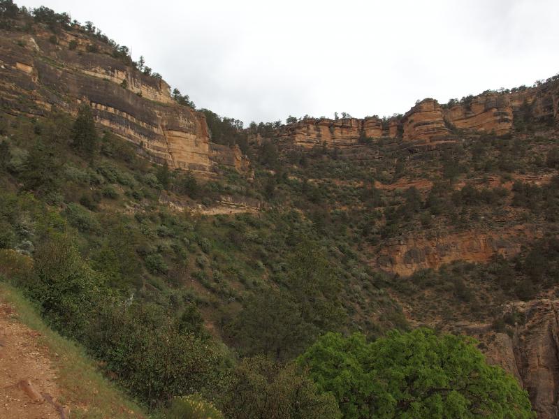
The home stretch
There was one intense series of switchbacks where the gorge walls narrowed, a series that quickly climbed up the rubble that spilled down in a flume-like shape, and then a few long swoops. A small drizzle started back up and the wind began to chill the air. Up here, way up at the top of the rim, the temperatures were probably going to be much cooler than today's hike. At least I had a sweater stuffed in my tiny pack.
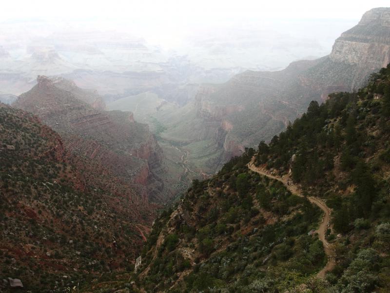
Haze back over the canyon
A few last bends and I was at the top. I checked the time - it was right before 3. Perfect. I crested the rim and looked around, feeling elated and exhausted. The only thing that greeted me was a sharp wind and icy drizzle.
Bright Angel Trailhead
3:00 PM, 6840'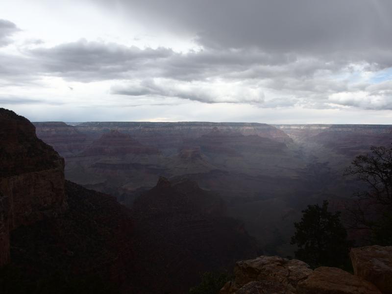
Dark clouds and drizzle over the canyon
I figured I had at least a half hour to kill before Chris made it over the rim so I wandered around for a while. There was no concession stand or store at the rim, something I was a bit surprised about, so I wandered over to Bright Angel Lodge a few hundred yards to the east to check it out (I know, a few hundred yards? Geesh). Part of me wanted to find a pair of beers for Chris and I to celebrate with, though on our dehydrated state this would make for a tough drive through Flagstaff.
There was no beer to be found so I settled for two king-sized Snicker bars. The gift shop was packed, making me overly sensitive to my all-day-hike stench. I paid for the bars and quickly headed back to the trailhead. There was actually two points where the trail comes up, one the official trailhead and the other a tempting side path that goes to a few buildings via a softer grade, so I decided to head back down a short distance and wait for Chris there.
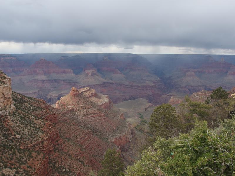
One last view of the Grand Canyon from the rim
Sure enough, about forty minutes later he came into view, all smiles and loud shouts on completing the hike. This was more like it. We headed up to the car, snacking on our candy and wishing they were cool beers, and started on the long drive back to Phoenix. We had done the Grand Canyon… well, sort of. The true rim-to-rim, from South to North (and maybe back again), would have to wait for another day.


-
Jacob Emerick
Jun 2, '15
1 liter, no lemonade. :snake_eyes:
-
Chris
Jul 31, '15
You'll probably just lie about your consumption again..:double_snake_eyes: #bonusroll
-
Jacob Emerick
Aug 1, '15
Challenge accepted. :infinite_snake_eyes:(but not really, i'm going to be drinking straight out of the spigots)
Add to this discussion-
Jacob P Emerick
Nov 1, '16
Hiya Dan, the trail was very straightforward. Well-defined, the few forks clearly labeled, and there was enough traffic along it to ask for help if needed. Having a clear idea of where you're going (in this case, South Kaibab -> along the river -> turn to Phantom Ranch -> back to river -> Bright Angel up) is all you need, no maps or GPS. My only gripe would be the dust - so many people and animals walk it that the rock is getting pounded away :)
-
Dan
Nov 2, '16
Great info thanks. So did you park your car at Bright angel parking lot and then took the shuttle to South Kaibab trailhead? Im assuming this hike can be done in one day.
-
Jacob P Emerick
Nov 3, '16
Yup, parked at Bright Angel and took the first shuttle to South Kaibab. I wanted us to hike the distance to get an earlier start but this turned out just fine. And yes, it can be done in a day, but it's a rough one. We made awesome time on the descent and really dragged on the climb back out. Doing the climb on tired legs (downhill can be a workout) in the afternoon heat was rough. Between 10-12 hours would be expected.
Add to this discussion-
Jacob Emerick
Nov 27, '16
Awesomely done, sir! Glad to hear that you nailed it.
Add to this discussion