Dead River
Falling over eleven hundred feet from the Peshekee Highlands, the Dead River empties into Lake Superior near Marquette. Thanks to this large elevation change and route through the southern reaches of the Huron Mountains, there are many waterfalls and dams along the Dead River. The water takes after the rivers name, having an odd color and poor fishing thanks to the huge basins and dewatered stretches. Also, the Dead River was the scene of a major disaster in 2003 which gave the Upper Peninsula national attention and millions of dollars of damage.
Dead River's route to Marquette
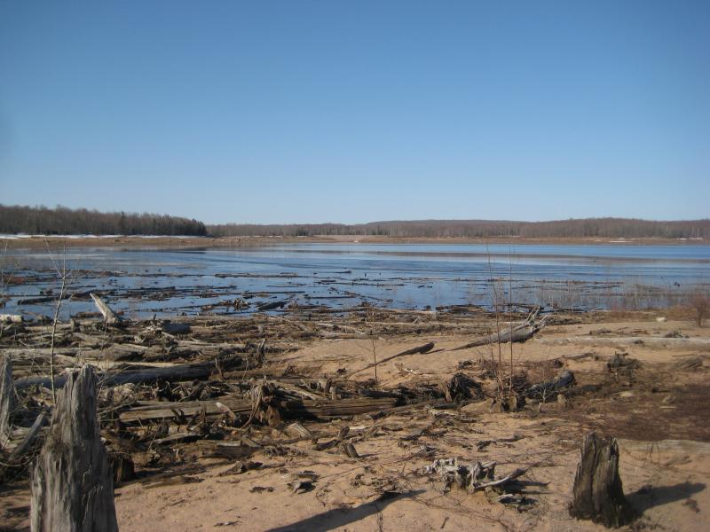
Starting in a circular Dead River Headwater lake, the river starts out a meager creek winding through the swamps and rocky hills south of the expansive Mulligan Swamp. The first dam is located on the Silver Lake Basin, about a dozen miles from its headwaters. This dam only controls the annual melt with no power generation, but is currently half empty (there are plans to refill it by the end of 2009). Several creeks join the Dead River in this basin, but the river doesn't gain significant strength for several more miles.

Empty Silver Lake Basin
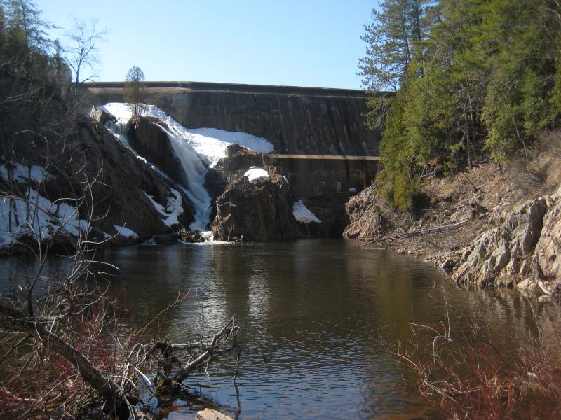
After being joined by Mulligan Creek, the Dead River enters the Dead River Storage Basin. This is a huge lake stretching over ten miles from end to end with the large, impressive Hoist Dam holding back the water. Many creeks flow into this basin and a power generator is located at the bottom of the dam. After exiting this basin, the Dead River is significantly larger, but only flows a slow mile before entering the McClure Storage Basin, a smaller and narrow basin. Much of the water is normally diverted here into a penstock to a power station further downstream (damages have shut down the penstock for 2009, so the river currently flows over the dam and along the normal route).

Overflowing waters at McClure Dam
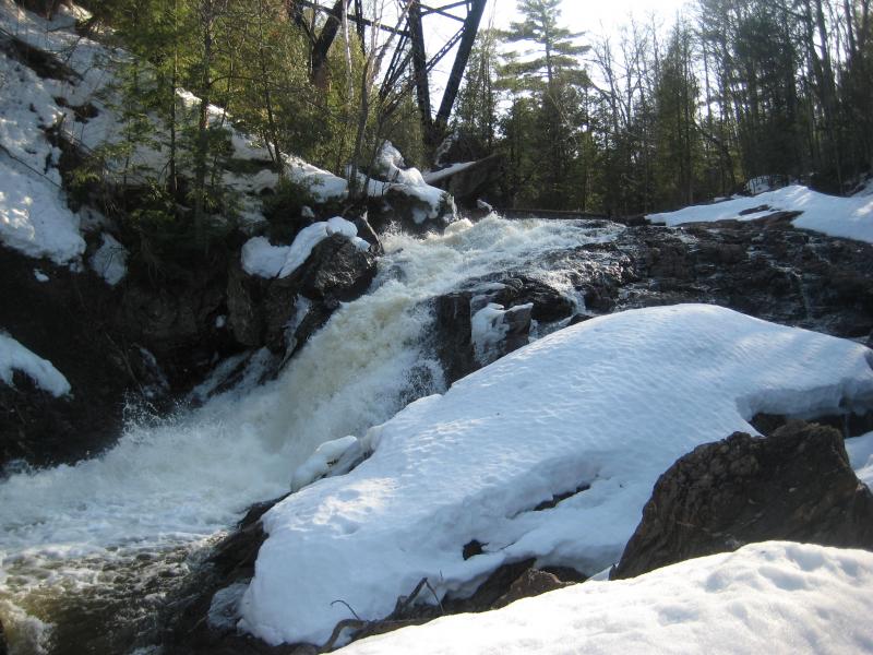
The first waterfalls along the Dead River occur downstream of the McClure Dam. A series of unnamed drops, the tallest around thirty feet tall, are located deep within the river's gorge. Near the LS&SI railroad trestle over the gorge, half a mile from the dam, is another thirty to forty foot drop called Trestle Falls. There are rumors of much taller waterfalls buried under the McClure and Dead River Storage Basins, but if they exist, they would be very difficult to view.

Trestle Falls
The next series of waterfalls occur several miles downstream of Trestle Falls. Collectively called the Dead River Falls, a series of seven impressive waterfalls with well-trod trails led away from an old Forestville power station parking lot. After these drops, the Dead River enters the Three Lakes basin, held up by the Forestville Dam near Wright Road outside of Marquette. An impressive waterfall is located at the spillage for this dam, though it is difficult to view without climbing under an old penstock.

Forestville Dam
The penstocks for McClure and Forestville Dams meet downstream at a power station below a few waterfalls along Wright Street. The water is added back to the river before the Tourist Park near Lake Superior, where an old dam and basin used to exist. The Dead River then flows into Lake Superior just north of downtown Marquette near a large power plant.
Over its route, the Dead River is forced to sit in several large storage basins with much of its water diverted into penstocks for power. Because of the green algae from the basins combining with the orange tint of the headwater's swampy reaches, the water has an ugly grey/brown color and sickly smell. Swimming in the river would take a strong stomach and walking along the shore for several hours may become unpleasant. However, the waterfalls, deep gorges, and powerful dams are impressive sites to visit.
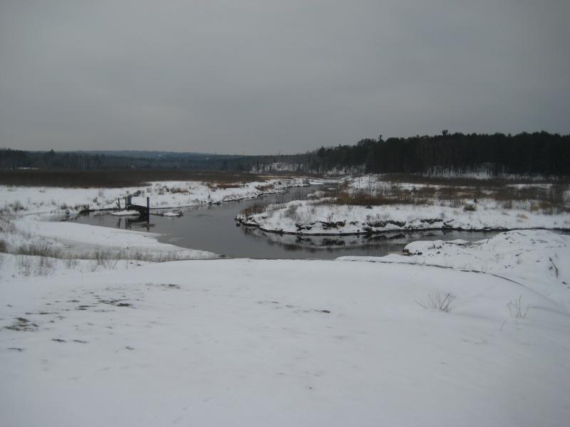
In the spring of 2003, an earthen plug in the Silver Lake Basin gave after several days of rain, emptying a good portion of the water downstream. The resulting floodwaters damaged homes along the river, washed away bridges, and tore away the lowermost Tourist Park dam and basin. No one was injured during the flood, but the riverbed and area is still scarred from the massive flow.

Drained Tourist Park Basin
The Dead River is fairly accessible, but no road runs along its entire length. Wright Road in Marquette provides access to the river's lower and middle falls as well as Forestville Dam. Neejee Road off of County Road 510 takes you to McClure Dam Road, which ends near the McClure Dam and upper waterfalls. Access to the Hoist Dam is located on Hoist Road also on County Road 510. Silver Lake Basin is located near Mulligan Plains, and there are signs past the Dead River Storage Basin leading to the boat launch. The headwaters on the Peshekee Highlands can be found north of Wildcat Canyon Road.


-
Jacob Emerick
Dec 2, '09
Glad this came in handy! Sounds like a heck of a hike, too - I usually cut off some time by following the penstock to or from the trestle. It'd be nice to be able to cross the river to see the falls under the dam better, but the southern cliffs look a bit daunting, especially by Trestle Falls. This area of the Dead River is nothing short of amazing, especially since it's more remote and unknown then the lower drops.
Add to this discussion