A Keweenaw Hike
On several waterfall hikes in the Keweenaw during the summer of 2008 attempting to find Copper Falls, I became confused by different directions and descriptions of the drops along the creek. Owl Creek starts from a swampy lake on the top of Brockway ridge, heading downhill to the north past an old mine shaft (now covered) and mill before meandering through a swamp on the edge of Lake Superior. With a drop of six hundred feet, there are many unnamed drops along this creek, and it is difficult to differentiate the real waterfall.
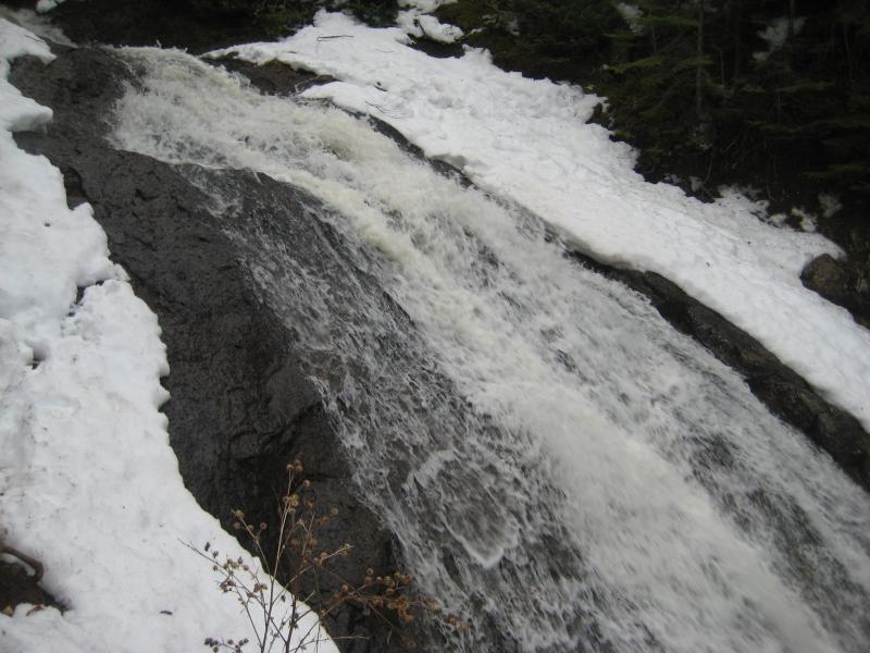
Jacob's Falls
In hopes to find this creek with actual water flowing down it, as it is usually close to bone dry during the summer, I headed north to the Keweenaw in the spring after a few very warm days. Also, I decided to add a few miles onto the trip by making Jacob's Creek to my route. Logan and I parked at Jacob's Falls, near the Jam Pot along M-26, and headed up a nice trail on the east side of the creek. The trail was very defined and used for the first half mile, where the lower set of waterfalls are, but as we gained elevation along the steadily increasing gorge it started to dissipate. The creek below us was fairly calm with only minor rapids and thick underbrush until we hit a surprising sight - a straight drop several dozen feet in height, much taller than any other waterfall along the creek.
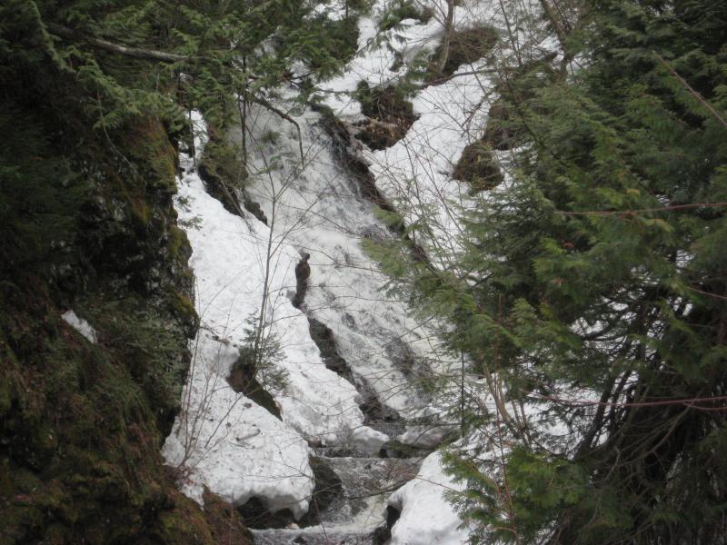
Upper drop on Jacob's Creek
The thick underbrush and narrowed gorge made climbing down tough, but both Logan and I made it down to the creek's side to see the drop. It was very impressive, and further drops could be seen above the tall falls. The swollen creek made it difficult to get too close to the waterfall without getting soaked, so we made our way back to the top of the gorge and continued on past the waterfall, pushing our way through the woods now that our trail had completely disappeared.
There were several more interesting sights along Jacob's Creek, including a campsite with stacks of wood, poor rock piles from Arnold's Mine, and some waterfalls. When we finally reached Brockway Drive, I put Logan on a leash and we headed east towards Copper Falls. Though we had been climbing uphill for most of the trip, we still had elevation to gain along the seasonal Central Cutoff Road before we would meet up with Owl Creek. This was surprisingly tough, as the entire road was covered in wet snow. We were both quite tired when we reached the next spot on our hike - the old entrance to Copper Falls mine.
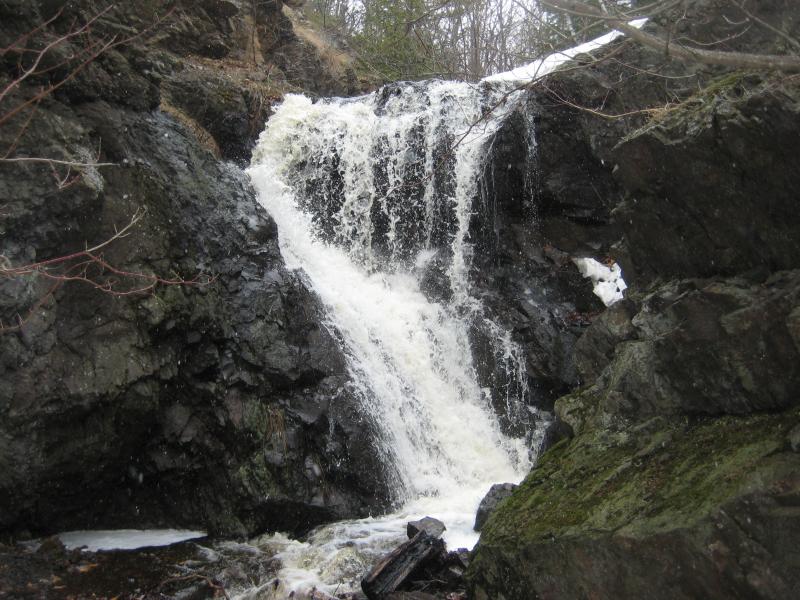
Copper Falls
An unnamed drop near the headwaters of Owl Creek, this waterfall is one of the few drops in the Keweenaw that is an actual plunge - that is, the water leaves the surface of the rock during its fall. Right below the drop is the old entrance to the mine, now covered in blasted rock that sucks up every drop of water from the creek. This waterfall, usually only a trickle, was very impressive with the snowmelt. Twenty feet from the waterfall the creek bed was once again dry, so Logan and I headed up the bank to follow a two-track to the next drops, near the Copper Falls Loop, which had gathered enough water from tributaries to look very impressive.
Heading down Brockway Ridge along Owl Creek was much more difficult then I had originally planned. The gorge was not as well defined as Jacob's Creek, so I was constantly climbing in and out of the creek instead of following its bank to continue downhill. The woods and underbrush were very thick even with the lack of summer growth. The waterfalls and rapids along the creek were pretty constant, scattered regularly along our route, but none of them were as impressive as the upper drop on Jacob's Creek. Our most welcomed sight along Owl Creek was its convergence with the stamp sands near Great Sand Bay, as the lack of woods and elevation change promised an easy hike.
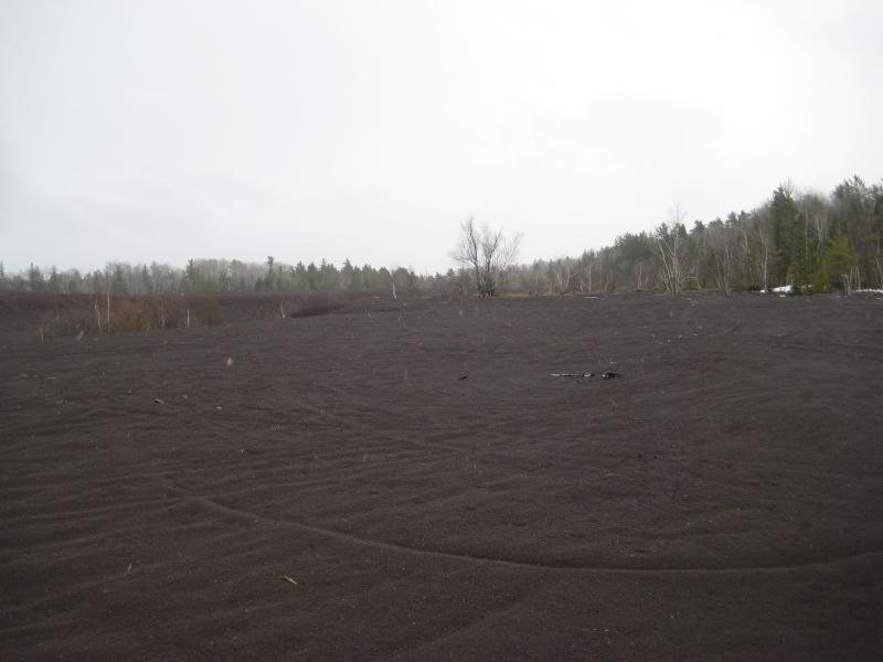
Stamp sands below Owl Creek
After a quick side stop to an impressive waterfall formed from an old adit of Copper Falls mine, where the water sucked up from the entrance at the top of Brockway empties out near the bottom, Logan and I attempted to follow the stamp sands back to our car, which was now about two miles to the west. Unfortunately, the sands run out after a short distance and are replaced by a menacing combination of swamps and ponds. We couldn't head over to M-26 or Great Sand Bay, as the weather had turned very cold and windy, so we went back to the side of Brockway in hopes of finding a route along the south side of the swamp. Unable to find any other way, we were soon forced back up the side of Brockway, climbing up and down along the hillside to avoid logged-out brush and gorges formed by small creeks. Between the constant up-and-down climbing and foot deep snow, this part of the hike was completely unexpected and undesirable until we hit a well-made logging road near Jacob's Creek that we followed back to our original path.
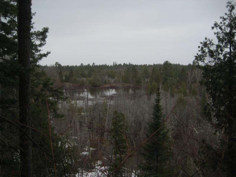
Brush-filled marshes below Brockway ridge
There was a lot of interesting sights on this hike, including numerous waterfalls, old mining remains, and a sea of stamp sand located at the base of the Brockway Ridge. If the weather permits, heading north to the Great Sand Bay and following it to the Jam Pot would make an excellent circular route and the only difficult portion of the hike is Owl Creek. However, I'd recommend avoiding following the side of Brockway back to Jacob's Creek or attempting to cross the marshes west of the stamp sand, both of which made my route very unpleasant.


-
Jacob Emerick
Nov 11, '10
It is a beautiful spot. I need to get back there during the late spring... Haven't been able to get to the base of it w/ the steep walls and difficult creekbed. Do you approach it from Jampot or Arnold's mine?
Add to this discussion