Migisy Bluff
Migisy Bluff sits south of Marquette Mountain, a curving ridge that stretches from County Road 553 east to Harvey. There are several spurs of exposed rock that poke south along the length, the most prominent one sitting on the far east and promising excellent vistas of Lake Superior. Near the eastern spur sits a tiny little pond, Buschell Lake, with no significant inlets or easy access. For a relatively unknown spot, Migisy Bluff has plenty of interesting features to lure me in, even if it was uncomfortably close to Marquette and civilization.
The bald spur of Migisy Bluff
Late morning warmth surrounded me as I stepped out of the car. It was late in the spring, the snow retreating up to the highlands and the buds still hesitating even with the convincing sun's heat shining down. The damp ground squished under my boots as I stood on the shoulder of 553, faced with a tough decision before traveling a single yard: to trespass or not?
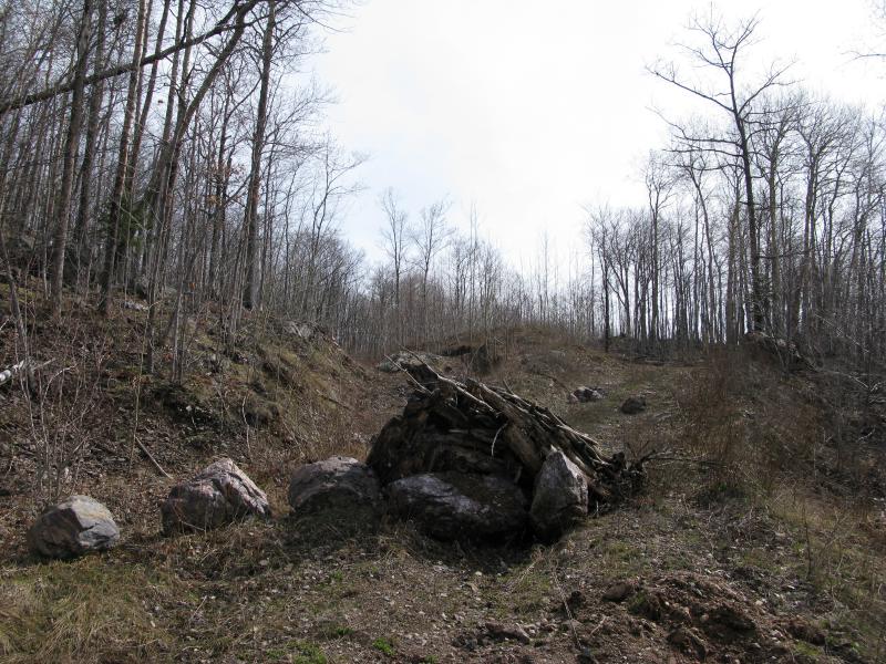
The hill rose to my left, the south flank of Marquette Mountain, and a wide sand pit sprawled out to the right. A road wound over to the pit, following the border with several access points down, a conveniently level route that was well maintained. The road was gated off with a severe No Trespassing sign posted nearby. An overgrown two-track climbed up the hill, a tough and prickly route that would only burn up energy before the real hike began, a mile to the east. Deciding to be a good little hiker (a decision partially motivated by the closeness of Marquette and well-traveled roads) I lowered my head and started up the overgrown track, climbing the hill to avoid the private property.
Blocked off logging road climbing the hillside
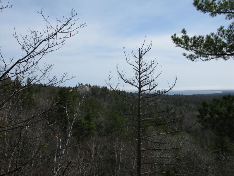
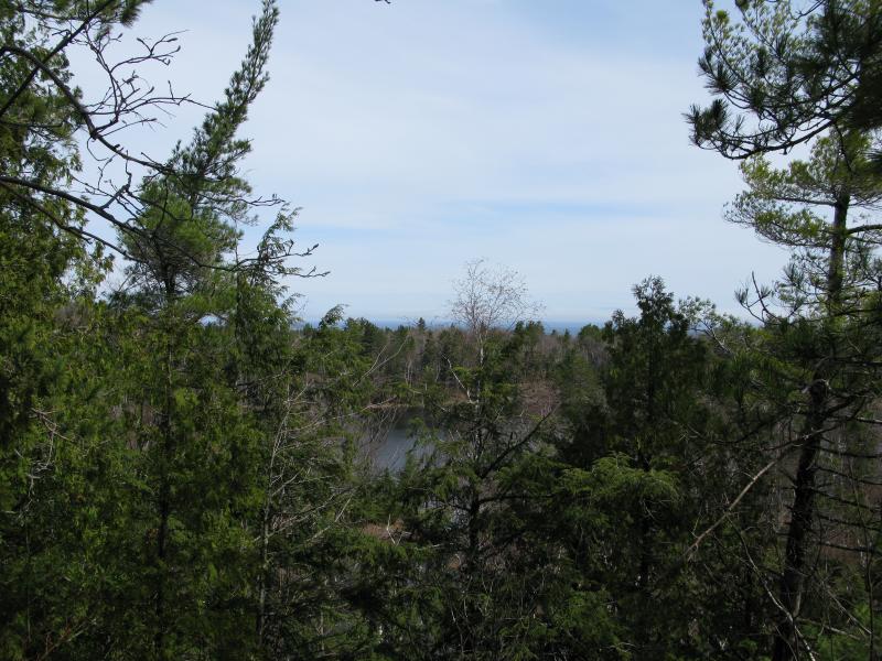
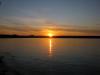
My route bucked along the hill, a stubborn mule of a climb up and around the pit below. Long abandoned, the track had saplings springing up between time-worn tire grooves and was slowly eroding away thanks to seasonal trickles. As I made my way around the puddles and more prickly brush I tried to make the most of my choice, looking around frequently to see what I could see when I came upon a break in the trees. 553 shot out in a straight line below, and pit lay out in the sun, and a corner of Lake Superior flickered in sight through the trees ahead. Maybe this route wasn't so bad after all - I wasn't expecting to see the ol' Gitchee Gumee for another hour at least.
County Road 553 through the trees
First glimpse of Lake Superior to the east
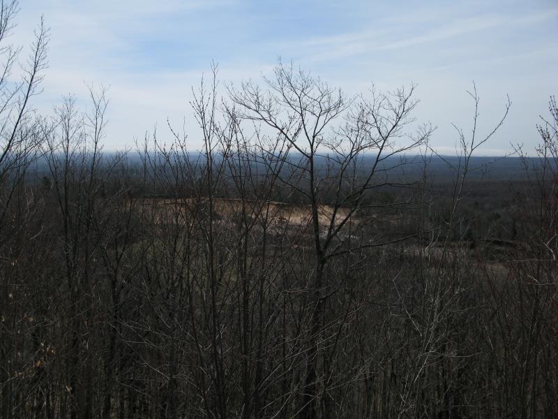
Sand pit through the trees
The hilly track eventually twisted and crashed back down towards the pit, way on the far east end, beyond what I hoped the owner of the property would be interested in. Still, I felt uneasy walking along so close to the pit, being able to see a few mounds along the edge through the empty woods, and took one of the first left turns that showed up. I wasn't completely sure which path this was, as there is a small maze of tracks here, but at least it was wooded and led away from the pit.
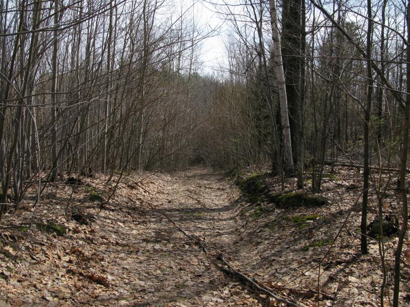
Quaint little track leading into the woods
This wooded trail faded away to slowly for me to notice at first. For awhile the path was straight and clear, almost nice enough to drive a car down. A few trees started to lean in and block the way, forcing me up or around to continue. Then it started to twist around sudden rock walls and clumps, young saplings replaced by large pines, and then the trail was gone. Surprised I checked my map and realized that I was not on the through-road I thought, that I had wandered off and was now very close to the first south spur of Migisy Bluff.
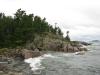
Grateful now I leaned forward into the hill in front of me, the hill that had stopped the trail. It was an easy climb, a bit scruffy and loose underfoot in places, but overall mild and short. The top was hard to navigate, a rounded nub that was difficult to get my bearings on. Trusting the sun I continued east and came right out on sudden bluff with a great view of Lake Superior. If I concentrated and used just a little imagination I could even hear the distant waves tumbling up on the sandy shoreline.
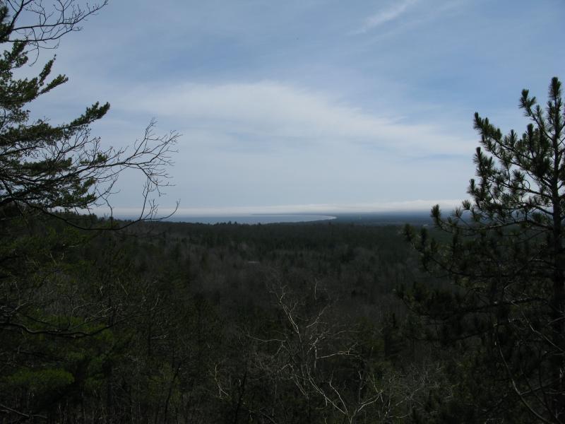
Sweeping view of Marqette Bay to the east
There was more to see further east so I looked for a way down. The east face was scary steep, more a sharp cliff than anything else, and I was forced to head back west to circle around. When I found a spot to head down, a tiny little crook that was protecting a long stretch of snow to cushion the way, I still had to lower myself feet at a time over the drops until I was stood in a narrow valley. A thin seasonal brook bubbled down the middle, one that was easily stepped across, and the next spur stood in front of me. The sheer rock resembled the prow of a giant ship rising from the woods than something I could actually scale.
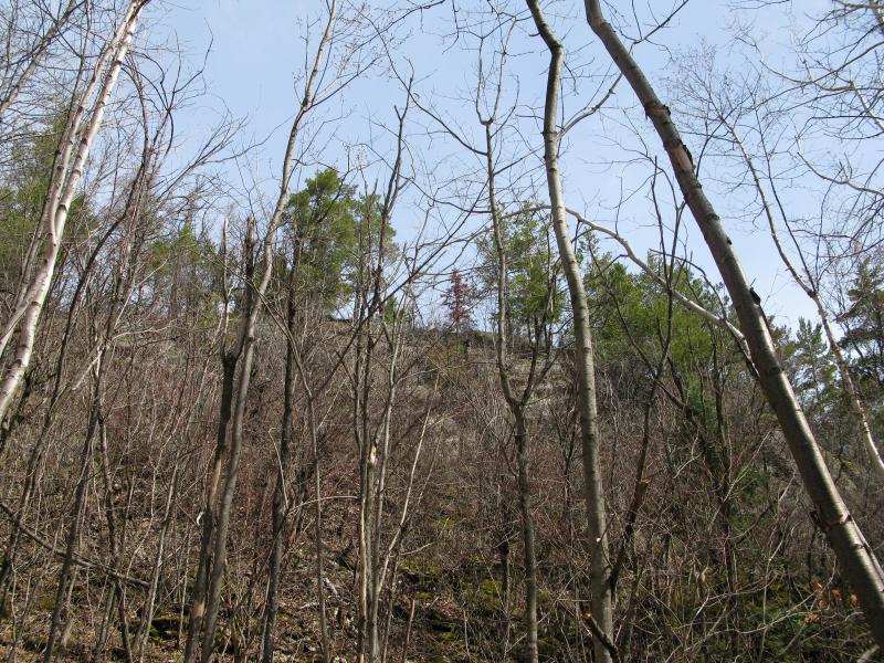
Looking up a challenging climb
Scale it I did, though, scrabbling up a jagged crack like a four-legged spider. There was multiple holds that alone would not support my weight, holds that gave slightly as I lunged further up, and I made sure to move quickly before any of them were given the chance to topple me back down. When I finally pushed over the ledge, or at least to a point where the rock was angled enough to lean on without grasping, I took a long and thankful break.
I was close now, close to Buschell Lake and the bald western peak of Migisy Bluff. Still, I wanted to look around and see where this last climb had brought me to. Finishing the climb I wandered a bit to the left, towards a break in the trees, and was greeted with my first view north. The lake lay below me and Lake Superior far beyond. Through a few branches I could almost make out the smoke stacks up by Presque Isle, way on the other side of Marquette. Hopefully the bald peak would offer a better view north.
North over Buschell Lake towards Marquette
Turning around I headed to the very point of this spur, the southeast thrust. The trees were thin here and I could make out plenty of rolling hills to the south, undulating curves of nameless hills. I don't know a lot of the highlands out there, just that they slowly rise up towards the Sands and KI Sawyer, Who knows, maybe there is a north-facing bluff out there that I'll stand on in a few years and look back north towards past-Jake. Shrugging off this thought I turned eastwards and was greeted by the best darn view of the bald spur I could have ever hoped for.
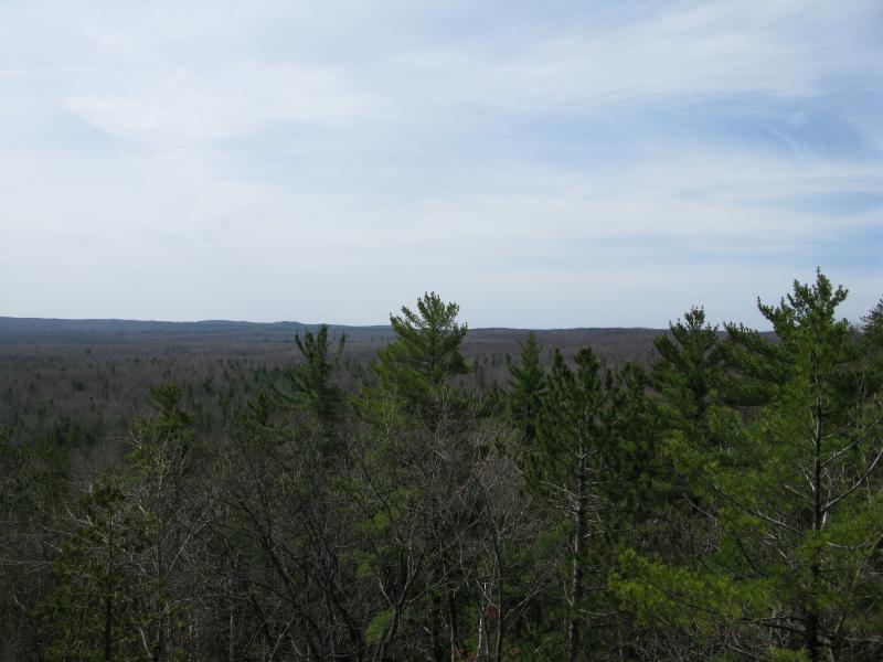
Trees and hills out to the south
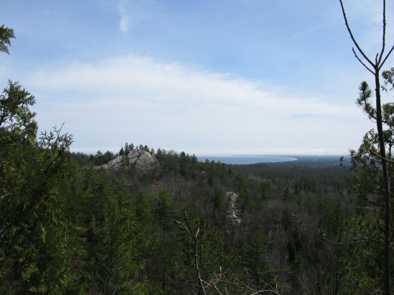
Great view of the bald spur and Superior
Excited to continue on I scrambled onwards. The climb down would not be easy. If I veered left, where the spur should have sloped down to an easy stroll, I would end up walking right over Buschell Lake. To the right was the edge of the rocky prow, a perilious cliff at least a hundred feet in height. I cut a tough line in between the two, clinging on trees and sliding over loose rock until I stood upon a bulge in the lake. The water still had ice on it.
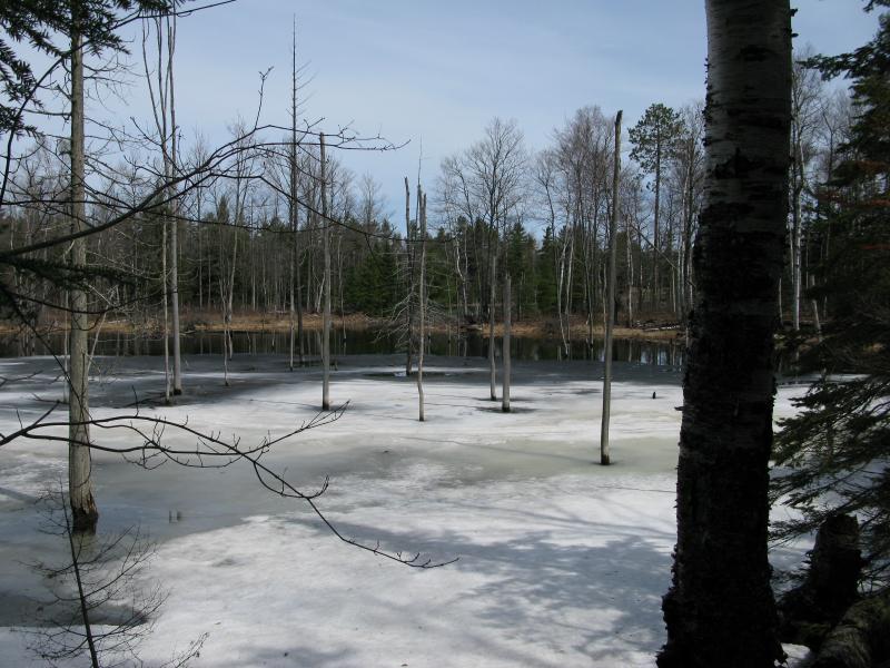
Icy slush over a part of Buschell Lake
The plan was to follow the edge of the lake, a route that had looked simple on the maps. It wasn't. The hills around the lake grew suddenly from the shoreline, towering cliffs that did not offer a path underneath and whose climb was not welcoming. It was time to cut back to the easy route. I turned and headed away from the lake, down a small valley, and towards a meandering two-track.
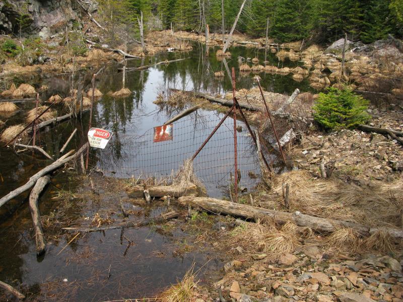
Along the way I noticed something odd, a horizontal line where there was only verticals, above me to the right. Twisting my head I recognized it, an old strand of barbed wire, the remains of a small fenced-off rectangle. I saw the sign next, a warning against wanderers like me. I had stumbled upon an exploratory shaft.
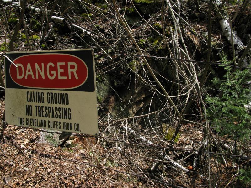
Warning about a shallow depression in the hillside
I cautiously circled it, looking for a gaping hole of black to be comfortably sitting on the other side of the fence. There was nothing but a little depression filled with leaves and branches. I thought about poking at it for a while, seeing if the brush was just a thin covering over a chasm to the underworld, and continued on instead. It was too nice of a day to risk a tumble down a dark shaft.
Making out the road from the other side of a thick tangle of brush I pushed through and out. This track connects back to roads by the sand pit, a place that seemed much farther away that it actually was, and runs right to the base of the bald peak. My hike to this point had been little more than a 'scenic shortcut'. I followed the track up for a ways until I came out to a fork in the road. To the left was the lake, to the right the peak. I headed left. While I had already seen a shallow bulge of water, a recent addition to the lake probably caused by ambitious beavers or some sort of natural dam, I was curious to see what the proper body of water looked like. After a short walk uphill I came upon a wide view out over the woodland lake.
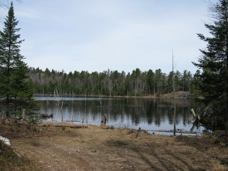
Looking over the shallow main body of Buschell Lak
With all of my pre-destinations out of the way I headed back towards the peak, more than ready to stand atop the bald spur of Migisy Bluff. After the views from the last two points I had some fairly high expectations, specifically hoping for a northern view up along Marquette Bay and the ore docks. As I neared the peak my heart began to sink, though. The entire thing was fenced off, 'Keep Out' signs every couple of feet.
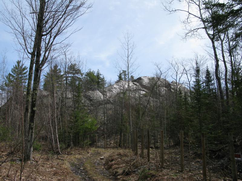
The bald spur of Migisy Bluff surrounded by fence
Hoping against hope I continued down the track, looking for a 'Just Kidding' or obvious way up the bare rocks that would not be trespassing. There was none. I wasn't about to jump over the fence, not when the landowner had taken this much care to mark his property, and didn't have a lot of other options. Frustrated I turned north and headed up a forested rise to look for a different view, another view north and east. There was none.
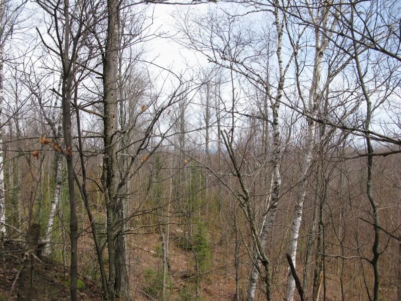
Obstructed view northwards
I was now directly across Buschell Lake from where I had first bumped into it, climbing down the steep rock spur. It was tempting to just continue around, circling around the lake, to take some of the disappointment out of not climbing the bald peak. That would have taken me far away from the easy way out, far off my course, and I decided against it. I wouldn't find out until after my hike that there are several impressive rocky bluffs over there with possible northern views. Today I just headed back along the shoreline, back to the track out.
Along the way I bumped into a narrow swamp bulging out of the lake, and in the swamp there was another mine shaft. This one was flooded with the land around it, a scary looking dark hole of water in an already-murky swamp. There was more loose rock around this one, piles of shifting pieces that had been brought up from the ground. I wondered what the Cliffs would have been looking for this far east. My best guess is iron, as that seems to be their ore of choice. Whatever it was they didn't find it, as this shaft and the other one had been left for nature to reclaim.
Flooded shaft surrounded by rock and swamp
The walk back was easy once I got back on the track. It led down below the bluff, far below the spurs I had climbed, and I had to climb back up to get to the same level as the sand pit. The track never actually entered the pit proper, just snuck around the perimeter, but I still maintained a wide berth. I peered over once, just to get a closer look at the exposed dirt, before climbing back up the annoyingly bouncy hill. I swung into my car and headed out, glad to have finally visited Migisy Bluff even if the best views were out of my reach.
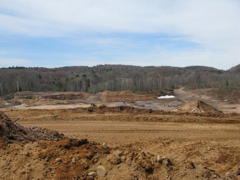
Peering over the edge of the sand pit
-
Jacob Emerick
May 28, '13
Hey Dave! I was hoping you would venture onto this post. I have a feeling you'll enjoy some that are coming up - recently visited some spots in the Keweenaw as well as another old mining spot (a gold one at that!). That's also a good point about the swampy area. There wasn't a ton of rock pulled out from the second spot (though they might have carted some away) but it was more than enough to account for some sinking. The lake creeping in here was odd, with the surrounding land seeming put off by the intrusion. I'm curious exactly how extensive the shaft was and how many more there are around here, as both spots were found by accident.
-
dcclark
May 29, '13
Awesome, looking forward to the next posts! I saw your "activity stream" with some posts about Mandan and the Point... there's a LOT of old stuff to find out there.
-
Jacob Emerick
May 30, '13
Ah, I stuck pretty close to the shoreline. Mandan and Clark Mine will probably wait for next year (wife and I are thinking of staying up at the 'Harbor and exploring Estivant w/ the baby). The rocket range was neat, though I was a bit surprised that Tech was not on the plaque.
Add to this discussion-
Jacob P Emerick
Oct 28, '16
Oh wow, copper and gold? That's really neat. Rarely think of Marquette area for those type of things, mostly just assume iron is the main goal of any exploratory shafts.
-
s
Oct 29, '16
I assumed you always knew to watch for gold and quartz,as you were looking for waterfalls. Just do a search for Upper Peninsula Gold mining. Did you think Gold Mine Road was an imaginary name?Although there are many small pits all over;usually hit water and quit. Any small flash in a creek could be gold. Certain families up here have blown cliffs etc. up just for fun,just in case.
-
Jacob Emerick
Dec 14, '16
Ah, that's fair, s. I've heard about such rumors around Bushy Creek, Yellow Dog, and Birch Creek. Shoot, I think even Big Garlic could have some flakes. I just didn't think about gold at the time. The combination of the location (south of Marquette) and the Cleveland Cliffs notice got me immediately thinking of iron.
Add to this discussion