Abandoned Lighthouse of Fourteen Mile Point
On a small point of land north of Ontonagon, MI sits an abandoned lighthouse. Built in the 1890s to help guide traffic from Houghton to Ontonagon along the unmarked coast this lighthouse was in commission for over fifty years before it was snuffed out. In 1984 a fire consumed everything but the brick walls, leaving an empty shell where once one of the grandest and most remote lighthouse of the Great Lakes stood. Today I set out to hike the icy coastline to visit the abandoned lighthouse of Fourteen Mile Point.
The Abandoned Lighthouse of 14 Mile Point
The roads north of Ontonagon were slick and slushy with the melting temperatures. I coasted through the turns and kept my speeds reasonable on both paved and dirt surfaces as my small car was pushed and pulled in different directions. It was surprising just how far the road commission had plowed and how bad the roads still were. The handful of homes I passed had huge trucks and/or snowmobiles next to their houses, obviously used to the driving conditions, and I was unprepared.
I had driven out this way once in the summer. Lakeshore Drive ends shortly after crossing Firesteel River with a new housing development continuing up the shoreline. This development, The Shores at Ten Mile Point, was obviously in the vicinity of Ten Mile Point, but I wasn't sure if it extended north of the actual point. I drove on the icy dirt road through the development until it ended at two private drives.
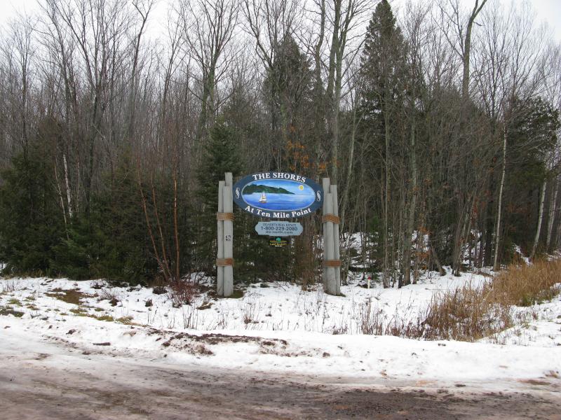
Sign for The Shores development
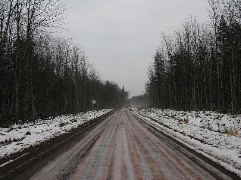
Icy, slushy dirt road heading north
Neither my maps or GPS could tell me just how far I had traveled north. My route was fairly easy anyways; follow the shoreline north until the lighthouse showed up on Fourteen Mile Point. Before leaving the car I paused to listen to breaking waves, almost visible through the barren woods. It was tempting to head straight for the water and look out upon Lake Superior. I didn't know if the beach hike would on sand or ice at this time of year, an unknown that, when combined with the uncertain distance, weighed heavily on me. Shrugging away the worry I headed down one of the private drives instead parallel to the lake, choosing to start with the easy path.
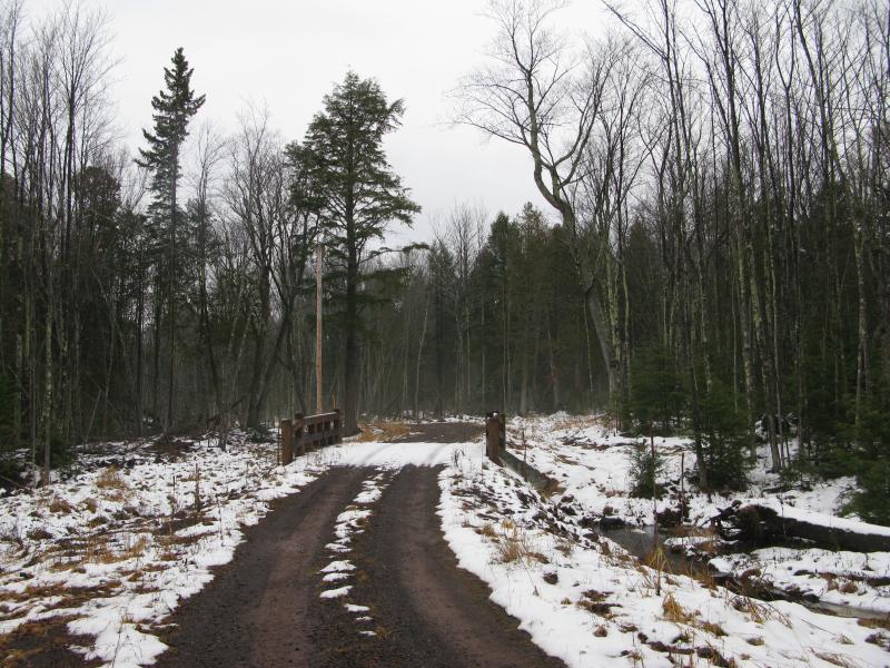
Bridge over 10 Mile Creek
The smaller private drive gave me an easy route over the small Ten Mile Creek and through the thawing woods. I was starting to get hopeful that my entire hike would be this easy when the road suddenly ended with a 'No Trespassing' sign in front of a camper. With a sigh I cut into the woods, circumventing the marked land, and broke out onto a logging road that continued on the far side of the camp. This logging road led off towards the woods and I knew it was time to face the unknowns of Lake Superior's beach. I broke through the brush westwards and stepped out onto a grassy dune, sand stretching away in both directions for miles.
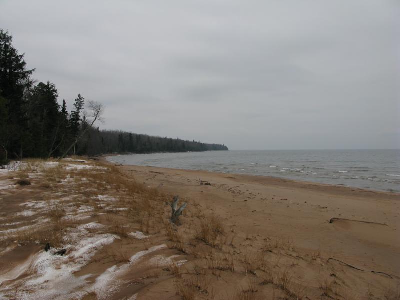
Looking south along the sandy 10 Mile Bay
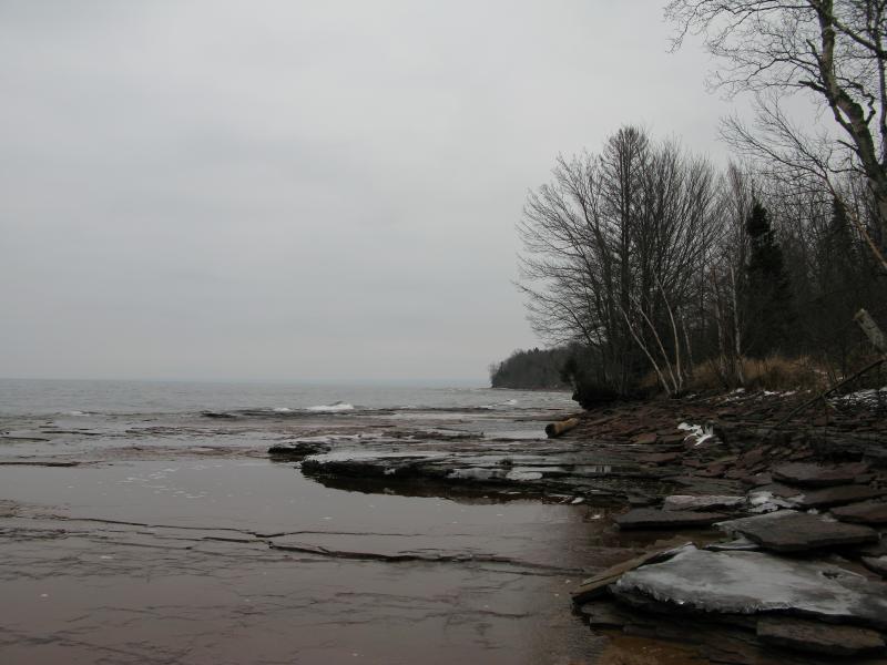
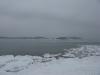
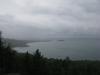
At the time I didn't realize I was already in Ten Mile Bay, which lies between Fourteen Mile and Ten Mile Points. There was another sandy bay south of Ten Mile Point, and there was no good way of knowing which one I stood in now. If I was south of the point than my hike would end up being close to a dozen miles, an unappealing venture along the unfrozen, giving sand. Still, the sandy beach was cool to look at, and I spent some time enjoying the cool breeze and breaking waves before heading north on the shore.
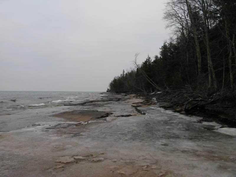
It's hard to say if I prefer walking on a beach to bushwhacking through thick woods. There is no ducking or weaving, no careful placing of feet on a beach. You can stroll leisurely and enjoy your surroundings more. However, sand is not easy to walk on. The dry stuff gave easy and the wetter sections near the breaking waves were on an angle and easily soaks through boots. I did have a third option between these, frozen slabs left over from earlier high waters. Every hundred yards or so I would switch between the options, not truly comfortable with any yet thankful for the chance to enjoy the sounds and open views.

Broken shelves of frozen sand
After passing a few small creeks and thoroughly soaking my boots with the small, lapping waves, a welcome change presented itself. Flat slabs of sandstone extended out from the shoreline, replacing the sand and promising easy walking. I was at the north end of Ten Mile Bay, and being able to look ahead and see the terrain I could finally place myself on the map. A few miles of sandstone shoreline and I would reach the lighthouse. Excited I stepped onto the slab and was surprised to feel my footing slip. Kneeling I touched the damp rock. It wasn't icy or green with algae, yet it was smooth and slippery. Then I got it. I was in the Ontonagon County, where the soil itself is red with clay. The rocks were slick with sediments. Carefully I continued on the rock, treating it as if I was walking on ice, and made it across safely. I realized then that the shifting sands were the easy part of this hike and the next few miles of sandstone would be the real challenge. With a sinking feeling I made my way over the next rock, and the one after, knowing that this hike was going to be a tough one.
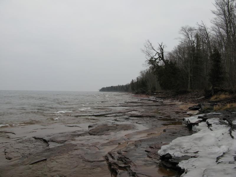
Slick sandstone shoreline
Last wistful look at the sand on 10 Mile bay
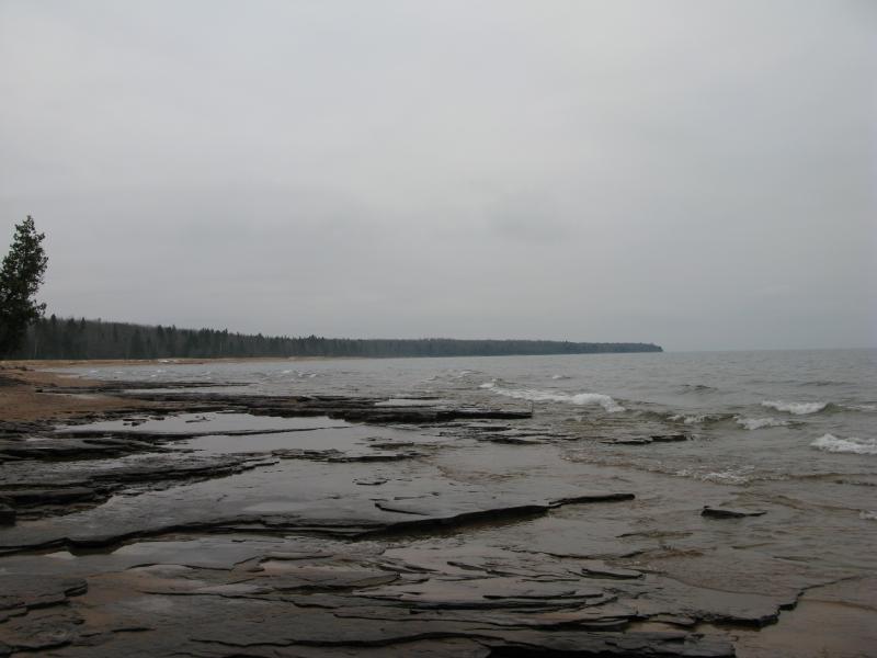
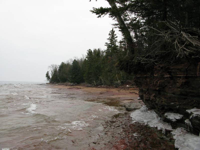
Shuffling, scooting, at times with a hand on the ground for balance, I slowly made my way along the shore. Not all of the walk was on the slick sandstone. There were a few patches of broken sand or gravel rock that offered a quick reprieve from my awkward pace. The shoreline was uneven, hiding upcoming pieces of my route until I rounded a small point or low-slung tree. One foot in front of the other, one small section of the shore at a time, I continued to make my way north. I passed tiny melt waterfalls and icy slabs, glazed trunks and hidden coves, and the constant challenge kept the tough hike fresh.
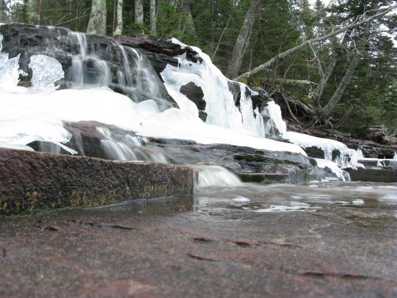
Tiny half-frozen waterfall from the melt
Ice-covered shelves of sandstone

Frozen rocks coating the shoreline
Even though I knew I was past Ten Mile Bay it was hard to judge how much farther the lighthouse was. It was until I rounded a small outcropping of sandstone that I could trace the shore's profile onto the topo map. I was close, very close. Taking a moment to rest in the small hidden bay past the outcropping I reviewed what I knew about the lighthouse. I knew it was on the shoreline, probably within a few hundred yards, and I knew it was abandoned. Beyond that I didn't know if it was overgrown, visible from the water, or even how tall it was. I started to get worried that I would pass it unknowingly. I checked my assumed position again and decided to continue forward for another mile before considering circling back onshore to hunt for it.
Small hidden bay
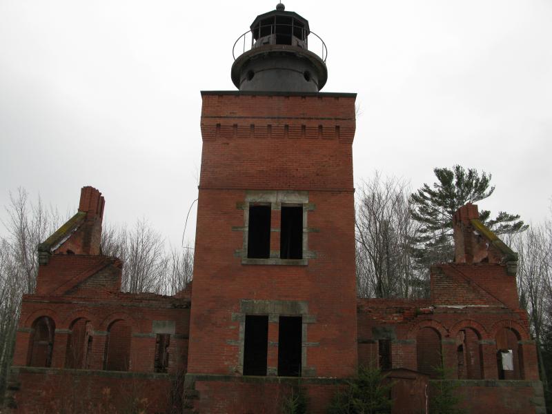
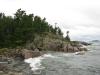
Exiting the small bay and rounding a few more bends I realized that I had nothing to worry about. A lonely brick building with a small smokestack lay ahead of me, right on the shoreline, obviously part of the lighthouse's ruins. I rushed ahead on Fourteen Mile Point, drawing closer to the old fog signal building. The one structure that remains intact, this building's foundation is right on the water's edge. I circled it slowly, marveling at the excellent condition, before turning my attention on the lighthouse.
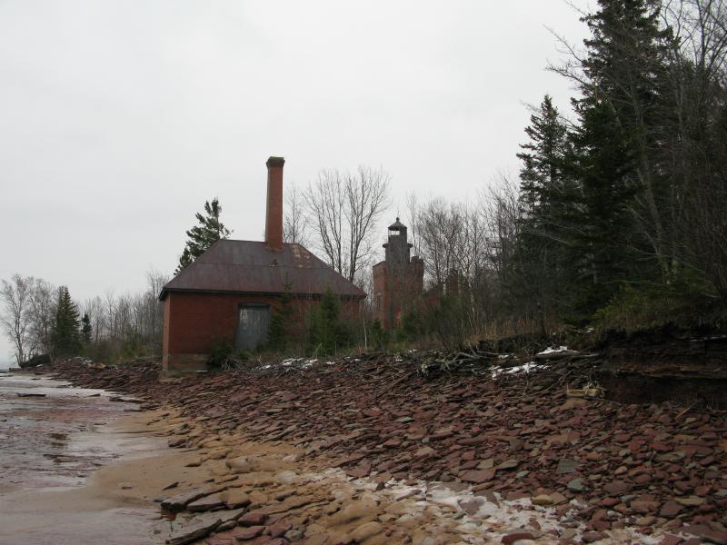
First view of signal building and lighthouse
Fog signal building, right on the shoreline
I stepped close to the lighthouse, peering into the high windows. The square tower loomed over the broken walls and small pines grew through the floor. The metal cage that once housed a light on high was rusty but looked solid. The layout of the lighthouse was a bit confusing, with the main building being divided in half by a solid wall. There was a door in the middle that was bricked up long ago. I guess that this building once housed two separate families; perhaps they got in a heated argument and decided to block each other out. Only the western half seemed to have access to the tower.
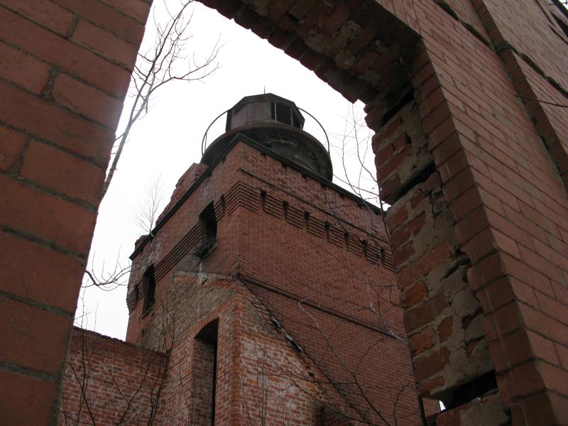
Through a window, looking up at the imposing tower
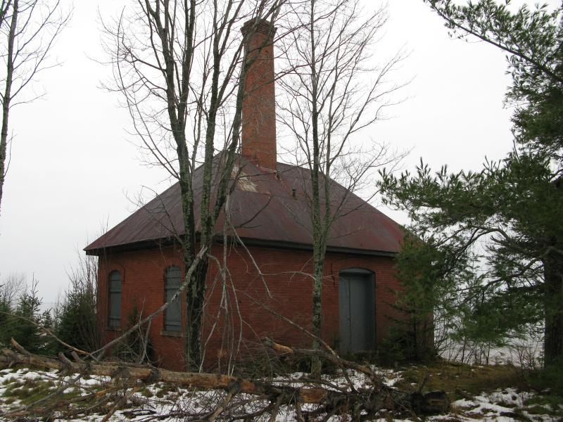
There were other buildings besides the fog signal and lighthouse. A small brick shed, which may have been a very sturdy outhouse, and several wooden buildings surrounded the area. None were in good shape. I took a close look at one that may have been a barn or house that was located right behind the lighthouse. The floor had alarming holes and warps, bending up several feet in the middle, but that didn't stop previous visitors from marking up the walls with names and promises of eternal love. The foundation was also giving way, making me wonder how many more years this building would be left standing.
Ruined barn or house behind the lighthouse
Circling back to the lighthouse I took another look inside. It was shocking how much growth was springing up inside the brick walls. Small pines were reaching five to ten feet already with a few other saplings scattered around. Outside of a few scattered bricks, what appeared to be a stove, and a gaping hole that may have been a cellar, the forest was taking over the building. The floor must have been raised judging by the door height, and today's ground floor would have been yesterday's crawl space.
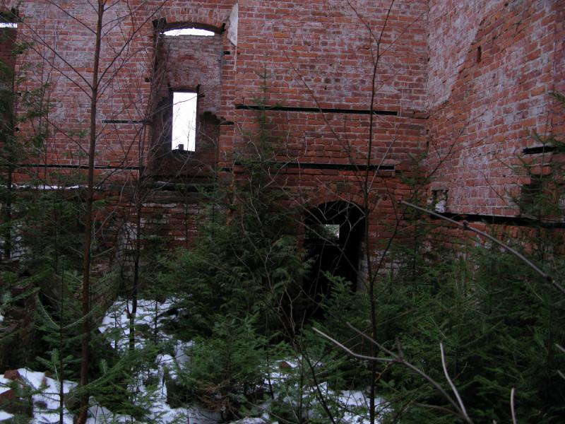
Looking around the inside of the lighthouse
I finished my perimeter of the area, finding a few old foundations and overgrown sidewalk paths connecting different buildings, and started to prepare for my return. I did notice a fire ring, a tempting reason to return in the summer. There was one last thing I wanted to check out. I had seen some pictures looking northeast, up the coast to Wolf Point and beyond, and was hoping to catch the same view. Down to the shoreline I went on the path that must have led to the now-gone dock, making my way further west on the point. There was nothing to see. Around the next bend was another quarter mile of shoreline that blocked the view beyond. I wasn't about to re-tackle the slick sandstone for a vew of Wolf Point, so I turned about and started backtracking.
West towards Wolf Point and Sleeping Bay
As tempting as it was to retrace my path on the shoreline I decided to be smarter this time. There were no roads or paths leading directly to the lighthouse but there were a few two-tracks that got close. I followed the shoreline for about a quarter mile before heading inland, weaving through the brush and around swampy sections on a slight diagonal leading away from the lake. I was still within eyesight of the water when a gunshot reverberated through the woods. It was a rifle, maybe a mile away. Confused, I stopped and thought. Deer season was over - why would anyone be shooting a rifle? Suddenly I realized that I was close to an Indian reservation. I doubt that they have to follow the same rules or seasons as other hunters. Scrambling a bit I pushed my way back to the shoreline, resigned for another slippery shamble back to my car.
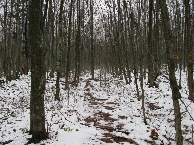
After another half mile on the shore I decided to try the woods again. There were no more gunshots and the slick rocks were beyond aggravating. Pushing and weaving I tackled the thick brush on a similar angle, this time hitting an old grade after a couple hundred yards. Thankful for the level ground I strode along the narrow path, possibly the remains of a logging road or railroad track, before breaking out a wide, maintained dirt road.
Old grade parallel to the shoreline
I knew it was all downhill from here. This was the second private drive on the end of the housing development where my car was parked. Relaxing a bit I let me mind wander as my legs picked up the pace. The lighthouse on Fourteen Mile Point was for sale. Ignoring the ridiculous price tag, what would Katie and I do if we could buy the land? Most of the buildings would probably need to be knocked down. We'd try hard to preserve the lighthouse, though. It might take a few years, but the brick walls could be strengthened, interior walls insulated and drywalled, strong copper or steel roof put on… Yeah, it would be possible. If an old brick building couldn't be modernized to withstand the cold winters we could always build an independent caretaker's house and just maintain the lighthouse for summer use. To get the circular staircase up again, maybe a telescope or a light up in that tower again, would be amazing. A boat and few snowmobiles could be our main transportation unless we could work out a deal with the county to build a road all the way out here, preferably from Misery Bay so we'd have easier access to Houghton.
Rounding the last bend in the road I saw my car ahead, snapping me from daydreams. As I drove away I thought about my route in. Parking in a new housing development is not a great way to approach the lighthouse. My original plan was to came in from the northeast, from Misery Bay down, which would have been easily three times as long of a hike, over two wide rivers, and past a multitude of camps. Another path could be made from the land, driving along the logging roads extended west from the Twin Lakes, and would involve a hefty bushwhack through unforgiving woods. I do plan on tackling Wolf Point and Misery Bay at some point in the future, if only to see if the northeast route would be viable for future visits to the abandoned lighthouse.

-
Jacob Emerick
Dec 19, '12
Ha, yes there was. I was a bit hesitant on sharing that right away, but there is a loose way to climb up to the top. A rope ladder, some bolted logs, and the circular staircase link together to make a not-very-safe route to the top of the tower. I'd recommend bringing along a hiking buddy if you're thinking of tackling it, just to be safe.
-
dcclark
Dec 19, '12
Yeah, that sounds totally safe. :P Good advice: bring a buddy... who is smart enough to talk me out of climbing it!
-
Jacob Emerick
Dec 19, '12
Ha ha, very nice. The view from the top is pretty amazing, though... Or so I've been told...
Add to this discussion-
Jacob Emerick
Dec 19, '12
Hey Lydia, thanks for the comment! Glad it makes you smile. I'm totes game for a good hike, just let me know when you're in the Upper Peninsula area and we'll make it work ;)
Add to this discussion-
Jacob Emerick
Dec 22, '12
You'd think that the beach would be easy. It sounds so lovely, just a stroll down the beach... My hip gets sore just thinking about this hike. I was wondering how fast those wooden buildings were going. I've seen plenty of photos of the lighthouse, not as many of the buildings around it. And yeah, it's hopeful that they are doing some stabilization work. I don't even know if it's possible given the current state, but the thought of this station fully restored is pretty darn exciting.
Add to this discussion-
Jacob Emerick
Dec 31, '12
Ha, I did! I tried once this summer, got discouraged by the housing development (I expected logging roads, not fancy cabins and lots), but finally made it out there this winter. Long overdue! I really wish we could have seen it before the fire. Bumped into some old black and whites from early 1900s, this lighthouse was pretty dog gone fancy for being so remote. That's what kinda got me thinking about a true restore and what all that would entail. The opening is still there, that's what the rope ladder is tied to. If I had to guess, both by the construction and your statement about the funds, the access was probably built by local kids. Someone on the twitter got a hold of me about this post and mentioned that her friends visit by four-wheeler. I didn't think the logging roads stretched all the way out to the lighthouse (and doubt we could find the path unless we started at fourteen mile point), but a couple of teenagers could easily haul out the gear and put together the ladders in a few days if they hauled in supplies over the roads. Anyways, it was sure fun visiting. It's tempting to try a summer hike down from Misery Bay, if only to use the camping site near the point.
Add to this discussion-
Jacob Emerick
Jan 25, '13
Howdy Hikerken! Thanks for the comment. Firesteel River, eh? That would have added a lot of distance to the hike! Interesting that the rocks were still slippery. I suspected that there was more than ice making them slick, guess the clay and moss does add some difficulty after all. Thanks for finding that video, too. That route looks... difficult... but might actually be easier than the slick beach rocks.Also, that's a pretty sweet site you linked to. I haven't done nearly enough exploring of the Porkies or have even gotten close to Isle Royale, although I have been trying to stock up gear in preparation for real backpacking. Most of my hikes are in-and-out, a few circles here and there, but nothing (well, few) over twenty miles. Will probably be spending some time browsing through your different stories and trips ;)
-
Brian
Jan 28, '13
Hello, Jacob. I stumbled across your site while I was looking for info / blogs about the Fourteen Mile Point Lighthouse. I really enjoyed the read. It brought back some memories of when I was out there with two of my friends in late September 2012--HikerKen who posted right above me was one of them. After reading your experience, I'm disappointed that I didn't explore the "basement" of the lighthouse. We entered the hallway to the lighthouse from the west side. I remember standing on that "landing" and looking into the interior of the lighthouse. I contemplated jumping down there and walking around, but I never did. Now, after reading your blog and looking at your photos, I wish I had gone down there to explore. I never saw that "doorway" to the cellar or the old stove. Those would have been cool to see. My buddy sent you a link to my website where I have posted all of our previous hikes. Unfortunately, those things take me a while to complete and the Porkies hiking trip is not finished yet. When it is done, I will try to remember to send you an email so you can read about our hike. Thanks for sharing your trip.
-
Jacob Emerick
Jan 28, '13
Hi Brian. Glad you stumbled over! It sounds like you and HikerKen had a tough hike out there too. It wasn't easy to get into the lighthouse. I had to wiggle in through one of the charred basement windows, contorting around and whatnot. Funny how difficult a three-foot drop is when you're at an odd angle. Anyways, the little pines and saplings were thick in there, making it hard to make out everything, but the stove and cellar were fairly visible from the floor. The one cellar was particularly creepy, with only a few bricks caved in, hiding the depth and size in the dark.Ah, and I hear you on the updates thing. I've been spending far too many hours lately working on my waterfall site, trying to catch up with the last few years of hikes (as well as a little redesign). These side projects really know how to eat up time, eh?
-
Dave
Feb 10, '13
Jacob, There must be a large group of us who have visited this lighthouse as I made the same trip in 2009 and I'm living in Cincinnati! When they built lightouses on the lakes they tended to repeat the same designs, Big Bay on the other side of Keeweenaw was built 2 years later in 1896 and 40 Mile Point near Cheboygan is also similar. Big Bay is a bed and breakfast(I understand it is also for sale) and 40 Mile Point is a museum. Each lighthouse had a date-stone built in somewhere. 14 Mile Point's used to be above the porch entrance on the west side and you'll notice somebody must have wanted it pretty bad...it's gone. I often wonder if it is a salavgeable lighthouse?
-
Jacob Emerick
Feb 13, '13
Dave, there must have been! Bit of a pleasant surprise. For how little content there is about the lighthouse on the interwebs and how overgrown everything is out there it's nice to see so many people, especially from way-out-of-state, have visited the lighthouse! That's a good point about Big Bay. I've only seen photos but the design is pretty similar. Never really thought about it. Sure hope 14 Mile Point gets a bit fixed up, though I can't imagine in other way than replacing most of the bricks and re-mortaring it and everything.
-
A different Dave
Aug 28, '13
Nice write-up! I've been checking out this lighthouse on Google Earth and will be staying near 4-Mile Rock this weekend, so your piece is a great guide. I may try a combination of mountain bike and hiking. The logging road looks WAY too messy but maybe that's seasonal. Any opinion on that, Hikerken, Brian or Jacob?
-
Jacob Emerick
Aug 29, '13
Thanks Dave! The road that leads up the shoreline, past ten mile point, was actually pretty nice. It may look nasty acos of the snow/rain in these pictures but it is pretty driveable. The roads past that, though, get bad. So if you're hoping on biking the entire way it may be tough for both the bike and the navigation. If you're willing to walk at the end of the housing development along the shoreline you'll be good.
Add to this discussion-
Jacob Emerick
Aug 9, '13
Hi Timothy! Glad you found this - it really is a great spot to check out. It wasn't warm, though, I'll admit that much.I came in from the south, and I may have gotten lucky. There's the housing development that has just started up and does not have a lot of buildings on it yet, so there wasn't any signs along that road. I'm assuming that it will be all built out and private within the next few years (if they get the buyers up there) so I think that won't be an option soon. The other roads in that area, the ones that stretched past the development, were private. In fact, for kayakers and hikers both, I'm thinking that Misery Bay is probably the best starting point.Thanks for the comment! I'm glad I made it back as well :P
-
mary smith
Sep 3, '13
Great set of pictures;glad people are so interested in these structures. I saw the Big Bay Light House interior and climbed to touch the light in the early 1950s. A fellow that took us knew the caretaker. Guess it is good that the fellow from Chicago put so much money in it to make a home;at least it was preserved to become a bed and breakfast....Great view from top of the light...
-
Chuck Prass
Sep 3, '14
It's great to see others getting out to 14 Mile Point. We hiked out there in 2004 from the beach near the Firesteel River. At the time, we were unable to access as good of maps as there are today, so that was the 'safer' option for us. What was really strange to us was the great amount of deadfall on that first beach....Hundreds of trees, bleached and stripped by the water before washing ashore. And, there were plenty of those slippery sandstone slabs (most just underwater then) between there and Tenmile Beach...We ditched our shoes and did that barefoot for better traction. We did see that cabin from the beach at Tenmile, but lacking knowledge of the road, we hiked back the same way we came. The whole trip took about 10 & a half hours, with 40 minutes at the Lighthouse. We aren't hikers, but Lighthouse Hunters of the Great Lakes. Our goal, which took 13 years to complete, was to see every Light and Lighthouse on the US Great Lakes. Sadly, my Wife is lost to Cancer, 2 years ago, but we had some great adventures getting to many of the Lights. The 14 Mile Point was our longest single hike of any of them though. While at the Light, I took many photos (on film, now preserved on disc), and did some exploring, dropping down into the basement to check out the kitchen stove, which had fallen through the floor due to the fire. Back then, there was no way into the tower, but could see the spiral stairs hanging far up. This once-grand Lighthouse was torched by vandals who set a 'campfire' inside the place, and has a lot of history. The house was divided for the Keeper and Assistant Keeper & their families. There are the remnants of the very ornate stone tile at the separate entrance-ways. I was able to check out the old Privy, but the Fog Signal Building by the water was locked up tight. The wood building in back was in poor condition then, I was surprised to read it was still standing. Fourteen Mile Point, constructed in 1894, is one of the 'Holy Grails' of Lighthouse Seekers. Not many of us make it out there to the Lighthouse itself. I know of a few others, though very few. We did do some planning (enough water & snacks), but had been led to believe it was an easier hike than it turned out to be. Fortunately, I'm stubborn, after coming 500 miles I was going to get there one way or another. It turned out to be a memorable adventure.
-
Jacob Emerick
Sep 23, '14
A ten hour trip from Firesteel? Well, that definitely makes my hike seem like child's play. Thanks for your story, Chuck - sounds like you and your wife had one heck of an adventure here.
Add to this discussion-
Jacob Emerick
Oct 1, '14
I've definitely been there, with the Zippo Lighter. You get so caught up in the adventure that you lose track of time... Yeah. Mine was cell-phone backlight up by Lower Montreal Falls, way up by Bete Gris. Thanks for expanding the story, Chuck - again, it sounds like it was a heck of a fun time.
-
Louis R Lacina
Mar 18, '15
Thanks for the pictures' brings back memories when myFather & george Markham bought the place & decided to sell it too a young couple. Will write more when I find out old information thank you again!
-
Jacob Emerick
Mar 21, '15
Hi Louis, great to hear from you! When did you own the lighthouse?
-
John Kowal
Dec 11, '16
Fascinating. I visited twice, by 4x4 trek called The Lighthouse Expedition, in 1991 and again in 1996, coming in from the east. Bent the frame of my pickup the first trip, broke a front jackshaft the second. It is a hellish offroad trip with trucks and jeeps. The second time we drove over 3 100 foot tall narrow gauge railroad bridges. I remember on the first trip a muddy trail under water just before breaking out to the beach that I needed to pull my full 150 feet of winch cable twice. And then we drove along the beach and into Lake Superior, rolling over boulders you could hear underneath your truck, water to the bottom of my doors (4" lift and 35" tires). Of course, compared to the locals, my truck was small (they run 38" to 44" Swampers). It took us ten hours to go 10 miles on these trips. I'll probably never drive back there again, but being a city boy (Chicago) I still relish the adventure decades later.
-
Jacob Emerick
Dec 14, '16
Hi John, and thanks for sharing! That sounds like a heck of an adventure. I've heard of some rough roads that come in to 'near' the lighthouse, and considered hiking them (definitely don't have a vehicle anywhere close to your capabilities) but ended up taking the shoreline route out of curiousity (and shorter distance). Still, the route you took, through Lake Superior and everything? That sounds like a lot of fun.
Add to this discussion-
Jacob P Emerick
Feb 2, '17
Thanks for the clarification, David! It is far too easy to just associate hunting gunfire with deer season.
Add to this discussion-
Jacob P Emerick
May 23, '18
Hi Isaiah - I do not think that there is a quicker way, unfortunately. The inland roads are quite muddy and maze-like. I never tried it, though, so maybe someone else would have a better recommendation :)
Add to this discussion-
Jacob P Emerick
Aug 10, '18
Hi Eric, thanks for the updated. Assuming that you're talking about the pines inside the lighthouse... If so, wonder how much longer before they overtake the old brick walls.
Add to this discussion