A Brief Visit to Cliff Ridge
My little Saturn bounced and shuttered as I pressed down Cliff Drive. Gritting my teeth I pushed faster, steadily approaching the breckneck speed of 45 mph, doing my best to avoid the bumps and pot holes on the rough road. I was behind schedule after a few detours near Copper City and didn't know if I'd have enough time to explore Cliff Range of the Keweenaw.
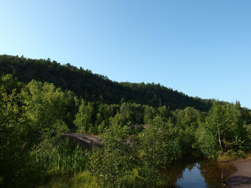
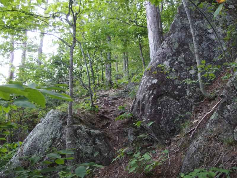
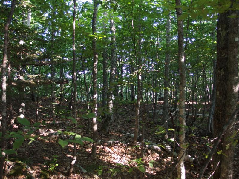
Long rows of dark cliffs
This wasn't my first time on Cliff Range. Back in the winter of 2008-09 I wandered up the steep climb, frustrated by the winter's efficient hiding of my precious waterfalls. I didn't know much about the mines, just followed snowshoe paths through the woods and along the ridge, and came away a bit disappointed. The cliffs are tall, sure, but there's not much to see. Hills block any view south to Keweenaw Bay and there's no north-facing outcropping. All I found was rock and snow. I left the cliffs and forgot about them for five years.
Today I came with a plan. I wouldn't merely scale at a single location and look around: I would start near Ojibway and follow the ridgeline all the way to the mines, exploring multiple heights, angles, and maybe catch a few views of Lake Superior along the way. That was the plan. And then I ran out of time.
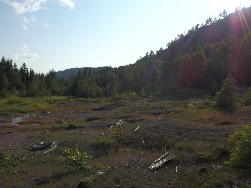
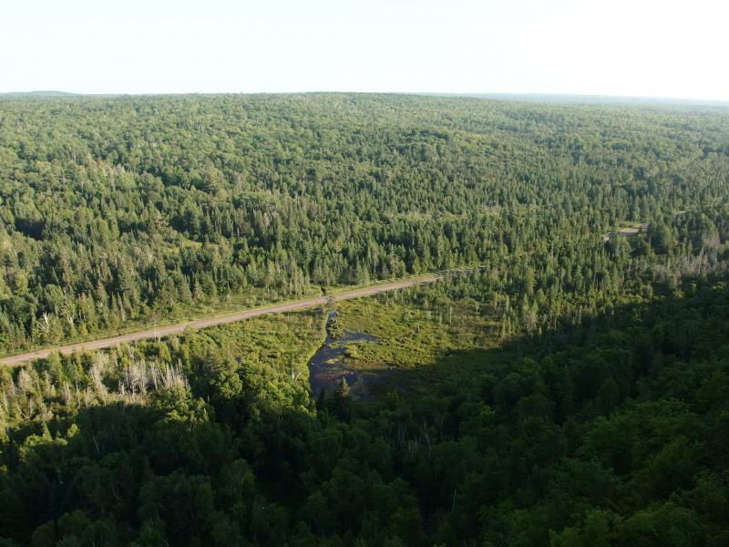
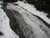
Desolate ground of rock and swamp
With a few short hours of daylight left I pulled off on the shoulder near the ruins of Cliffton and quickly set off across the trickles of Eagle River. If I was on a schedule I'd aim for the good stuff, the old mine set in the cliff itself. The land was alien and weird, bare patches of poor rock stretching into meager green wetland growth. I trotted quickly over the loose rock, entering in evening shadows before I was halfway to the woods.
Trails were easy to find, blazed with tape and well-trod. First I wandered west and south, stepping over huge cedar roots, and then the ruins showed up. That didn't take long. Dark rock grew from the needle-covered ground in crumbling walls and sharp angles. And then the smokestack. Good grief, a rock smokestrack.
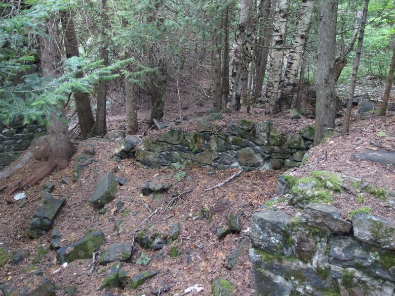
Old foundations growing from the forest floor
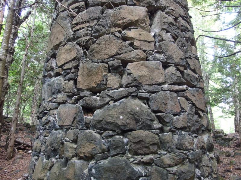
The ancient rock smokestack
The smokestack was impressive, towering up like the trunk of a giant, lightning-struck pine. I circled it slowly, gazing up. It's hard to find smokestacks in the Keweenaw - I can only think of a half-dozen at most - and I'm pretty sure that they're all brick or metal. A stone smokestack seemed so ancient compared to any of those, which given the age of this mine makes sense. They were pulling ore out of this area long before many other spots.
There were more ruins further to the north but the cliffs called to me. I couldn't walk this close to a tempting climb without attempting a scale. A narrow footpath wound up between the rocks and I followed, gaining elevation and losing breath. It took less than ten minutes to reach the top of the cliffs and find… a campsite. At the end of a four-wheeler trail. Well, that takes a lot of sport out of it.
Rugged footpath up the cliff
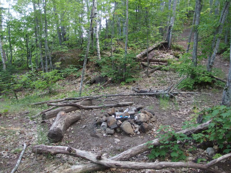
Small campsite on the top
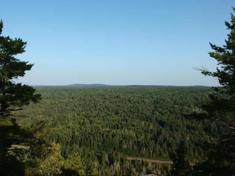
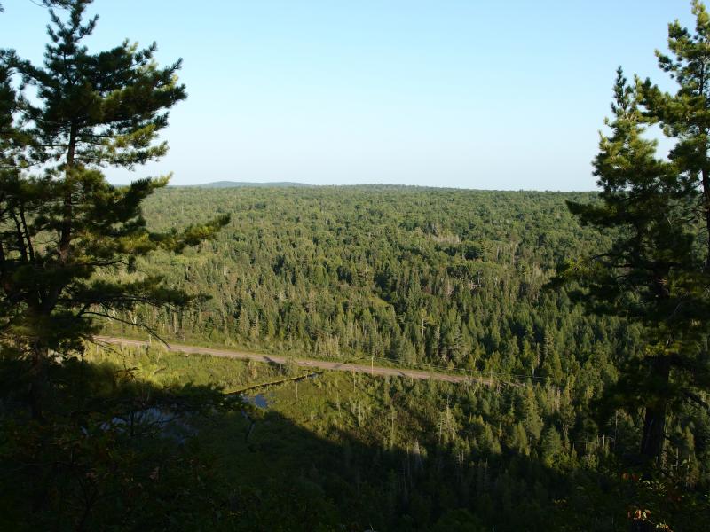
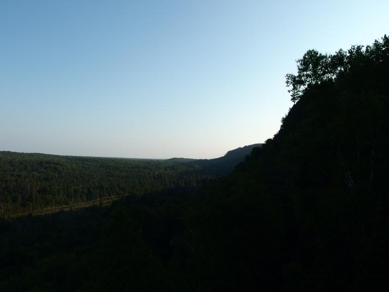
Shaking off the presence of an atv trail I headed over to the nearest outcropping, excited to see what kind of view the climb had granted me. It wasn't terrible. The poor rock and my car seemed so far away, turned micro by the deceptive distance. Beyond that, though, there wasn't much. Distant rises of green could have been Horace Greeley or Gratiot Mountain or just unnamed hills. No blue of Lake Superior showed itself.
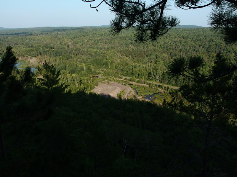
So far down to the rock and drive
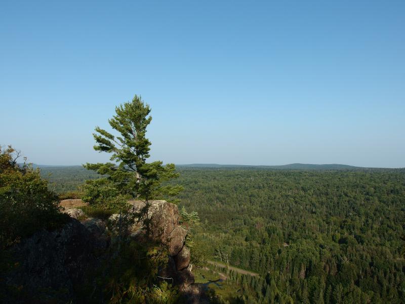
Hoping for more I set off to the southwest, following the ridgeline as it rose and curved. The trail was easy to follow, a well-defined footpath that sometimes cut through the woods yet managed to hit just about every good outcropping. There was only one time right away that I decided to cut off trail in hopes to gain a different vantage, a decision I soon regretted when I waded into a rugged, thorny, and unstable patch of cliff. The views steadily got better, though Lake Superior never really showed itself in the distance.
A lonely, rocky spur
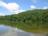
Swampy waters on Eagle River
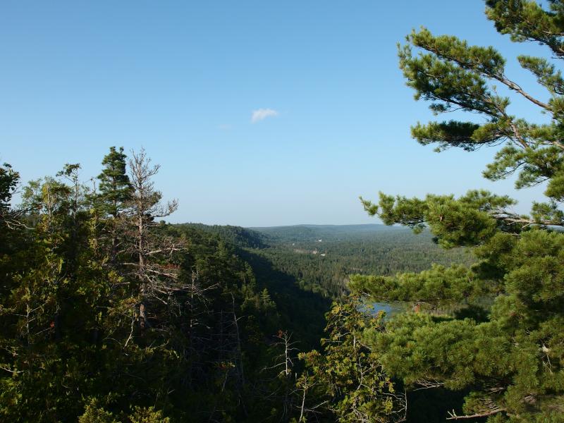
Looking along the ridge towards Phoenix
The atv trail also made a reappearance, coming up from the woods to open out on a rather large outcropping like an unwelcome guest. I'm not sure where it came from. It must connect with some of the trails to the north, either running down the slope towards 5 Mile Point Road or looping around on one of the breaks of Cliff Ridge. I guess its nice to have an easier way up here for those unable to make that steep climb. Just wish they would take their empty beer cans back down with them.
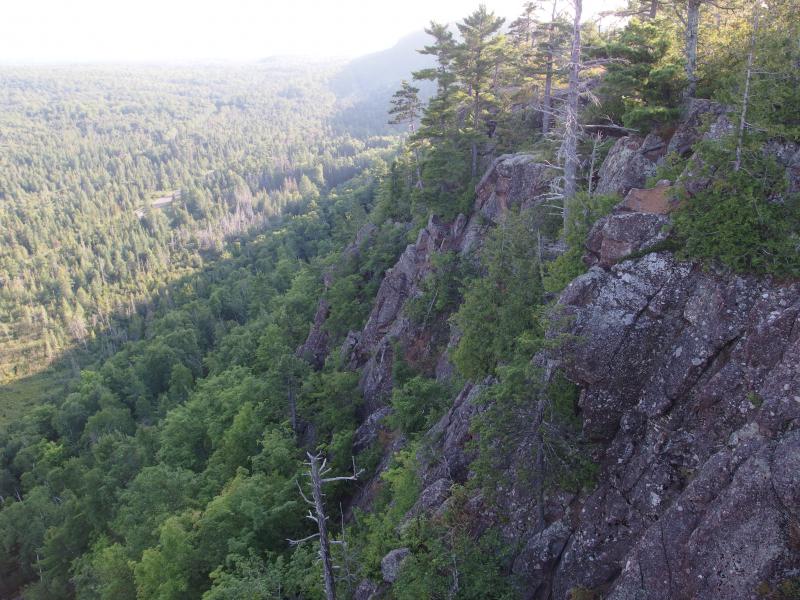
Steep rock cliffs ahead
Distant rise of Horace Greeley
After the trail disappeared back into the woods I decided to stay close to the ridge, keeping it a comfortable couple of yards to my left, and bushwhacked along. A very small part of me was still considering hiking all the way down to the general Ojibway area, maybe two miles to the south. I could always walk along Cliff Drive in the dark and set up my tent… somewhere. The plan was to camp on Copper Falls Bluff and watch the sunset over Cat Harbor. That sounded like too much fun to pass up.
Thick, young woods in a saddle
When I came out of the saddle I came upon a narrow view down to the swamps below. The shadows stretched long now, almost touching Cliff Drive. I was almost at a cut in the ridge that would really complicate my forward progress. I gazed down at the swamp, a completely unwelcome sight, and wondered how difficult it would be to cross that in the dark if I couldn't make it to a track.
Narrow view down to the road below
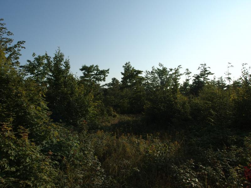
The ridge was dying so I headed inland, looking for a way forward. Logging blocked my way. Piles of brush lay under thick grass waiting to bruise and tangle my legs. At least there was thimbleberries scattered throughout the grass. I stumbled and cursed, munching on the sour berries by the handful, looking and sounding like a cross black bear. Eh, it was probably time to head back.
Overgrown patch of logging activity
It took almost a half hour to get out of the overgrown logging area and refind the atv track. The track led me back up ridge and to the campsite. Begrudgingly I acknowledged its usefulness to me this evening and took off down the ridge. I didn't exactly follow my original path, though.
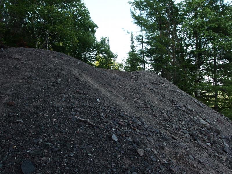
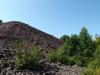
Piles of poor rock
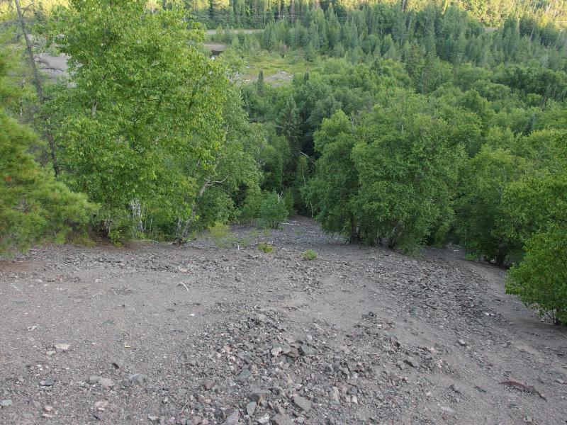
Long slide down over poor rock
Next to the narrow paths up the cliff was a huge pile of poor rock that almost reached the top of the cliffs. A huge pile of rock that made for an excellent slide down. I recklessly half-ran, half-slid down the pile, dust and clatter leaving a long trail behind me. That, that was fun. And possibly very stupid.
Silhouettes of giants
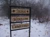
There is a lot more to Cliff Ridge. There's a well-known cemetery to the north, more ruins above the ridge, an old town to the east, and plenty more cliffs to the south. And, once again, I barely touched the surface. At least I got to eat some thimbleberries. I got in my car and continued north to Copper Falls, leaving behind many hours of exploring on my way to a most unforgettable sunset from the bluff.
-
Jacob Emerick
Aug 27, '14
Not sure about the Copper Falls Bluff post yet. It really was just a hike up to the bluff, camp, and then hike back. Well, sort of. There was a bear. It may make for a good story. And yes, the photos were spectacular.The North American Gap... that's where I wanted to go! Would have made it if it wasn't for them meddling loggers, too. Shoot, that would've made a great find, to continue along the cliff edge and come down upon more ruins (if I was lucky enough to find them, that is).Really wish I had more time here. And a guide. There is just a lot in this area, lots of overlooks and ruins, and this visit felt very cursory to it. Oh well. Maybe next time. A hike from Ojibway (or North American) all the way to #3, then a wander through the ruins on the way back, would make for a great all-day adventure.
-
dcclark
Aug 27, '14
Well, I'd love to hear the Copper Falls story. But then again, that's one of my favorite places. I have a pipe dream of owning that entire area and keeping it as a sort of public nature-history preserve.Not that I know when this would be possible, but if we're ever in the Keweenaw at the same time, I'd gladly show you around the Cliffs. There's a lot to find, and I know the Cliffs like the back of my hand and love to climb around there.
-
Jacob Emerick
Aug 27, '14
That would be a most wonderful time, sir. The timing would be fun to work out. If I'm not mistaken you don't make it up there that often anymore, eh?
-
dcclark
Aug 28, '14
Yeah, I'm living downstate now (in GR), but we try to make it up a few times each summer. Something may be possible!
Add to this discussion-
Jacob Emerick
Aug 27, '14
Thanks Navi! It would have been nice to get some better views, but yeah, that smokestack still made for a good visit.
Add to this discussion-
Jacob Emerick
Aug 27, '14
Oh, you're one of _those_ people, eh? (kidding, kidding)There does see to be a lot tucked away here, doesn't there? I found a few crude maps and they seem to be pretty busy. The little town, Cliffton, seemed quite big for those days. And if you get too crazy there are other mines along this ridge, north of Phoenix and south towards Ojibway... lots to explore.
Add to this discussion-
Jacob Emerick
Aug 31, '14
Good grief, Sue! I can't imagine why someone would be shooting from the top of the cliffs. Glad you made it out okay, and that you dropped a few choice words to the reckless shooters.
-
dcclark
Sep 1, '14
Nowhere near as scary, but I was once pelted by a Boy Scout troop's worth of apple cores at the Cliffs. They were on top of the #3 rock pile (the big one you found), I was on the bottom. They couldn't hear my yelps.
-
Jacob Emerick
Sep 3, '14
Ha, that's pretty funny Dave. To be wandering around the bottom of a rock pile and suddenly get caught in a hail of apple cores - one of the last things someone would expect!
Add to this discussion