Mink Run up Mt Benison
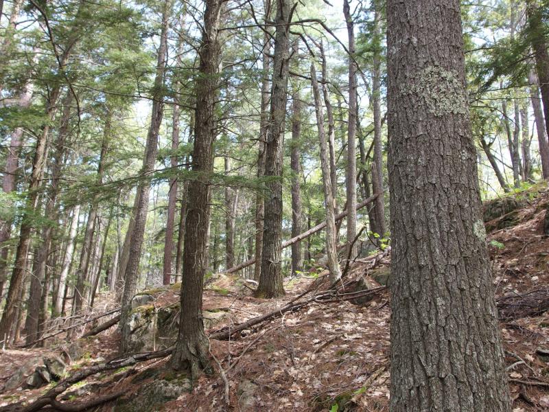
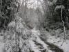
The trail along Mountain Lake faded in and out like a quicksilver snake. Downed branches and undergrowth masked sections, leftovers from the long winter, and other parts just slipped into the ground. I tried my best to follow it on my way from Turner Point to the mouth of Mink Run. There's a marsh by the mouth that I did not want to stumble into.
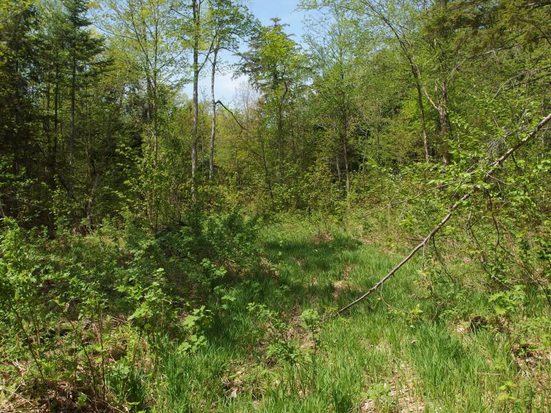
As I neared Mink Run the forest changed quickly from old, deep colors to golden-yellow-green young growth. The footpath I was trying to follow became engulfed by the small plants on the forest floor. Eh, I was close to Mink Run anyways. Turning left I cut a wide swath around the expected marsh ahead, moving north to meet up with the small creek upstream.
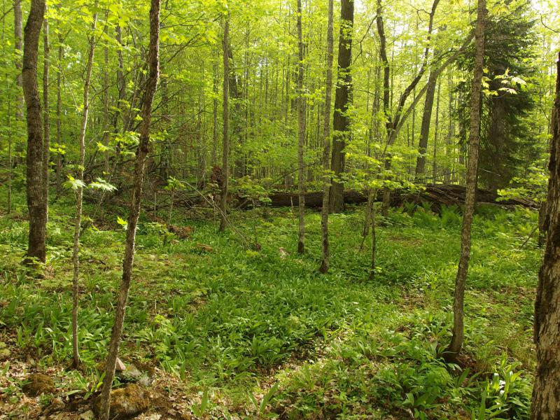
Spring green light in the forest
This hike was simple enough: follow Mink Run to its headwaters. The hike is short and steep. The creek is about two miles long with few tributaries, no swamps or ponds to speak of, only feeding from the eastern side of Mount Benison. From its headwaters in the northernmost reaches it falls over five hundred feet in a quick tumble to Mountain Lake. All I had to do was follow Mink Run upstream and I'd be perched a stone's throw within the peaks of both Mount Benison and Ida.
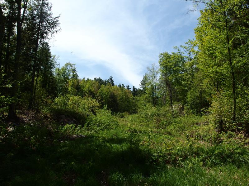
I continued north through the lowlands, swatting impatiently at the bugs that clustered here. The damp land coupled with a nearby creek bolstered the number of insects that circled around me. In the back of my head I knew I would have to stop for water soon, that the bottles I had brought along were already empty, yet the thought of sitting still while the mosquitoes bled me was unbearable.
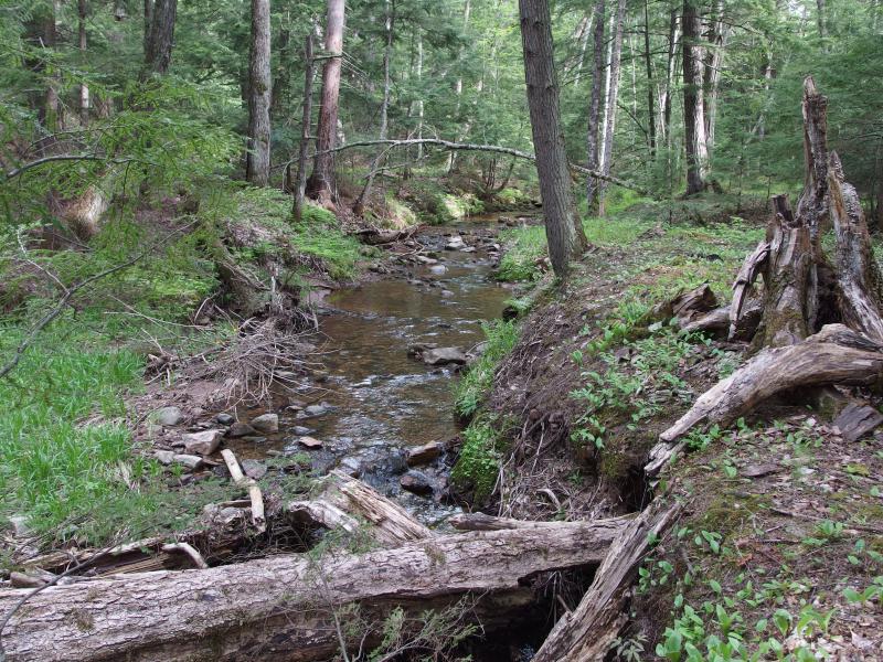
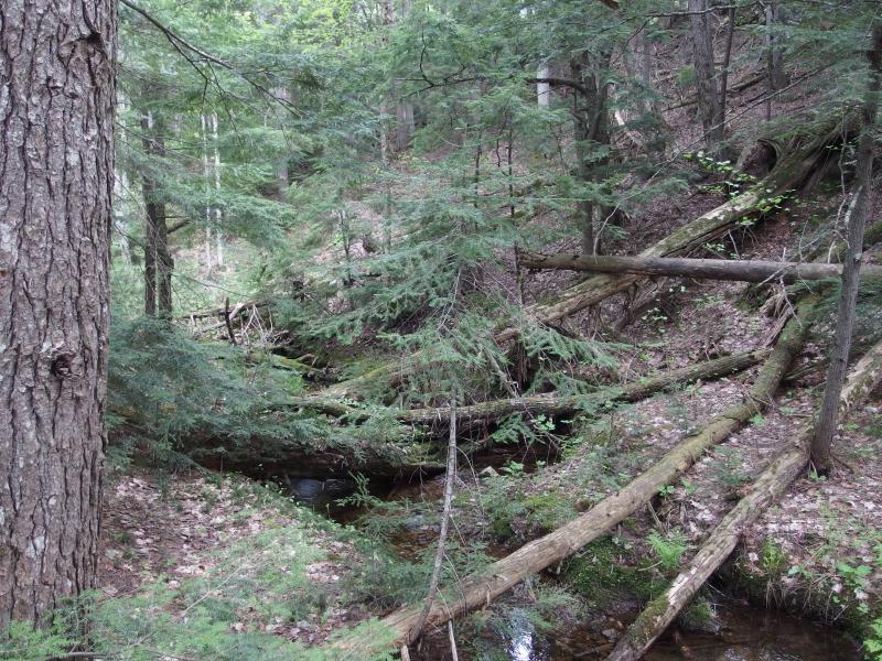
Lower stretch of Mink Run
Before long I was on the creek and hop/skipping up it. The earthern banks were more than wide enough to give me passage and the creek was narrow enough for me to cross at my convenience. There was some clutter here and there, downed trees and young pines, that were easy enough to circle around. It was surprisingly nice to hear the watery gurgle fill in the otherwise quiet forest.
When I reached a small set of rapids I stopped and pulled off my backpack. Moving quickly I pulled out the bug spray and covered myself with a fresh layer. Fresh spray held back the bugs for about fifteen minutes. Reaching back into the pack I took out the water filter and some bottles and got to work. Normally I wouldn't worry about a filter, with Mink Run having such a clean source and no cabins or roads on it, but I was going to be drinking a lot of water on this hot day. Might as well play it safe.
I was able to fill several bottles (and drink a few more) before packing back up. That wasn't too bad, only a half-dozen new bites from the tiny biting flies. They were quick little things, zipping onto my face and aiming for my forehead and cheeks. There was a steady line across the brim of my hat from them already, an itchy and swollen line. They were also small enough to fly up my nose. It was not the best of times.
Steep earthen banks on both sides
Sprouting greens around the tiny creek
With fresh water I pushed on with a quick step. Soon I passed another dashed line (that didn't end up being a road) and entered into a deeper part of Mink Run. Here the water scraped out a deep gorge in the soft earth, walls rising twenty feet around me, leaves and branches spilling down into the creek. My guide began to zig and zag furiously here as if looking for a way out, writhing from one steep bank to the other and never escaping. I tried not to mind too much and crossed the waters more frequently, not wanting to climb up the banks for a straighter path.
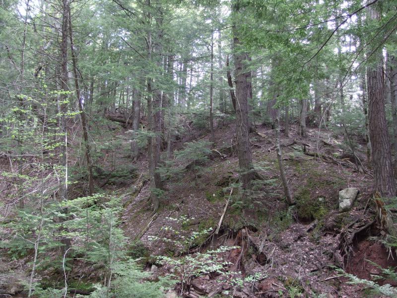
This section of Benison always surprised me, just how much loose earth there was. It could be from erosion, the peak of the mountain slowly sloughing off, though I'd venture that Mink Run would have drained it all down to the lake below by now. Most of my climb today was over dirt, hundreds of feet of dirt climbing, rock not poking out until the very end.
Downed trees and clutter
Aside from a few downed trees that stretched from bank to bank, though, the hike was not tough. Before I knew it a full hour had passed, then two. It was slow going, following the little creek, and I stopped for water again. I welcomed the ritual as much as the fresh drink, the chance to stop and re-spray and get a few blissful minutes with less bugs. They were unnecessarily thick, crawling in my hair, eyes, mouth, and nose. A number of enterprising mosquitoes began to bite through my socks and pants, breaking the safety I thought clothes would give me. I did have some decent protection against ticks, with pants-tucked-in-socks and shirt-tucked-in-paths, and so far only had to pull a lucky dozen who had snuck through my defense.
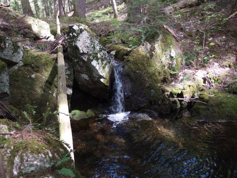
Tiny falls on Mink Run
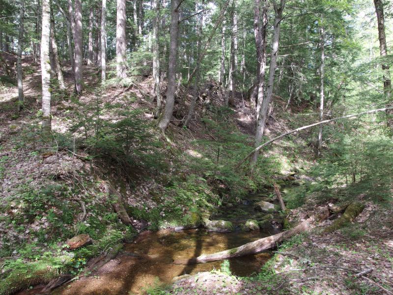
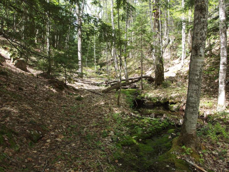
After the second stop the terrain began to change, dirt walls changing to solid rock. I was entering the thin squeeze between Ida and Benison. A waterfall cropped up, the first (and only) sizeable drop on the creek, and then the first gorge appeared. My guide darted in between two massive rock walls with only slick, broken rocks and bugs to find in between. I contemplated entering the dark gorge briefly, trying to determine if the bugs were worth a chance at a broken ankle, and turned to the bank. It would be nice to walk through the woods and take a break from the damp creek.
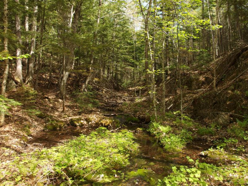
Meandering forest spring
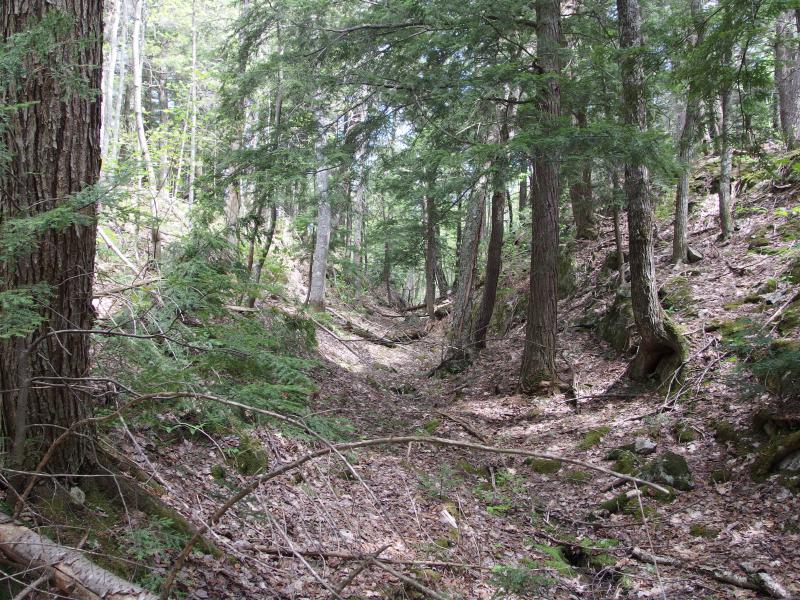
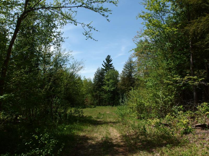
Ancient logging trail
An old-old logging road showed up, one that must have been following Mink Run for some time. Trees grew from it now, sprouting right where horses once pulled logs off the mountain, trying to hide that past away. I know that they still log sections of Benison, some areas that are not protected by the preserve as well as sporadic weeding out the younger growth, though I don't think they need to pull the wood out anymore. They just let them lie where they fall.
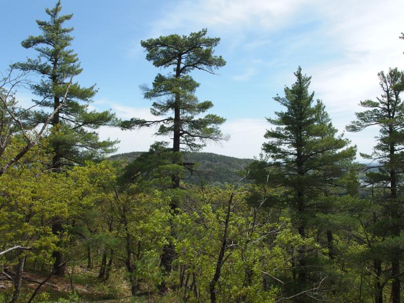
After a few more gorges and many more bug bites the creek calmed back down, meandering through flat lands again. By now it was tiny, a fraction of its former flow, small enough to seep through the ground without breaking through for small chunks. I was near the end of this leg, almost near the top of Ida, and it was time for a good view.
I cut right and walked away from the creek, moving due east through the warm forest. Before leaving I had refilled my water again. My legs had began to burn and cramp by now, the hot temperatures and frequent uphill motion taking their toll, and I hoped that pushing water would help. When I came upon the target knoll that lay north of Mount Ida, I tackled it directly.
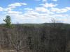
Rocky outcropping and tall trees
As I climbed I felt my legs cramping underneath me, quads starting to twist painfully. Trying to will them into working I pushed on, scaling the small peak, until I came to the top of the needle-covered rock. There were no views. I began to circle around, careful not to lose too much precious elevation, keeping an eye out for a northern view. A few obstructed ones opened up, glimpses of the epic land beyond, though I never did find an open vista.
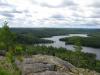
Huron Mountain ahead
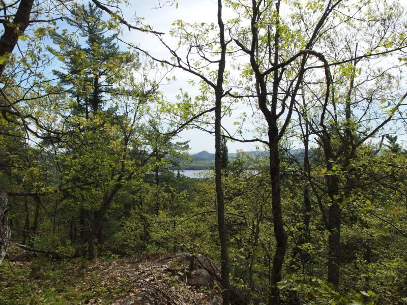
Sudden spur of Mount Ives across the way
I plopped down on a rock, pretending the gentle breeze was enough to deter the bugs buzzing around me, and looked at my map. Huron Mountain was so, so close. To climb it would be tough, though. Huron Mountain stands alone with no ridge to connect it to Benison or Ida. There'd be two seven hundred foot climbs, one for the moutain and one for the return trip, and they'd both be steep. I looked down at my legs, seeing and feeling the knots in my quads. The extra water was not enough for today's heat. I turned and headed back to Mink Run.
Headwaters of Mink Run
After another refill I turned northwest and followed one of the branches up to a familiar location. A few years ago I climbed up Mount Benison and made it to the peak. Hoping for a northern view I had pushed further north and stumbled onto a nice logging road that circled around to Little Huron River and the drive to Cliff Lake. I'm sure this road is watched, as so much of the nearby land is on Club property, but it makes a very convenient exit route. If I could find that road it would be an easy three mile walk back to my gear.
Recent logging clutter
Familiar winding roads of Mount Benison
It was easy to find the road. The old-old logging road that had paralleled Mink Run for much of its way was the same one that was being used for more recent logging on the north face. It was more overgrown now, green spring vegetation leaping up to cover downed brnches and thorny prickles grasping at me, yet it was the same one. I followed its twists and turns down, gently dropping down in elevation until I made it back to my gear. After a brief stop to drink yet some more water I headed out towards Erick's Road.
Tall pine on the way
One thing that I noticed on my return were the numbers. Erick's Road has numbers spray painted on trees, a count of the miles away from the fork off of Ford Road. Those numbers continued up the side of Benison. The true road continued past the camps on Little Huron River, past the multiple gates, and up the headwaters of Little Huron River. The other branches off the road, the ungated routes to the south shore of Cliff Lake and mouth of Little Huron, were new and unmarked.
As I trotted back to my car, the heat waves rolling off the ground and insects circling, I couldn't help but glance around at the peaks to my right. Tick Mountain is right there, Superior a short distance away. It had been many years since I climbed these peaks, choosing instead to push deeper and deeper into the wilds of the Huron Mountains. Shoot, maybe there'd be less bugs too. Next time, perhaps.
-
Jacob Emerick
Jun 27, '14
Ha, I'll have to try to get one this weekend.
Add to this discussion-
Jacob Emerick
Jun 27, '14
Hi Matt, great to hear from you! I'm willing to share as much as I can, though gating the Northwestern is news to me (geesh, I hope that's not the case, that closes out a lot of publicly accessible land). If you want to keep things over email just ping me on my contact page.
-
Matt
Jun 27, '14
Thanks! I'll reach out over email. I'm hoping the Northwestern gates are just a rumor. I haven't been that far north yet, but didn't want to ride all the way out there to find it a no-go.
-
Matt
Jun 28, '14
I'm not sure there even is one. A guy I ride with said a buddy of his that lives in the area told him it was gated but you see how that sounds... I can't imagine why it'd be gated at all.
-
Jacob Emerick
Jul 7, '14
The only thing that I've heard about in that area was that the bridge over Cedar Creek was constantly getting washed out by beaver dams. That was maybe last spring, so quite dated. I don't get up north more than once a month if I'm lucky, and haven't been on the Northwestern in quite a while, so its entirely possible that the road is washed out or that a zealous landowner gated it off (like Celotex over by Herman).
Add to this discussion-
Jacob Emerick
Jun 27, '14
Ha, glad that the writing was so immersive! Isn't their old tales of flea/tick circuses? I'll have to start working on that next...
Add to this discussion-
Jacob Emerick
Feb 9, '15
Howdy Mitch,For topo maps I usually go straight to the Mountain Lake page by just clicking on the image.Hope that helps!
-
dcclark
Feb 10, '15
Just for online viewing, http://mapper.acme.com/ is great. I use it to scout a lot of areas, including aerials.
Add to this discussion